Perimeter wire is quietly destroying the ROI of commercial robotic mowing fleets — and most operators don’t see it coming until the costs are already compounding.
Buried boundary systems are not a one-time installation cost. They are a recurring operational liability.
According to research published in the Journal of Autonomous Vehicles and Systems, perimeter wire installation and maintenance account for approximately 20%–25% of the total lifetime cost of ownership for traditional commercial robotic mowers. On a multi-unit fleet managing a corporate campus or municipal park system, that percentage translates into substantial additional costs.
Wire vulnerability is the first problem. Soil aeration equipment cuts through boundary cables with alarming regularity. Rodent activity chews through insulation. Ground shift during freeze-thaw cycles introduces signal breaks that are notoriously difficult to trace and diagnose. Each fault event pulls a technician off productive work and parks a mowing unit until the break is found and spliced.
Trenching complexity compounds the issue at scale. Large commercial sites — sports complexes, university grounds, HOA communities — require hundreds or even thousands of linear feet of trenching. That labor cost arrives before a single mowing hour is logged.
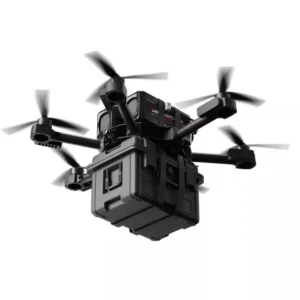
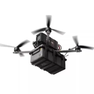
These combined pressures have pushed R&D teams at leading robotics manufacturers toward a single governing requirement: the boundaryless robot mower. Virtual boundary systems built on spatial sensing hardware eliminate the physical wire entirely, enabling faster deployment and dramatically lower lifecycle costs.
However, not all wire-free navigation technologies are created equal — and the difference is significant in complex commercial environments, particularly where satellite signals struggle to reach.
Why RTK-GPS Fails Where LiDAR Excels: The Urban Canyon Effect
Satellite-dependent navigation crumbles in precisely the environments where commercial mowing fleets need the most precision — and that’s a fundamental physics problem, not a software fix.
The core issue: RTK-GPS often requires a clear line of sight to multiple satellites simultaneously. When that line breaks, positioning accuracy doesn’t degrade gracefully — it collapses. As noted in the GPS World / AMR Industry Report, “The shift from RTK-GPS to LiDAR-centric navigation is driven by the ‘urban canyon’ effect, where tall buildings and dense tree canopies degrade satellite signals.”
Urban canyon interference is the dominant failure mode on corporate campuses and mixed-use commercial properties. Tall facades reflect and scatter satellite signals, creating multipath errors that can push positional readings off by several feet — enough to send a robotic mower into a curb, a flower bed, or a pedestrian path.
Tree canopy coverage compounds the problem in parks and university grounds, where mature oaks or dense hedgerows block sky visibility across large mowing zones. RTK systems in these environments experience frequent signal dropout, forcing machines to pause, re-acquire, or worse, drift off their programmed paths.
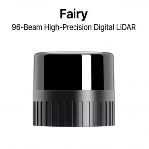
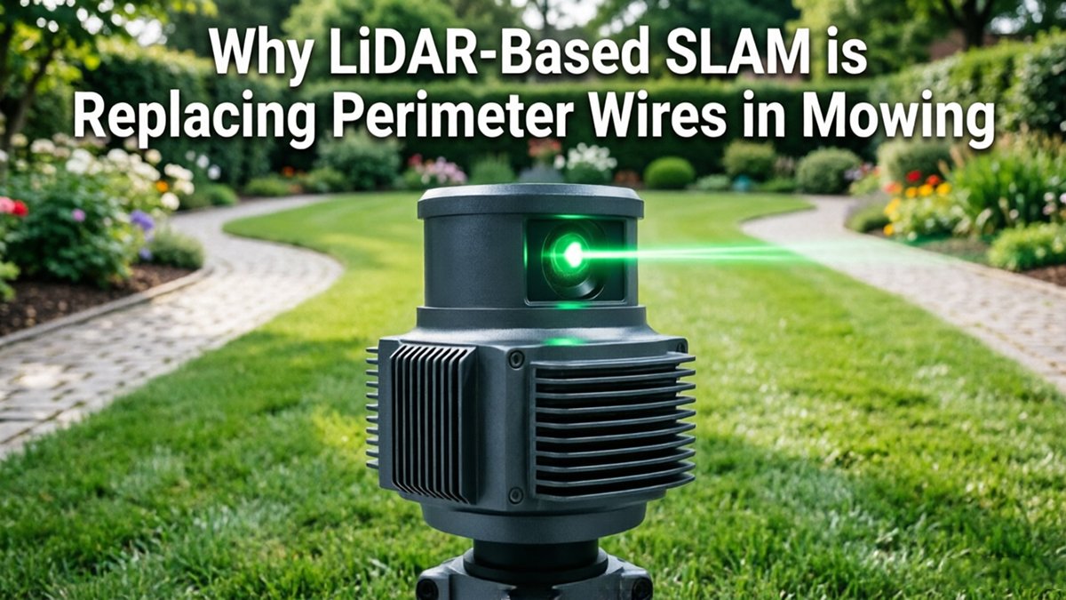
LiDAR technology for robotic lawnmowers platforms sidestep these constraints entirely. Rather than looking upward for satellites, LiDAR actively scans the surrounding physical environment — buildings, fences, benches, tree trunks — and references those fixed landmarks to maintain centimeter-level positioning through SLAM algorithms. Signal consistency doesn’t depend on weather, canopy density, or building height. Understanding how sensor dimensionality affects this process helps explain why 3D LiDAR outperforms both RTK and 2D alternatives in layered environments.
That landmark-referencing capability, however, raises an important question: what happens when the terrain itself becomes the hazard?
3D LiDAR and the Problem of Negative Obstacles
Autonomous mowers navigating commercial properties face a hazard category that most sensor technologies simply aren’t built to handle: negative obstacles — and missing them can mean a $50,000 machine at the bottom of a retention pond.
Negative obstacles are terrain features defined by absence rather than presence — trenches, steep embankments, drainage channels, and open water features. Unlike a bollard or a bench that protrudes into a sensor’s field of view, these hazards represent voids in the landscape. That distinction is critical, because it exposes a fundamental weakness in ultrasonic and basic 2D scanning technologies.
Ultrasonic sensors operate by measuring the return time of sound waves bounced off nearby surfaces. In practice, a sharp drop-off produces little to no return signal — which the sensor interprets as clear space rather than danger. The result is a navigation system that is structurally blind to the exact obstacles most likely to cause catastrophic equipment loss or, in public commercial spaces, serious injury.
This is where outdoor LiDAR solutions demonstrate a decisive advantage. A 3D LiDAR unit fires thousands of laser pulses per second across multiple vertical planes, generating a dense point cloud that maps the surrounding environment in three dimensions. According to LiDAR Magazine, 3D LiDAR sensors provide superior negative obstacle detection, identifying hazards like steep drop-offs or water features that ultrasonic sensors routinely miss.
The point cloud data allows onboard processing to distinguish between:
- Mowable turf with normal surface continuity
- Steep grade changes exceeding safe operating thresholds
- Open water surfaces with anomalous reflectivity signatures
- Subsurface voids or trench edges with abrupt depth discontinuities
- Decorative water features common in hotel and campus landscapes
As detailed in spatial awareness research across sensor types, the density of 3D point cloud returns is what separates reliable hazard mapping from guesswork. For commercial operators managing public-facing properties — corporate campuses, resorts, municipal parks — that density isn’t a luxury. It’s the baseline requirement for safe autonomous operation.
That precision, however, only becomes fully actionable when paired with robust localization. Which raises the next question: how do modern systems achieve the centimeter-level accuracy needed to hold virtual fence lines while avoiding these hazards?
Achieving Centimeter-Level Precision with Multi-Sensor Fusion
LiDAR alone doesn’t deliver centimeter-level accuracy — it’s the fusion of multiple sensor streams that transforms raw point clouds into actionable, high-confidence positioning data.
Combining inputs is the key: When 3D LiDAR is paired with an Inertial Measurement Unit (IMU) and wheel odometry, the system continuously cross-validates its position estimate. LiDAR provides rich environmental geometry. The IMU captures instantaneous acceleration and angular velocity, bridging the gaps between scan cycles. Odometry tracks cumulative wheel displacement to anchor movement estimates. Together, they feed a SLAM pipeline that reconciles conflicting signals and produces a stable, unified pose.
According to research published in the IEEE Xplore Digital Library, multi-sensor fusion combining 3D LiDAR with IMU and odometry reduces localization errors to less than 2–3 centimeters in complex outdoor environments — the precision threshold needed for clean mowing stripes and repeatable coverage patterns.
Virtual fence navigation depends entirely on this precision. Without sub-3cm localization, software-defined boundaries around flower beds, pedestrian walkways, and property edges carry an uncomfortable margin of error. A 10cm drift sounds minor until a mower blade undercuts a planted border or encroaches into a high-traffic zone. High-resolution sensors — particularly those running at 10Hz or faster scan rates — update the position estimate frequently enough to hold virtual fence lines even on irregular terrain or during sharp directional changes.
Preventing encroachment is ultimately a data density problem. Denser point clouds mean finer obstacle mapping, and finer obstacle mapping means tighter boundary enforcement. A system sourcing quality sensors — whether exploring direct procurement options or evaluating specification sheets — should prioritize angular resolution and return frequency as first-order criteria.
The hardware choices underlying that precision are worth examining closely, which is exactly what the next section addresses.
Integrating LiDAR into Commercial Mower Hardware Architecture
Selecting the right sensor stack is the single most consequential decision R&D teams make when building SLAM for autonomous mowers — and it goes far beyond simply choosing a LiDAR unit.
The hardware architecture determines whether a mower navigates intelligently or just survives in the field.
2D vs. 3D sensor placement is the first fork in the road. A rotating 2D LiDAR sweeps a single horizontal plane — cost-effective, but blind to overhead canopy, low curbs, and surface-level grade changes. A 3D forward-facing sensor captures full volumetric data, enabling the kind of negative obstacle detection and slope mapping covered earlier. As this breakdown of dimensional tradeoffs makes clear, 3D fundamentally outperforms 2D wherever terrain complexity matters.
Blind spot compensation is the next critical layer. No single sensor has 360° vertical coverage. A practical checklist for R&D teams:
- Primary sensor: Forward-facing 3D LiDAR for navigation and obstacle detection
- Secondary sensors: Rear-facing ultrasonic or short-range 2D LiDAR for trailing blind spots
- Redundant IMU: Validates motion state when point clouds are momentarily degraded
- Vision module: Fills color/texture gaps LiDAR alone can’t resolve
According to IEEE Xplore, high-resolution LiDAR allows a mower to maintain a virtual fence line with extreme accuracy — but only when sensor placement eliminates coverage gaps entirely.
Environmental hardening can’t be treated as an afterthought. Commercial mowing environments generate vibration, fine clippings dust, and irrigation spray. Minimum specs should include IP67-rated enclosures, vibration-dampened mounts, and thermally managed housings.
Procurement strategy also affects hardware quality. Direct-to-factory sourcing bypasses distributor markups that inflate unit costs 20–40%, giving teams access to tighter specification control. Browse the full sensor catalog to evaluate current commercial-grade options.
The sensors you select ultimately determine the quality of the real-time map the mower builds — which leads directly to how that map actually looks in operation.
Visualizing LiDAR SLAM in Action
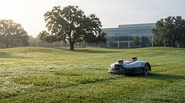
Watching a LiDAR-equipped commercial robotic mower navigate a busy grounds environment in real-time makes the technology’s advantages immediately concrete and undeniable.
Video: No Wire. No Setup Headache. This Robot Mower Just Works.
The video above captures what the sensor pipeline actually produces during an active mowing run — and the technical depth on display is worth unpacking carefully.
Real-time spatial awareness begins with the point cloud. As the mower moves, its rotating LiDAR assembly fires thousands of laser pulses per second, constructing a continuously refreshed 3D map of everything within range. According to LiDAR Magazine, this dense point cloud allows the mower to distinguish between mowable grass surfaces and dangerous terrain changes — a capability no buried wire can replicate. The SLAM algorithm simultaneously updates the occupancy map and refines the mower’s estimated position within it.
The data pipeline moves through four distinct stages:
- Raw pulse return — distance and intensity data arrive from the spinning sensor head
- Point cloud assembly — returns are stitched into a structured 3D representation of the scene
- Map comparison and localization — current scan is matched against the stored map to confirm position
- Navigation command generation — the path planner issues throttle, steering, and blade commands in milliseconds
Dynamic obstacle avoidance is where the system earns its commercial credibility. When a groundskeeper, pet, or stray object enters the operating zone, the updated point cloud flags the intrusion instantly. The planner reroutes — no pause, no perimeter breach alarm. Understanding how spatial data flows in real-time from raw sensor input to actionable commands explains why this architecture scales so naturally across complex, populated sites.
That scalability, in fact, points directly toward what’s coming next for infrastructure-free grounds maintenance.
The Future of Infrastructure-Free Grounds Maintenance
The commercial grounds industry is approaching a tipping point where deploying autonomous mowers across a 50-property portfolio requires no more site prep than downloading a map.
Scalability is the defining advantage that separates LiDAR SLAM from every wire-dependent approach that preceded it. A facilities manager overseeing multiple campuses, resorts, or municipalities can onboard a new site in hours rather than days — no trenching crews, no boundary wire, no recalibration when a landscape changes. As wire-free platforms become the industry standard, the operational model shifts from reactive maintenance to proactive fleet management at scale.
Sensor affordability is the second accelerant. Factory-direct procurement of high-performance LiDAR units has compressed costs that once made autonomous outdoor robotics prohibitive. As noted by GPS World, LiDAR provides consistent centimeter-level precision by referencing physical landmarks rather than satellite pings — a capability that, when sourced directly from manufacturers building purpose-built autonomous sensing platforms, bypasses the traditional distributor markups that slowed earlier adoption cycles.
Multi-purpose outdoor AMRs represent the natural next frontier. The same SLAM stack powering a commercial mower today is architecturally compatible with snow removal, turf treatment, perimeter security patrol, and debris collection tomorrow. Hardware teams investing in a robust LiDAR foundation aren’t building a mowing robot — they’re building a reconfigurable outdoor platform.
Triple-certified, high-performance sensors — meeting CE, FCC, and IP-rated durability standards simultaneously — are fast becoming the baseline specification for fleet procurement. Buyers are no longer willing to trade compliance for cost.
The perimeter wire isn’t being phased out. It’s being made irrelevant. The key takeaways that follow distill exactly what R&D teams need to act on this shift now.
Key Takeaways for Robotics R&D Teams
LiDAR-based SLAM doesn’t just improve commercial mowing — it fundamentally restructures the economics, precision, and scalability of autonomous grounds maintenance. Here are the core insights every R&D team should carry forward.
- LiDAR eliminates a significant TCO burden. Perimeter wire infrastructure adds roughly 25% to total cost of ownership through installation labor, trenching downtime, and ongoing maintenance. As ResearchGate research confirms, transitioning to LiDAR-based SLAM eliminates those recurring costs entirely — a compelling business case for any fleet operator.
- 3D LiDAR is non-negotiable for safety-critical deployments. A 2D scanner reads a horizontal plane and will miss a retaining wall drop-off or a sudden grade change. Only 3D LiDAR maps vertical geometry, making it essential for identifying negative obstacles. Explore how rotating mechanical sensors handle full-field depth to understand why sensor architecture choices matter here.
- Sensor fusion is what delivers precision striping. LiDAR alone drifts under dynamic conditions. Pairing it with an IMU tightly couples rotational and translational corrections, enabling the 2–3cm path accuracy required for professional-grade striping patterns. Neither sensor achieves this independently — the fusion layer is the differentiator, as outlined by Sveaverken’s dual-sensor approach.
- Direct-to-factory sourcing compresses development timelines. Traditional distribution channels add weeks of lead time and markup. Working directly with sensor manufacturers bypasses those delays and gives R&D teams earlier access to spec sheets, calibration data, and engineering support.
These principles shape every design decision covered in this article — and several practical questions naturally follow, which the FAQ section below addresses directly.
Frequently Asked Questions about LiDAR Mowers
LiDAR-based SLAM resolves the most persistent technical objections that grounds managers and robotics engineers raise before committing to wire-free mowing deployments.
Does LiDAR work in direct sunlight for outdoor mowing?
Yes. LiDAR sensors emit their own laser pulses and measure return time, making them largely immune to ambient light interference. Unlike camera-based systems that can wash out in harsh glare, LiDAR maintains consistent point-cloud accuracy across the full solar day. Real-world user reviews confirm reliable performance in high-UV environments with no degradation in mapping quality.
How does LiDAR handle rain or heavy dust? This is a genuine limitation worth acknowledging. Heavy rainfall and dense particulate can scatter laser returns, reducing effective range and introducing noise into the SLAM map. In practice, most commercial deployments pause mowing operations during downpours — a scheduled behavior, not a failure mode. Dust-rated enclosures and IP67-class sensor housings mitigate most outdoor contamination scenarios.
What is the difference between 2D and 3D LiDAR for boundaryless mowers?
2D LiDAR scans a single horizontal plane, which is sufficient for flat terrain boundary detection but misses raised obstacles like low branches or uneven curbing. 3D LiDAR captures a full volumetric point cloud, enabling the mower to interpret grade changes, overhanging hazards, and complex geometry. For commercial sites with varied topography, the investment in precision spatial sensing hardware consistently justifies the cost differential.
How can I source affordable sensors without sacrificing precision?
Sensor procurement is where many R&D budgets stall unnecessarily. LidarStar offers factory-direct pricing and technical support to engineers in over 26 countries, removing the distributor markup that inflates per-unit costs. Evaluating sensor specs against your specific scan frequency and range requirements — rather than defaulting to the highest-tier SKU — is the most reliable path to cost-efficient precision.