
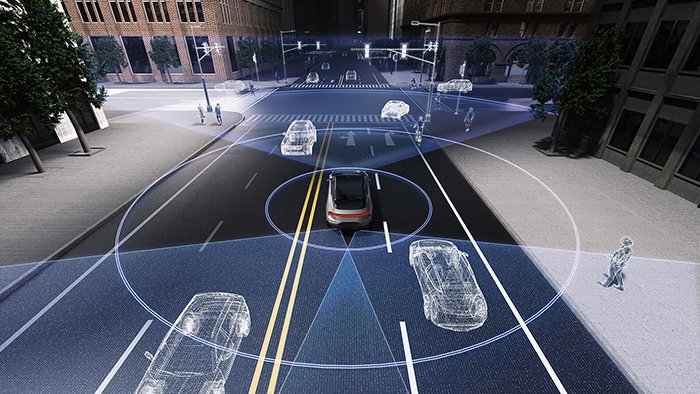
Solid-state and vision-only systems have dominated headlines, but 3d mechanical lidar continues to define the operational baseline for autonomous systems that cannot afford to guess.
The “cameras are enough” argument sounds compelling in controlled demos. In practice, depth perception from stereo vision degrades with lighting changes, texture-poor environments, and high-speed motion — exactly the conditions autonomous platforms face daily. Mechanical scanning sidesteps this by emitting laser pulses and measuring return times directly, producing distance data with no inference required. The sensor doesn’t interpret depth; it measures it. That’s a foundational difference that no amount of neural network tuning can fully bridge.
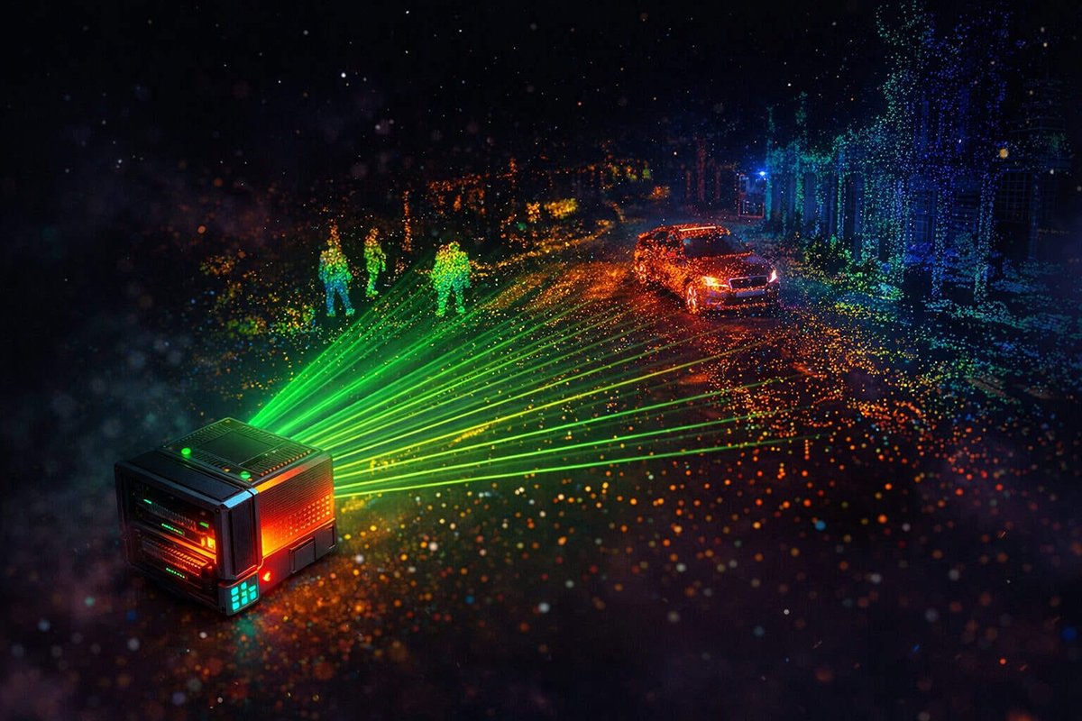
360-degree field of view is the mechanical design’s defining structural advantage. Where fixed-array sensors cover a constrained cone, a rotating emitter-detector assembly sweeps the entire horizontal plane with every revolution. For platforms navigating unstructured environments — freight yards, construction sites, open roads — blind spots aren’t a UX problem; they’re a liability.
Equally important is consistent point cloud density across the full rotation. Because the laser fires at a fixed angular interval throughout each spin cycle, the resulting point cloud is geometrically uniform. There are no privileged zones with higher resolution and no peripheral falloff. This uniformity matters enormously when building accurate spatial maps in real time, because downstream algorithms — SLAM, object detection, path planning — depend on predictable data structures.
The market reflects this durability. The global LiDAR market is projected to reach approximately $6.3 billion by 2032, with mechanical scanning retaining a substantial share in industrial and robotaxi deployments. Within the emerging AI for Science (AI4S) paradigm, where models must operate on verified physical measurements rather than probabilistic estimates, that reliability is non-negotiable.
Understanding why mechanical scanning holds this position requires looking closely at where competing technologies — specifically radar — fall short on resolution. That gap is more consequential than most engineers initially expect.
Mechanical LiDAR vs. Radar: The Resolution Gap
The lidar vs radar debate ultimately comes down to physics — and in autonomous systems, physics determines what gets classified and what gets missed.
Radar and LiDAR are not interchangeable; they operate in fundamentally different domains with different consequences for object classification.
Angular resolution is where the gap becomes concrete. Radar typically achieves angular resolution in the range of several degrees, which translates to blurry, low-point-density returns that can detect a vehicle’s presence but cannot reliably distinguish a cyclist from a roadside post. LiDAR, operating in the near-infrared spectrum, resolves objects at fractions of a degree — generating dense point clouds capable of identifying pedestrian limb orientation, trailer boundaries, and lane-level lane markers at distance.
The physics of light vs. radio waves compounds this difference in complex environments. Radio waves scatter around and through many objects, producing ambiguous multi-path returns. Laser pulses, by contrast, reflect off hard surfaces with high fidelity, preserving object geometry across a wide detection range. However, it’s worth acknowledging a real caveat: LiDAR performs less reliably in heavy rain or dense fog, where radar retains a weather-penetration advantage — which is precisely why sensor fusion matters.
Autonomous trucking demands a level of long-range precision that radar simply cannot supply. Identifying a tire carcass on a highway at 250 meters, or distinguishing a slow-moving farm vehicle from a stopped car, requires the kind of fine-grained spatial data that 3d laser scanning delivers. As McKinsey & Company notes, “mechanical scanning remains the gold standard for long-range detection and high angular resolution in autonomous driving research.”
Key Difference: Radar detects that something is there. LiDAR tells you what it is, where its edges are, and how fast each part is moving relative to you.
In a redundant safety stack, radar and LiDAR are complementary — not competing. Radar handles adverse weather and velocity measurement; LiDAR owns classification and spatial mapping. Understanding how sensor dimensionality shapes these decisions is foundational before exploring how full 360-degree perception further amplifies that advantage.
The SLAM Advantage: 360-Degree Perception and Localization
Mechanical LiDAR’s rotating assembly is the single most important hardware feature enabling reliable SLAM — the backbone of every credible lidar for autonomous vehicles deployment today.
As noted by IEEE Xplore, mechanical sensors utilize a physical rotating assembly to distribute laser pulses evenly across a full 360 degrees. That uniform spatial coverage isn’t a convenience — it’s the foundation on which Simultaneous Localization and Mapping is built. Without it, a vehicle must reconcile blind spots, overlapping sensor footprints, and conflicting reference frames before it can even begin to localize itself.
A single spinning sensor eliminates the multi-unit patchwork that fixed-view alternatives require. In practice, replacing four to six narrow-FOV units with one mechanical sensor dramatically simplifies the data fusion pipeline — fewer timestamps to align, fewer coordinate transforms to compute, and lower onboard compute load at a moment when processing budgets are already under pressure.
The data fusion pipeline that feeds a SLAM system depends on three interlocking stages:
- Raw scan registration — each full 360-degree rotation produces a structured point cloud that can be matched against the prior frame using algorithms like ICP (Iterative Closest Point), giving the vehicle a continuous pose estimate.
- HD map anchoring — consistent angular resolution across every rotation means map features are reproduced with predictable fidelity, which is essential when building and updating 3D spatial models in real time.
- Loop closure validation — when a vehicle revisits a previously mapped zone, the uniformity of mechanical point clouds makes feature matching more reliable, reducing accumulated drift over long operating cycles.
Consistent point cloud geometry is what separates a navigable HD map from an unreliable one. This matters most in demanding environments — underground parking structures, port terminals, and flooded roadways where GPS dropout is guaranteed and visual systems degrade. In these scenarios, mechanical LiDAR’s predictable scan pattern is the only sensor modality that sustains localization without external correction.
Of course, generating dependable point clouds is only half the challenge. What happens to that raw data stream — and how algorithms learn to interpret it — is where the next layer of complexity begins.
Processing the Noise: From Raw Data to TF-IDF Point Clouds
Raw hardware output is only half the equation — turning a dense lidar point cloud into actionable classification data demands algorithmic sophistication that most hardware discussions overlook.
The bottleneck in modern LiDAR systems isn’t the sensor; it’s the pipeline that interprets what the sensor captures.
Point cloud feature extraction is where advanced signal processing earns its keep. One proven approach borrows from information retrieval: TF-IDF (Term Frequency-Inverse Document Frequency) methodology, traditionally used in text analysis, applies surprisingly well to spatial data. In this context, common geometric patterns — flat ground planes, generic walls — function as high-frequency “stop words” that get down-weighted. Rare spatial signatures, like a pedestrian’s gait outline or an irregular obstacle edge, register as high-value features worth prioritizing. Research into point cloud segmentation algorithms confirms that TF-IDF-style weighting consistently improves classification accuracy in cluttered environments.
Managing bandwidth is the next challenge. A 128-channel rotating system generates data volumes that stress even high-throughput compute pipelines. In practice, teams rely on voxel downsampling and region-of-interest filtering to reduce raw stream density before feature extraction begins — preserving precision where it matters while discarding redundant returns.
“Algorithmic efficiency in point cloud processing isn’t about computing everything — it’s about computing the right things faster than the environment changes around the sensor.” — A principle broadly reflected in LiDAR sensor research from PatSnap’s 2026 technology landscape analysis.
AI for Science (AI4S) approaches are accelerating the labeling problem that has historically slowed LiDAR dataset development. Automated annotation tools now tag millions of point cloud frames for training without proportional increases in human labor — compressing the cycle from data capture to deployable model.
The result is a tighter bridge between hardware output and algorithmic input: cleaner features, faster inference, and models that generalize across environments. That same drive toward robust, reliable processing is reshaping how LiDAR hardware gets deployed beyond autonomous vehicles entirely — a shift playing out most dramatically across industrial floors.
Industrial Automation: Beyond the Robotaxi
Mechanical LiDAR’s impact extends far past autonomous vehicles — in 2025, factory floors and distribution centers are where its reliability is being stress-tested most aggressively.
The autonomous vehicle narrative has overshadowed a quieter revolution: industrial robotics is now one of the fastest-growing deployment environments for mechanical LiDAR.
Automated Guided Vehicles (AGVs) and the 3D Advantage
AGVs operating in warehouses and manufacturing plants demand continuous, collision-free navigation across dynamic environments. 3d laser scanning gives these vehicles a full volumetric picture of their surroundings — detecting pallet overhangs, conveyor obstructions, and personnel movement simultaneously. According to Velodyne LiDAR Technical Documentation, mechanical LiDAR systems offer a full 360-degree field of view, directly reducing the sensor fusion complexity that previously required multiple overlapping 2D units.
Durability in 24/7 Industrial Environments
Consumer-grade sensors simply aren’t built for continuous industrial cycles. In practice, mechanical LiDAR systems are engineered to sustain operation across temperature extremes, vibration, and particulate-heavy air — conditions common in automotive assembly lines and cold-storage logistics. This reliability advantage is why procurement teams increasingly specify mechanical systems over alternatives for mission-critical deployments. What typically happens is that a single unexpected sensor failure cascades into costly line stoppages, making mean-time-between-failure a top evaluation criterion.
Why 2D Sensors Are Losing Ground
Flat-plane 2D navigation sensors were sufficient when robots traveled fixed routes on clear floors. Modern fulfillment centers are different — racking configurations change weekly, and navigating complex dynamic spaces with only a horizontal slice of data introduces real blind spots. Three-dimensional perception closes that gap by capturing height data that 2D simply cannot provide.
The Procurement Shift Toward Factory-Direct Hardware
Procurement strategies are evolving alongside the technology. Enterprise buyers are bypassing traditional distribution layers and moving toward factory-direct hardware models, driven by the LiDAR market’s projected growth and the demand for tighter supply chain control and faster firmware update cycles.
This industrial maturation of mechanical LiDAR is setting the stage for its next frontier — contributing high-fidelity spatial data to the AI4Science research paradigm taking shape in 2025.
The 2025 AI4Science Shift: LiDAR in Research Paradigms
High-fidelity spatial data has become the essential fuel driving AI-powered scientific discovery — and mechanical LiDAR is the engine generating it at scale.
AI4S — Artificial Intelligence for Science — represents a fundamental shift in how researchers model physical systems, simulate environments, and extract meaning from complex datasets. The 2025 Scientific Intelligence White Paper from BAAI identifies AI4S as a new paradigm reshaping global research breakthroughs across disciplines from climate modeling to structural biology. At the center of this paradigm is a simple requirement: precise, high-dimensional spatial data that algorithms can actually learn from.
Spatial modeling is where LiDAR earns its place in the research stack. Environmental scientists are deploying rotating mechanical sensors to build millimeter-accurate terrain maps for flood prediction and deforestation tracking. Structural engineers use the same hardware to monitor infrastructure fatigue — capturing sub-centimeter deformation across bridge spans that cameras simply cannot resolve. In each use case, SLAM — the backbone of every credible lidar for autonomous vehicles deployment today. underpins the workflow, anchoring dynamic sensor readings to a consistent coordinate frame so AI models can perform cross-session comparisons with confidence. Systems like those explored in multi-sensor fusion architectures demonstrate how tightly SLAM and physical sensing are now coupled in production-grade platforms.
The convergence of physical sensors and generative world models is accelerating this trend. Researchers are feeding LiDAR-derived point clouds directly into neural radiance fields and physics-informed neural networks, creating synthetic environments that generalize from real-world geometry. This cross-disciplinary embedding — where spatial data informs both physics simulation and life-sciences imaging — is producing models that outperform those trained on camera data alone.
The core insight is straightforward: generative AI models are only as accurate as their training inputs. Noisy, low-resolution sensor data produces brittle models; dense, geometrically consistent point clouds produce robust ones. As AI4S applications demand ever-higher fidelity ground truth, the case for mechanical LiDAR strengthens rather than weakens.
That reliance on hardware fidelity raises a pointed question — one increasingly debated in autonomous systems circles: can software-only approaches ever substitute for a physical sensor?
Overcoming the ‘Vision-Only’ Narrative
The debate over camera-only autonomy versus sensor fusion is the defining hardware argument of 2025 — and the evidence increasingly favors LiDAR.
The vision-only case deserves a fair hearing. Proponents argue that dense neural networks, trained on billions of road-scene images, can approximate depth from a single camera frame. Modern camera systems are cheap, lightweight, and improving fast. Major AV players are actively debating the transition from hardware-heavy to algorithm-driven stacks, with some high-profile voices claiming LiDAR is unnecessary overhead. It’s a compelling pitch — until edge cases appear.
Edge-case failure modes are where pure-vision stacks still fall apart:
- Low-light and glare: Cameras lose contrast fidelity at dawn, dusk, and in direct headlight glare — scenarios where LiDAR’s active laser pulses are unaffected.
- Adverse weather: Fog, heavy rain, and snow scatter light unpredictably, degrading camera depth estimation while LiDAR’s return-time physics remain interpretable.
- Featureless surfaces: Plain concrete walls, unmarked road stretches, and reflective surfaces offer little texture for visual algorithms to anchor depth calculations.
Algorithm-driven does not mean hardware-independent. This distinction matters enormously. Smarter algorithms still require clean, high-density input data to function reliably. A 360-degree field of view — the geometric coverage that mechanical LiDAR uniquely delivers without blind spots — provides the spatial ground truth that even the best neural network cannot synthesize from cameras alone.
Cost-benefit reality shifts when L4 accountability enters the picture. A sensor fusion stack costs more upfront, but a single safety-critical failure from a vision-only system carries liability exposure that dwarfs hardware savings. Multi-sensor integration is increasingly the architecture that insurers, regulators, and fleet operators are demanding.
In practice, several tech stacks that initially pursued camera-first architectures have quietly reintroduced LiDAR for Level 4 deployments — confirming that LiDAR market growth projections are driven by real operational necessity, not vendor momentum.
These technical realities point toward practical decisions that engineers must weigh carefully — which the next section addresses directly.
The Bottom Line: Key Takeaways for Engineers
3d mechanical lidar remains the definitive sensor choice for autonomous systems in 2025 — and the case for it only strengthens as AI, robotics, and research demands converge.
The key points covered throughout this article distill into four actionable conclusions every engineer and procurement team should carry forward:
- 360-degree SLAM accuracy demands mechanical scanning. No competing approach currently matches the full-surround coverage and angular resolution that rotating mechanical LiDAR delivers for simultaneous localization and mapping. In practice, mission-critical deployments — from warehouse AGVs to outdoor mobile robots — consistently rely on this architecture where map fidelity is non-negotiable. For teams exploring sensor fusion in drone applications, mechanical LiDAR’s consistent point density across the full scan plane remains a foundational advantage.
- The data pipeline is half the battle. Raw point clouds are only as useful as the processing stack behind them. Algorithms like TF-IDF-based feature extraction, voxel filtering, and ground segmentation determine whether high-density scan data translates into real-time navigational intelligence or a storage bottleneck. Hardware selection and software architecture must be co-designed — treating them as separate decisions is one of the most common failure modes in autonomy projects.
- AI4Science trends are elevating the value of resolution. As covered earlier in this article, the shift toward geometric ground truth in research pipelines means that point cloud density is increasingly a competitive variable — not just a spec sheet number. The LiDAR market is projected to grow significantly through 2035, driven partly by research and scientific applications demanding ever-higher fidelity spatial data.
- Procurement strategy now shapes cost competitiveness. Direct factory pricing and streamlined global logistics are making triple-certified (CE, RoHS) mechanical LiDAR hardware more accessible than at any prior point, according to Lidarstar Market Analysis. Teams that engage factory-direct supply chains sidestep distributor markups without sacrificing compliance assurance.
If these takeaways have surfaced new questions — about sensor generations, maintenance realities, or integration with ROS environments — the following FAQ section addresses the most common ones directly.
Frequently Asked Questions About 3D Mechanical LiDAR
3d mechanical lidar remains the gold standard for autonomous systems precisely because it answers the hardest engineering questions that competing sensor approaches still cannot.
Q: What’s the practical difference between 2D and 3d mechanical lidar?
2D LiDAR scans a single horizontal plane, detecting obstacles at one fixed height. 3d mechanical lidar stacks multiple laser channels — typically 16 to 128 — rotating simultaneously to build a full volumetric point cloud. That depth dimension is what enables object classification, slope detection, and precise localization. For a deeper look at how spatial awareness evolved from flat scanning to full 3D perception, the distinction becomes immediately clear.
Q: How demanding are the maintenance requirements for rotating assemblies?
In practice, modern rotating assemblies are engineered for tens of thousands of operational hours before requiring service. Bearing wear is the primary concern — but sealed bearing designs and improved lubrication systems have extended intervals significantly. Scheduled inspections, vibration monitoring, and occasional calibration checks are standard practice for fleet operators rather than frequent teardowns.
Q: How does 3d mechanical lidar integrate with ROS?
ROS (Robot Operating System) integration is well-established. Most major mechanical LiDAR manufacturers publish native ROS drivers that output standard sensor_msgs/PointCloud2 topics. Engineers can plug directly into existing perception, SLAM, and navigation stacks with minimal configuration overhead — a significant productivity advantage over newer sensor formats that lack mature driver ecosystems.
Q: What is the future of mechanical versus solid-state sensors?
The honest answer is convergence. According to Intel Market Research, the automotive LiDAR market is projected to grow substantially through 2032, with both technologies capturing distinct roles. As noted by 3DMakerpro, hybrid architectures combining mechanical range and solid-state redundancy represent the most likely path forward.
- 2D vs. 3D: 3D adds volumetric depth critical for classification
- Maintenance: Sealed assemblies support long service intervals
- ROS integration: Native drivers with PointCloud2 output are standard
- Future outlook: Mechanical and solid-state will coexist in hybrid stacks
The bottom line: McKinsey & Company recognizes mechanical LiDAR as the standard for high-speed reaction times in safety-critical systems — and that reputation isn’t disappearing. Start evaluating your sensor architecture today before your next deployment cycle locks in yesterday’s decisions.










