
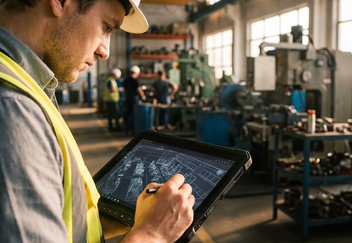
For decades, industrial robots and autonomous systems relied on 2D LiDAR to navigate their environments — scanning a single horizontal plane and flagging anything that broke that invisible line. It worked, until it didn’t. Shelving units, stacked pallets, low-hanging conveyor belts, and workers crouching below sensor height all became invisible threats. The flat world of 2D sensing was no match for the layered complexity of real industrial spaces.
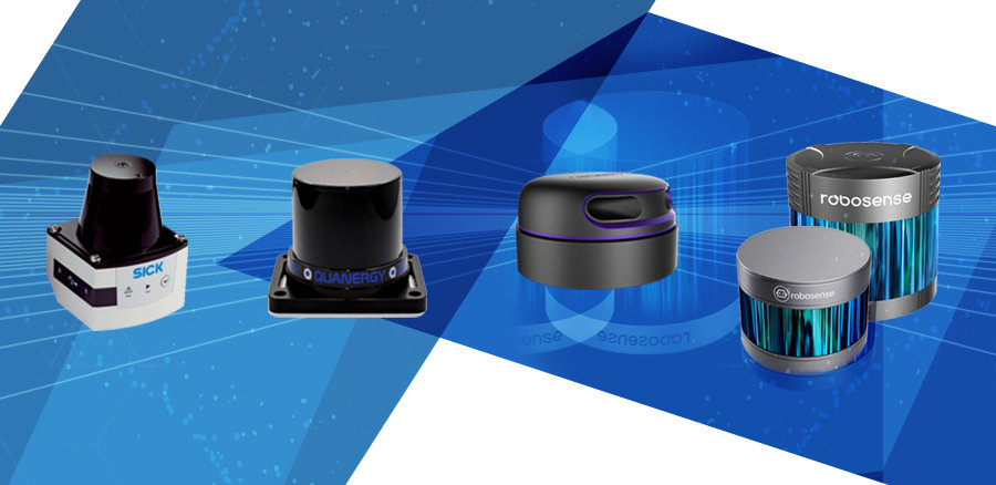
That gap is exactly what 3D LiDAR sensors were built to close.
“The transition from 2D to 3D LiDAR is not just about adding a dimension; it’s about moving from simple obstacle detection to complex spatial intelligence.” — McKinsey & Company
Where 2D systems see a slice, 3D systems see a scene. Every scan produces a dense, volumetric point cloud — effectively a living digital twin of the surrounding environment, updated in real time. This shift is why robotics engineers are rapidly adopting high-channel-count systems capable of 128 channels or more, which dramatically increase vertical resolution and enable precise object classification rather than mere detection.
The stakes are rising further with the emergence of 6G and ISAC (Integrated Sensing and Communication) frameworks, which envision sensing and wireless communication as unified infrastructure. In that future, spatial data isn’t a byproduct — it’s the foundation. According to Outsight’s LiDAR research, spatial intelligence platforms are already bridging perception hardware with actionable analytics at the edge.
Understanding why this evolution matters starts with understanding how 3D sensing actually works — and that means getting into the mechanics of depth perception.
What is a 3D LiDAR Sensor? The Mechanics of Depth Perception
Understanding why 3D LiDAR has become the spatial intelligence standard starts with understanding how it actually works — and it’s more elegant than most people expect.
Time-of-Flight: Light as a Measuring Tape
At its core, every LiDAR sensor operates on a Time-of-Flight (ToF) principle. The sensor fires a laser pulse, that pulse hits a surface, and a photodetector captures the returning light. Since the speed of light is a known constant, the sensor calculates distance by measuring how long the round trip takes. In a 3D context, this process repeats thousands of times per second across multiple vertical angles simultaneously — building depth in all three spatial dimensions rather than a single horizontal plane.
Mechanical Spinning vs. Solid-State Architecture
Two dominant hardware architectures define modern 3D LiDAR design:
- Mechanical spinning sensors rotate a laser array through 360°, delivering a full panoramic scan. They’re highly versatile but contain moving parts that introduce wear over time.
- Solid-state sensors use no rotating components, relying instead on techniques like MEMS mirrors or optical phased arrays to steer laser beams electronically. They’re more compact and durable — a key reason solid-state designs are gaining traction in applications like lidar in self-driving cars, where reliability under constant vibration is non-negotiable.
Channels and Vertical Resolution
The number of channels (or “beams”) a sensor carries directly determines its vertical resolution. A 16-channel sensor captures 16 horizontal scan lines per rotation; a 128-channel sensor captures 128. More channels mean denser, more detailed scans — critical for detecting low-profile obstacles or mapping complex infrastructure. You can explore how multi-beam configurations impact mapping accuracy in aerial applications to see this principle in action.
The Point Cloud: What the Data Actually Looks Like
The output of all this laser activity is a 3D point cloud — a dense constellation of georeferenced data points, each carrying X, Y, and Z coordinates plus intensity values reflecting surface reflectivity. According to NIST, modern 3D LiDAR sensors can generate up to 2 million data points per second, creating a real-time digital twin of the surrounding environment.
Key Terminology Sidebar:
- ToF (Time-of-Flight): Distance measurement via laser pulse travel time
- Point Cloud: A 3D dataset of georeferenced spatial coordinates
- Channels: Discrete laser beam rows defining vertical scan density
- Intensity: Reflected signal strength encoded per data point
- Solid-State: LiDAR architecture with no moving mechanical parts
That raw point cloud is just the beginning — the real question becomes how LiDAR stacks up against other sensing technologies fighting for the same real estate in autonomous systems. That comparison is worth examining closely.
LiDAR vs. Radar vs. Camera: The Multi-Modal Hierarchy
Now that we understand what a LiDAR sensor is and how it builds detailed 3D point clouds, the natural next question is: why not just use cameras or radar? The answer lies in the specific, unforgiving demands of industrial and automotive environments — where each sensing technology has a ceiling, and only one consistently breaks through it.
Cameras: Brilliant but Brittle
Cameras are inexpensive and rich in color and texture data. In controlled, well-lit conditions, they perform exceptionally well. But industrial settings are rarely controlled. Warehouse loading docks, outdoor construction sites, and factory floors all involve dramatic shifts in lighting — harsh glare from overhead floods, deep shadows cast by machinery, and dust or smoke that scatters visible light unpredictably. In these conditions, camera-based systems struggle with false detections and missed objects. High-contrast scenes can saturate image sensors entirely, rendering critical spatial data unreliable at the exact moments it matters most.
Radar: Long Range, Low Resolution
Radar handles poor visibility well and excels at measuring velocity. However, its angular resolution is coarse — it can tell you something is nearby but struggles to define its shape, size, or precise position. For tasks requiring centimeter-level accuracy, like navigating narrow warehouse aisles or detecting a pedestrian stepping off a sidewalk, radar simply doesn’t have the resolution to keep up.
3D LiDAR fills the gap neither camera nor radar can close: precise geometry, reliable depth, and consistent performance across lighting conditions.
The Sensor Fusion Approach
In practice, the most capable autonomous systems don’t choose one technology — they combine them. This sensor fusion architecture layers LiDAR’s geometric precision with radar’s velocity data and camera-derived semantic context. For L2+ autonomous driving applications, this approach is now standard. As the case for higher automation levels makes clear, without a dense, reliable point cloud anchoring the sensor stack, genuine conditional automation remains out of reach.
Importantly, the cost equation for LiDAR has shifted. Solid-state 3D LiDAR designs — which eliminate moving parts and improve durability in high-vibration environments, as noted by IEEE Xplore research — have reduced unit costs significantly, making LiDAR viable well beyond premium automotive programs.
| Technology | Strengths | Weaknesses | Best Use Case |
|---|---|---|---|
| Camera | Color/texture detail, low cost | Poor in low-light, glare-sensitive | Object classification, lane marking |
| Radar | Long range, velocity detection | Low spatial resolution | Speed monitoring, weather resilience |
| 3D LiDAR | High-precision depth, lighting-independent | Higher upfront cost | Navigation, mapping, obstacle avoidance |
With this hierarchy established, the next step is seeing exactly where 3D LiDAR delivers the most transformative results — from smart warehouse robots to highway pilot systems.
Industrial and Automotive Applications: Where 3D LiDAR Dominates
The multi-modal comparison from the previous section makes one thing clear: no single technology closes the gap between raw sensing and reliable spatial intelligence quite like 3D LiDAR. With the global LiDAR market projected to reach $6.38 billion by 2030 at a 19.1% CAGR, the real-world deployments driving that growth span three core verticals.
Robotics: AMRs in Smart Warehousing
Autonomous Mobile Robots depend on accurate, real-time environmental mapping to navigate dynamic warehouse floors safely. 3D LiDAR gives AMRs the spatial awareness to distinguish between a stationary pallet and a moving coworker — at speed, without hesitation. Explore the range of sensors purpose-built for robotic platforms to understand what modern deployments look like.
- Continuous 360° point cloud generation for obstacle-free path planning
- Sub-centimeter localization for precise dock alignment and goods retrieval
- Real-time map updates when floor layouts change dynamically
Automotive: Long-Range Detection and Blind Spot Compensation
Automotive LiDAR sensors serve two distinct functions on modern vehicles: forward-facing long-range detection for highway pilot systems and wide-angle coverage to eliminate dangerous blind spots around heavy machinery. In highway pilot scenarios, forward-facing units scan up to 300 meters ahead, giving the vehicle enough reaction time to handle unexpected hazards. For construction trucks and mining vehicles, side-mounted units reconstruct the full perimeter — spaces a human operator simply cannot monitor.
- Long-range forward detection at highway speeds (up to 300m)
- 360° blind spot coverage on heavy equipment and commercial vehicles
- High-precision environment reconstruction for lane-level mapping
Industrial Safety: High-Precision Mapping and Hazard Zones
In industrial facilities, 3D LiDAR redefines how safety perimeters are enforced. Rather than simple trip-wire detection, it generates a persistent volumetric model of the workspace, flagging intrusions in three dimensions. One practical approach is layering LiDAR-generated maps with access control systems to create dynamic safety zones that tighten automatically when machinery is active.
- Volumetric perimeter monitoring around dangerous equipment
- Automated worker proximity alerts with precise distance data
- Persistent environment reconstruction for audit and compliance reporting
These applications share a common thread: the need for spatial intelligence that goes beyond “something is there” — and that demand only intensifies as facilities and vehicles grow smarter, pointing directly toward the next frontier of integrated sensing and communication.
Future-Proofing: ISAC and the Path to 6G Sensing
The applications covered in the previous section — autonomous logistics, smart manufacturing, infrastructure monitoring — share a common trajectory. They’re all moving toward a world where sensing and communication don’t operate as separate systems. That convergence has a name: Integrated Sensing and Communication (ISAC).
ISAC is one of the defining architectural shifts in next-generation wireless networks. Rather than treating sensing hardware and communication infrastructure as parallel investments, ISAC merges them — using the same waveforms and spectrum for both data transmission and environmental perception. According to Huawei Research, ISAC technology enables high-precision positioning and environment reconstruction, directly fulfilling the 3D perception requirements of emerging 6G networks.
“The convergence of sensing and communication in 6G is not incremental — it’s a fundamental rethinking of how networks interact with physical space.”
This is where 3D LiDAR data becomes infrastructure-critical. For a 6G network to deliver centimeter-level positioning and real-time environment reconstruction — the kind required by autonomous vehicles, smart city platforms, and industrial automation — it needs dense, accurate spatial input. Point clouds generated by LiDAR sensors provide exactly that: structured, timestamped geometry that network nodes can interpret and act on.
One practical challenge is waveform design. Sensing and communication tasks impose competing demands on signal structure, and reconciling them without degrading either function remains an active engineering problem. This is why sensor selection criteria are shifting beyond raw resolution toward integration readiness — how cleanly a sensor’s output feeds into broader intelligence pipelines.
The debate over lidar vs radar vs camera doesn’t disappear in an ISAC context; it evolves. Radar contributes to ISAC’s communication backbone, but LiDAR anchors its spatial accuracy. Smart cities can’t be built on approximations.
Choosing the right hardware for this future-facing environment starts well before deployment — it starts at procurement.
Strategic Procurement: Selecting the Right 3D LiDAR Partner
By this point in the evaluation process, the technology case for 3D LiDAR is solid. The harder question becomes practical: who you source from matters just as much as what you buy.
What to look for in a 3D LiDAR supplier:
- ✅ Factory-direct pricing — Eliminating distributor markups keeps hardware costs predictable, especially when scaling deployments across multiple facilities
- ✅ Triple-certified hardware — Look for CE, FCC, and RoHS certifications to ensure compliance across international markets without costly re-testing
- ✅ 24/7 technical consulting — R&D timelines don’t respect time zones; round-the-clock support prevents integration bottlenecks from stalling entire projects
- ✅ Scalable channel options — Match sensor channel count to your actual use case rather than defaulting to the highest spec (and highest cost)
- ✅ Proven global reach — A supplier shipping to 26+ countries signals both logistical reliability and experience with diverse regulatory environments
Balancing channel count with budget deserves particular attention. A 16-channel sensor generating a usable 3D point cloud may serve a warehouse AMR perfectly well, while a 128-channel unit is necessary for highway-speed autonomous vehicles. Overspending on resolution you don’t need is a common procurement mistake.
LidarStar’s technical consulting services connect engineering teams directly with sensor specialists — not a sales layer — to scope the right hardware from the start. With factory-direct pricing and triple-certified sensors available to customers across more than 26 countries, the supplier relationship becomes a genuine competitive advantage rather than an afterthought.
Still have questions about specifications, operating conditions, or channel selection? The next section addresses the most common decision points head-on.
Frequently Asked Questions About 3D LiDAR
What is the difference between 2D and 3D LiDAR?
2D LiDAR scans a single horizontal plane, detecting objects only at that fixed height. 3D LiDAR uses multiple laser channels to build a full volumetric point cloud, capturing object shape, size, and precise elevation — the foundation of true spatial intelligence for complex environments.
Can 3D LiDAR work in rain or fog?
Performance degrades in heavy precipitation, as water droplets scatter laser pulses and introduce noise. In practice, modern sensors use filtering algorithms to mitigate this, though no LiDAR system is fully immune to extreme weather conditions.
How many channels do I need for an autonomous vehicle?
Most autonomous vehicle applications require 32 to 128 channels for reliable object classification at speed. Higher channel counts produce denser point clouds, improving detection of small or distant obstacles.
Is solid-state LiDAR better than mechanical?Solid-state LiDAR
offers significant advantages in durability, cost, and size — no moving parts means fewer failure points. However, mechanical sensors still deliver wider fields of view in many configurations. The right choice depends entirely on your deployment environment and performance requirements.
Key Takeaways
- Mechanical spinning sensors rotate a laser array through 360°, delivering a full panoramic scan. They’re highly versatile but contain moving parts that introduce wear over time.
- Continuous 360° point cloud generation for obstacle-free path planning
- Sub-centimeter localization for precise dock alignment and goods retrieval
- Real-time map updates when floor layouts change dynamically
- Long-range forward detection at highway speeds (up to 300m)










