
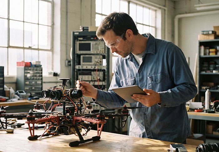
FPV drones have never just been about racing. Strip away the race gates and the leaderboard drama, and what remains is one of the most demanding real-time control problems in robotics — a human nervous system fused with a high-speed airframe, operating at the edge of physics. That engineering challenge is exactly what industrial applications now need to solve, autonomously.
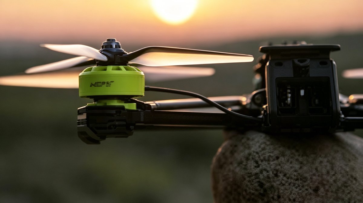
The global FPV drone market is projected to grow at a CAGR of 15.3% through 2030, driven largely by industrial inspection requirements — a trajectory that signals this technology is moving well beyond sport.
FPV racing built the hardware foundation: ultra-low-latency video links, high-thrust-to-weight powertrains, and frames engineered to survive 90 mph collisions. However, the pilot sitting behind those goggles represents a critical bottleneck. Human reaction times, fatigue, and regulatory constraints on beyond-visual-line-of-sight (BVLOS) operations all impose hard ceilings on what manual flight can achieve at industrial scale.
Autonomous FPV navigation breaks through that ceiling by replacing the human perceptual loop with sensor fusion. Instead of relying on a pilot’s eyes, modern autonomous systems depend on high-frequency inputs — IMUs sampling at 1 kHz, optical flow cameras, and real-time obstacle detection hardware — to perceive, decide, and act faster than any human can.
This is the core engineering tension defining the next era of FPV development: the shift from a tool controlled by exceptional pilots to a platform capable of exceptional performance on its own. Understanding that tension starts with the hardware itself — and not all FPV platforms are built for the same fight.
The Technical Divide: Racing vs. Freestyle vs. Cinematic FPV Platforms
Understanding what an FPV drone is means recognizing that “FPV” isn’t a single category — it’s a spectrum. Each sub-type is engineered around a distinct set of priorities, and those engineering choices have surprisingly direct implications for industrial autonomy research.
| Category | Primary Goal | Hardware Focus |
|---|---|---|
| Racing | Sub-100ms reaction loops, raw speed | Ultralight frames, high KV motors, analog video links |
| Freestyle | Controlled acrobatics, durability | Reinforced frames, balanced thrust-to-weight ratios |
| Cinematic/Industrial | Payload capacity, data quality | Brushless gimbals, LiDAR, secondary sensor suites |
Racing FPV: Built for Speed, Not Comfort
Racing platforms strip everything non-essential. Frames weigh as little as 30–60 grams, motors run at high KV ratings (often 2400KV or above) to maximize RPM on smaller props, and the entire build philosophy centers on minimizing latency. Analog video links dominate here because they deliver near-instantaneous transmission — a critical advantage when a pilot is threading gates at 90+ mph. Every gram added and every millisecond of delay lost translates directly to a worse lap time.
Freestyle FPV: Where Durability Meets Power
Freestyle builds sit between racing and cinematic in weight and intention. As Resilience Media notes, FPV platforms are increasingly engineered to surpass the limitations of human pilots. Freestyle frames use thicker carbon fiber arms to survive hard impacts, and motors are tuned for a balanced power-to-weight ratio that supports sustained inverted flight, power loops, and proximity maneuvers rather than pure straight-line velocity.
Cinematic and Industrial FPV: Payload Is the Point
At the industrial end, the design logic inverts entirely. As CaddxFPV notes, normal drones prioritize stable, cinematic shots, while FPV platforms are built for agility — and industrial variants leverage that agility while adding payload capacity for sensors like LiDAR, thermal cameras, and mapping arrays. You can explore how LiDAR integrates into these platforms to understand the sensor-side engineering involved. Standard consumer drones simply can’t replicate the tight-space maneuverability these builds offer.
That agility advantage, however, creates an immediate technical tension — one that runs straight through the video transmission system powering it all.
Analog vs. Digital: The Latency War in Autonomous Navigation
Having established how FPV platforms diverge across racing, freestyle, and cinematic applications, there’s another dimension that cuts across all three — and becomes even more critical when autonomy enters the picture. The debate over analog vs digital FPV transmission isn’t just a hobbyist preference. For industrial autonomous drones, it’s an engineering constraint that shapes everything from obstacle avoidance logic to sensor fusion architecture.
Analog: Raw Speed, Rough Picture
Analog video transmission has dominated FPV racing for one decisive reason: near-zero latency, typically under 1 millisecond from camera to goggle display. Pilots navigating gates at 80+ mph simply can’t afford the processing delay that digital encoding introduces. However, analog’s tradeoffs are significant — compressed resolution, susceptibility to radio frequency interference, and no native support for metadata overlays that autonomous systems rely on. In industrial environments where precision matters more than raw speed, those limitations compound quickly.
Digital: Clarity With a Cost
Digital FPV systems deliver high-definition video, cleaner feeds, and integration-friendly data pipelines. The catch is variable latency — typically between 20 and 40 milliseconds depending on compression load, interference, and link conditions. For a human pilot, that’s borderline acceptable. For an autonomous navigation algorithm making real-time obstacle avoidance decisions, it can be the difference between a clean corridor pass and a collision.
As AUVSI notes, “sensor suite latency is crucial in preventing high-speed collisions during edge-case maneuvers.”
The Latency Budget Problem
Autonomous drones operate on a latency budget — a finite window where perception, decision, and actuation must all complete before the aircraft’s inertia makes correction impossible. Every millisecond consumed by video transmission is a millisecond unavailable to the flight controller.
| System | Typical Latency | Resolution | Autonomy Fit |
|---|---|---|---|
| Analog | <1ms | Low | Racing only |
| Digital | 20–40ms | High | Industrial potential |
In practice, many industrial FPV platforms are moving toward hybrid architectures — using digital video for operator situational awareness while running dedicated, low-latency sensor pipelines for autonomous decision-making entirely independent of the video feed. This separation of concerns is a meaningful design shift. It also raises a harder question: when visual transmission becomes unreliable in GPS-denied environments — think dust-filled boilers or underground tunnels — what fills the navigation gap? That’s where autonomous indoor positioning technology steps in, and why LiDAR-based solutions are gaining serious traction.
Solving the GPS-Denied Challenge: LiDAR Integration in FPV
The analog vs. digital debate matters enormously for latency — but neither transmission system solves the deeper problem facing industrial FPV deployments: positioning reliability without GPS. Inside a mine shaft, a boiler drum, or a steel-framed processing facility, satellite signals simply don’t exist. That’s where conventional autonomous navigation strategies hit a hard wall.
When Optical Flow and Stereo Vision Fall Short
Optical flow sensors and stereo vision cameras are the go-to fallbacks for GPS-denied flight. In practice, they perform well enough in clean, evenly lit environments. Industrial reality is rarely that cooperative. Optical flow degrades sharply in low-contrast or dimly lit spaces — exactly the conditions found inside tanks, tunnels, and underground mining corridors. Stereo vision struggles with dust-laden air, steam, and the kind of visual noise that industrial processes generate constantly. The system either drifts, triggers false obstacle detections, or loses positional lock entirely. For a drone performing a close-proximity inspection, any of those failures carries real consequences.
3D LiDAR as the Industrial Positioning Standard
According to Drone Industry Insights, LiDAR-equipped FPV drones provide superior spatial awareness in GPS-denied environments compared to traditional optical flow systems — and the engineering rationale is straightforward. LiDAR doesn’t depend on light quality or surface texture. It generates dense, real-time point clouds from active laser pulses, giving the flight controller a reliable three-dimensional map of the surrounding structure regardless of ambient conditions.
3D mechanical LiDAR units, mounted on purpose-built inspection platforms, enable stable hover positioning inside boilers and vertical shafts. Forward-facing LiDAR provides continuous distance data to surfaces ahead, allowing the autonomy stack to hold consistent standoff distances even when the pilot — or the autonomous mission planner — is navigating complex geometries. For engineers evaluating sensor options, the 2D and 3D LiDAR selection resources available for drone integration continue to expand as industrial use cases multiply.
The Perceive-and-Avoid Framework
The ‘Perceive-and-Avoid’ framework works in three stages: the drone continuously perceives its full spatial envelope using LiDAR point-cloud data, evaluates detected surfaces against pre-defined proximity thresholds, and executes micro-corrections to avoid contact — all within milliseconds, independent of any human input.
This is where blind-spot compensation becomes non-negotiable. The IEEE Robotics and Automation Society notes that 3D LiDAR sensors with blind-spot compensation are essential for drones performing close-proximity inspections of vertical assets. A drone inspecting a flare stack or a cooling tower column isn’t just moving forward — it’s rotating, tilting, and navigating around protrusions. Without full-sphere coverage, a sensor array will leave angular gaps that create collision risk near structural edges.
Understanding how to fly FPV drone platforms autonomously in these conditions requires accepting that the sensor suite, not pilot skill alone, carries much of the safety burden. That reality sets up a broader challenge: how operators train for these deployments, and what regulatory frameworks govern them — both of which are driving major shifts in how the industry approaches FPV skill development and certification.
Mastering the Flight: From Simulators to Real-World Deployment
With LiDAR integration solving the GPS-denied challenge, the next obstacle is arguably more human than technical — getting engineers and developers actually proficient enough to operate these systems without destroying expensive hardware on day one.
Start in the Simulator, Always
Mastering the simulator is the first step to preventing costly hardware losses in real-world FPV testing, according to Indoor Drone Tours. This isn’t optional advice — it’s how serious development teams protect their budgets.
The recommended progression starts with three foundational maneuvers:
- Split-S — a half-roll followed by a descending half-loop, building spatial awareness under inverted orientation
- Power Loop — a vertical loop powered through the top, teaching throttle management at the extremes
- Orbit — a consistent circular path around a fixed point, directly applicable to cinematic and inspection workflows
Each maneuver trains a different muscle in your control input vocabulary.
Flight Modes: Choosing Your Framework
Understanding Angle, Horizon, and Air Mode is non-negotiable before any real deployment. Angle mode self-levels the craft — ideal for beginners and structured inspection passes. Horizon mode blends self-leveling with acrobatic freedom at stick extremes. Air Mode keeps motors spinning at zero throttle, preventing control loss during aggressive industrial navigation scenarios where real-time obstacle detection demands constant motor authority.
Navigating FPV Drone Regulations
Regulatory literacy separates hobbyists from professionals. Under Part 107, commercial operators must pass an aeronautical knowledge test and maintain a Remote Pilot Certificate. Industrial deployments frequently require a Visual Observer (VO) — a dedicated crew member maintaining unaided visual contact with the aircraft. This is especially critical in complex LiDAR survey environments.
Understanding these compliance layers upfront shapes everything about how teams source and certify their hardware — a challenge that points directly toward smarter procurement strategies.
The Future of FPV: A Hardware Supermarket Approach
The convergence of FPV agility and LiDAR precision isn’t a future possibility — it’s an active procurement challenge happening on engineering floors right now. As drone fleets scale from single-unit pilots to multi-vehicle deployments, the sourcing strategy becomes just as important as the flight stack itself.
Certified, factory-direct hardware is the foundation of any scalable operation. Inconsistent sensor specifications across suppliers create calibration drift, integration delays, and fleet-wide reliability gaps that compound quickly. A single point of procurement — covering both 2D and 3D LiDAR sensors — eliminates that variability. The IEEE Robotics and Automation Society notes that industrial automation specialists require a full hemispherical field of view to ensure drones don’t strike overhead obstacles, underscoring why sensor selection demands rigor, not just convenience.
The “one-stop” model also accelerates iteration. When engineers can evaluate discrete and continuous sensing formats from a single catalog, comparative testing shortens and validated configurations carry forward across builds. This is crucial for teams deploying LiDAR obstacle avoidance across variable environments — from warehouse ceilings to outdoor infrastructure corridors.
Purdue’s ongoing drone autonomy initiatives point toward a clear direction: the next generation of aerial systems will demand sensor fusion, not sensor substitution.
Three trends shaping what comes next:
- Miniaturized 3D LiDAR will push full volumetric sensing capability into sub-250g airframes previously limited to 2D sweeps
- Edge-processed sensor outputs will reduce onboard compute requirements, enabling faster autonomous reactions without heavier flight controllers
- Fleet-level sensor standardization will become a procurement baseline, not an afterthought, as enterprise operators mature their programs
The FPV drones that started as racing platforms are becoming highly maneuverable tools in industrial automation. Precision sensors, responsibly sourced and rigorously integrated, close that gap.
Key Takeaways
- Edge-processed sensor outputs will reduce onboard compute requirements, enabling faster autonomous reactions without heavier flight controllers
- Fleet-level sensor standardization will become a procurement baseline, not an afterthought, as enterprise operators mature their programs
- Split-S — a half-roll followed by a descending half-loop, building spatial awareness under inverted orientation
- Power Loop — a vertical loop powered through the top, teaching throttle management at the extremes
- Orbit — a consistent circular path around a fixed point, directly applicable to cinematic and inspection workflows










