Your Cart

The Go-To Supermarket for Affordable LiDAR Sensors!

Email:info@lidarstar.com

Conveyor belt LiDAR profiling for 3D LiDAR sensor applications

3D LiDAR Profiling: Dimension Irregular Parcels at Scale

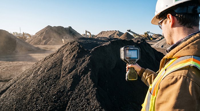
Conveyor belt LiDAR profiling works because light travels at a fixed speed — and modern sensors can exploit that fact thousands of times per second to build a complete three-dimensional map of every object that passes beneath them. Time of Flight (ToF) explained: A ToF sensor fires a laser pulse, that pulse strikes a surface, […]

LiDAR pallet positioning for high-density racking for 3D LiDAR sensor applications

LiDAR Pallet Positioning: Preventing AS/RS Stacker Collisions

A single misaligned pallet can halt an entire automated storage aisle, cascade into failed retrieval cycles, and cost a facility thousands of dollars in downtime before a technician even arrives on the floor. The shift to full automation removes the human safety net. In a manually operated warehouse, a forklift driver notices a skewed pallet […]

how to protect LiDAR from extreme heat for 3D LiDAR sensor applications

High-Temperature LiDAR: Cooling Solutions for Steel & Foundries

Deploying high-temperature industrial LiDAR in a steel mill isn’t an engineering upgrade — it’s a battle against physics that most sensors are simply not built to survive. Picture a laser scanner mounted above a continuous casting line. Within minutes of exposure to radiant heat, its housing is warm to the touch. Within an hour, internal […]

how to measure stockpile volume with LiDAR for 3D LiDAR sensor applications

Stop Inventory Shrinkage: 3D LiDAR for Bulk Material Volume

Inaccurate stockpile estimates don’t just create paperwork headaches — they quietly drain millions of dollars from operations that can least afford the loss. Inventory shrinkage in bulk material handling is a significant financial risk in mining and heavy industry. When a coal-fired plant believes it holds 50,000 tons of fuel and the actual figure is […]

sensor fusion robotics for robotics LiDAR sensor applications

LiDAR Collision Avoidance: The Gold Standard for Factory Safety

An autonomous pallet mover weighing several tons traveling at 12 mph doesn’t have the luxury of hesitation — and neither does the worker who steps into its path. Modern factory floors have undergone a fundamental redesign. Where automation once lived behind cages and safety fencing, today’s operations favor collaborative floor plans where AGVs, robots, and […]

open source point cloud processing software for 3D LiDAR sensor applications

LiDAR Hardware Strategy: Why Software Interoperability Matters

Raw LiDAR data doesn’t drive autonomous vehicles, guide robotic arms, or map construction sites — structured, classified point cloud data does. That distinction sounds obvious, yet the robotics and autonomous systems industry keeps investing heavily in sensor hardware while treating post-processing as an afterthought. The result is a widening gap between data collection capability and […]

why use LiDAR instead of photogrammetry for rescue for 3D LiDAR sensor applications

Dual-Sensor Fusion: The Future of Rescue Drone LiDAR Tech

Thermal-only drone deployments leave rescue teams navigating structurally unknown environments — a dangerous gap that rescue drone LiDAR technology is now closing for good. Picture a warehouse fire. Dense smoke has cut visibility to zero. A thermal camera picks up a heat signature through the haze, but the reading is ambiguous — is the source […]

how to calculate stockpile volume with LiDAR for 3D LiDAR sensor applications

UAV LiDAR for Mining Volume: The New Standard for Accuracy

Modern mining operations demand inventory accuracy that traditional surveying methods simply cannot deliver at production speed. Picture an open-pit copper mine running three shifts. By the time a ground survey crew finishes measuring stockpile volumes — walking GPS receivers across unstable aggregate, dodging haul trucks, and processing data back at the office — the numbers […]

Scan-to-BIM automation for industrial LiDAR sensor applications

Drone LiDAR: The Key to Accurate Digital Twin Infrastructure

Smart infrastructure can’t be built on flat maps — it demands geometric truth at centimeter precision. The gap between a conventional aerial photograph and a genuine digital twin isn’t a matter of resolution; it’s a matter of dimension. Where imagery captures surfaces as pixels, LiDAR captures them as measured geometry — every wall angle, every […]

uav lidar mapping for drone LiDAR sensor applications

UAV LiDAR Mapping: The Best Way to Survey Complex Topography

Rugged terrain doesn’t just challenge traditional surveying methods — it defeats them entirely, exposing critical failure points that no amount of field experience or equipment investment can overcome. Line-of-sight limitations are the most immediate constraint for ground crews. Total Stations and conventional GPS-based workflows require unobstructed sightlines between instrument and target. On steep mountain corridors, […]

Product Enquiry