Modern mining operations demand inventory accuracy that traditional surveying methods simply cannot deliver at production speed.
Picture an open-pit copper mine running three shifts. By the time a ground survey crew finishes measuring stockpile volumes — walking GPS receivers across unstable aggregate, dodging haul trucks, and processing data back at the office — the numbers are already wrong. Blasting, hauling, and crushing don’t pause for measurement. In high-throughput operations, a one-week lag in volumetric data can translate directly into reconciliation errors, misallocated tonnage, and costly over- or under-reporting to regulators and buyers.
The human cost compounds the data problem. Sending personnel onto active stockpiles introduces serious safety exposure. Loose material, steep repose angles, and proximity to heavy equipment create conditions where a routine measurement can become a lost-time incident. Many operations have already restricted manual pile walking under their own safety policies — yet still rely on the underlying manual methodology, just performed less frequently. The result is data that is both dangerous to collect and chronically out of date.
UAV LiDAR mining volume workflows change the fundamental economics of this problem. Where a ground crew might spend several days capturing and processing a single pit survey, a UAV LiDAR platform can cover the same area in hours. According to POB Surveying & Engineering Magazine, UAV LiDAR workflows can reduce data collection time by up to 90% compared to traditional ground surveying — a compression that makes daily or even shift-by-shift inventory cycles operationally realistic for the first time.
That speed advantage flows directly into what mine operators increasingly call a digital twin: a continuously updated, three-dimensional model of the entire mine site that reflects current stockpile volumes, bench geometries, and haul road conditions in near real time. The digital twin isn’t just a map — it’s a live operational ledger. And building one reliably requires a sensor capable of capturing accurate ground-surface data through the dust, shadow, and vegetation that define active mine environments — which is exactly where the physics of LiDAR start to matter.
Why LiDAR Outperforms Photogrammetry in Active Mine Sites
LiDAR’s active sensing design gives it a fundamental edge over photogrammetry wherever dust, shadow, and sparse vegetation compromise surface visibility.
Photogrammetry reconstructs surfaces by matching visual features across overlapping images — and that dependency on ambient light and texture is its core vulnerability in open-pit environments. When haul trucks kick up particulate clouds, or when deep benches cast hard shadows across pit floors, the image-matching algorithm loses reference points entirely. The resulting model fills gaps with interpolated data, not measured reality. For a drone LiDAR stockpile calculation, that distinction is the difference between defensible inventory and an educated guess.
Active sensing is where LiDAR breaks the dependency. Each laser pulse travels from the sensor, strikes a surface, and returns — with the elapsed travel time converted directly into distance. This Time-of-Flight mechanism requires no ambient light, no textural contrast, and no clear line of sight through the atmosphere. The sensor generates its own illumination at the speed of light, making it indifferent to the harsh optical conditions that are simply routine at active mine sites.
The practical gains over photogrammetry break down into three areas:
- Dust penetration: Laser pulses scatter through airborne particulates to reach the stockpile surface below, whereas cameras capture only the suspended cloud. According to the American Society for Photogrammetry and Remote Sensing (ASPRS), LiDAR outperforms photogrammetry precisely because it penetrates dust and sparse vegetation to record the actual surface.
- Shadow immunity: Steep bench walls and narrow cuts that produce hard shadows are invisible problems for LiDAR — no light is needed to measure them.
- Ground truth through vegetation: Sparse scrub on a stockpile apex returns multiple pulse reflections; LiDAR’s last-return filtering isolates the ground point beneath the canopy.
You can explore how active vs. passive sensing differs in more technical depth, but the operational takeaway is clear: photogrammetry models what it sees, while LiDAR measures what is there. That gap matters far less on a clear-sky construction site than it does inside a working open-pit mine producing thousands of tons per shift.
Delivering real-time accuracy under those conditions is only half the equation, however. The next critical question is how precise that data actually needs to be — and what standards it must meet to satisfy auditors and regulators.
The Precision Factor: Accuracy Standards for Earthwork Measurement
Audit-grade volume reporting in mining demands measurement accuracy that leaves almost no room for error — and UAV LiDAR is now consistently delivering exactly that.
For regulatory and financial reporting, the accepted benchmark is tight: UAV LiDAR workflows routinely achieve volumetric accuracy within 1% to 3% of traditional ground-based surveying methods, according to POB Surveying & Engineering Magazine. That margin is narrow enough to satisfy most mining regulatory bodies and financial auditors, making real-time earthwork measurement UAV deployments a credible replacement for far slower total station campaigns.
Vertical accuracy is the critical variable. Most mine site audit requirements call for vertical error margins below ±50mm, and modern UAV LiDAR systems — when properly georeferenced with ground control points — routinely hit ±20mm to ±30mm. That performance is directly comparable to total station benchmarks, without requiring a surveyor to physically traverse hazardous stockpile terrain.
Point density plays an equally important role when measuring irregular stockpile apexes. Flat base areas tolerate lower density scans without significant volume error, but a peaked or asymmetric apex introduces calculation risk if the point cloud is too sparse to reconstruct the true surface geometry. Typically, a minimum of 50 to 100 points per square meter is recommended for stockpile apex regions to prevent underestimation of peak volume.
Mining regulatory standards — particularly those governing coal, ore, and aggregate inventory reporting — require defensible, repeatable methodology. UAV LiDAR meets this bar by producing:
- Georeferenced point clouds with documented accuracy metadata
- Repeatable flight parameters that enable period-over-period comparison
- Timestamped deliverables suitable for third-party audit review
- Exportable volume reports compatible with standard reporting formats
Understanding how sensor dimensionality affects output quality is also relevant here — 3D LiDAR sensors provide the full spatial resolution that apex reconstruction demands, where 2D alternatives fall short.
Achieving this level of reliability doesn’t happen automatically. It begins well before the drone leaves the ground, in the mission planning phase — specifically in how the flight pattern is designed to capture complex vertical geometries without gaps or shadow zones.
Phase 1: Mission Planning and the ‘Cross-Hatch’ Flight Pattern
Understanding how to calculate stockpile volume with LiDAR starts well before the drone takes off — it starts with a flight plan built for complex, irregular geometry.
Standard linear flight paths are a liability on vertical stockpile faces. A single-direction grid captures nadir (straight-down) returns well but leaves steep angles and shadow zones chronically undersampled. The result is a point cloud with data holes precisely where stockpile geometry is most critical — along bench edges, conical shoulders, and near-vertical walls.
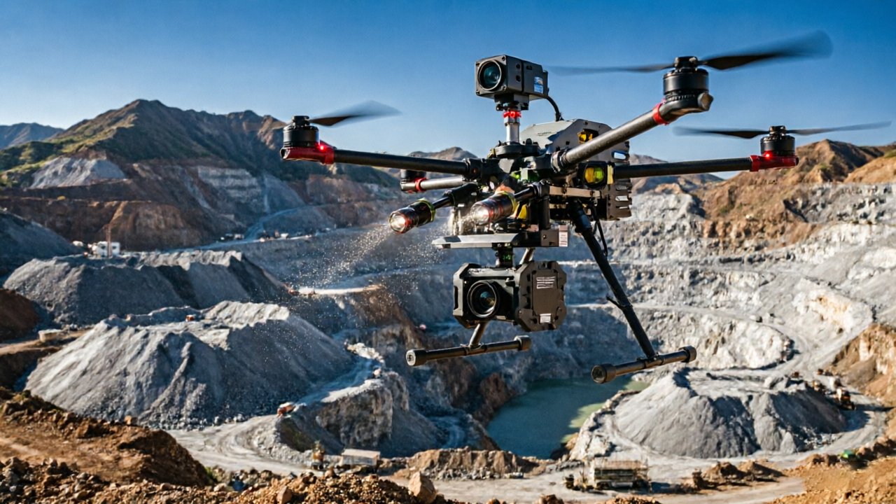
The double grid pattern eliminates this blind spot. According to DroneDeploy Industry Reports, a standardized SOP must include a cross-hatch or double grid flight pattern to ensure comprehensive side-slope density and eliminate data holes. The approach is straightforward: fly two perpendicular grids over the same area so the LiDAR scanner interrogates every surface from opposing angles. Sensors with wide fields of view — like those using 360-degree mechanical spinning designs — amplify this advantage by capturing off-nadir returns on every pass.
Overlap settings matter as much as pattern selection. For flat terrain, 60–65% sidelap is often sufficient. Complex bench geometries demand 70–80% overlap to ensure adjacent swaths stitch cleanly without introducing surface discontinuities. Tighter overlap is especially important near pit walls where return density drops sharply.
Flight altitude is a direct trade-off between point density and area coverage. Flying lower — typically 60–80 meters AGL on stockpile surveys — increases point density, which sharpens edge definition and reduces interpolation error in volume calculations. Flying higher extends coverage but thins the point cloud, forcing post-processing algorithms to fill gaps rather than measure them.
With a validated flight plan locked in, the quality of that plan gets truly tested during data acquisition itself — which is where IMU integration, real-time quality checks, and raw file handling become the next critical variables.
Phase 2: Data Acquisition and Real-Time Processing
Raw data quality during the flight itself determines whether your volume numbers hold up under audit — and that starts with knowing exactly what the sensor is capturing the moment it captures it.
On-site verification is the single most overlooked step in UAV LiDAR workflows. Once the cross-hatch pattern described in the previous section is complete, a quick field review of point density and coverage gaps can save an entire re-flight — which on a large mine site can mean hours of lost operational time. Most modern LiDAR ground stations display a live preview of the returning point cloud, flagging low-density areas caused by wind drift or occlusion before the crew packs up.
IMU and GNSS integration is what transforms millions of raw distance measurements into a spatially accurate, georeferenced dataset. The Inertial Measurement Unit records the sensor’s pitch, roll, and yaw at thousands of cycles per second, while a tightly coupled GNSS receiver anchors every pulse to real-world coordinates. This fusion is what determines what is the accuracy of drone LiDAR for earthworks in practice — systems using dual-antenna GNSS with RTK correction routinely achieve vertical accuracy within 1–3 cm. The quality of that sensor-to-IMU integration at the hardware level is non-negotiable; systems built around 360-degree mechanical spinning designs benefit from more spatially consistent returns, which reduces downstream noise filtering.
Handling massive LAS datasets is where the pipeline slows down if preparation is poor. A single mining survey can generate files exceeding 50 GB of raw point data. The practical workflow moves from raw LAS → noise filtering → ground classification → vegetation and machinery removal. This classified output is what feeds into volumetric software — not the raw file.
As Mining Magazine notes, integrating UAV LiDAR into mine site SOPs “transforms inventory management from a monthly ‘snapshot’ into a continuous, data-driven audit process.” Getting that integration right means exporting classified point clouds in formats compatible with common mining platforms — a step that connects directly to what happens next: building the Digital Terrain Model that makes accurate volume calculation possible.
Phase 3: Volumetric Calculation and DTM Generation
Once the flight data lands in your processing software, the real precision work begins — transforming a dense point cloud into defensible volume numbers that hold up in any boardroom or audit.
The calculation is only as accurate as the terrain model beneath it. That starts with generating a clean DTM. Unlike a surface model that captures everything the sensor sees, the DTM strips out non-ground returns — ore loaders, conveyor structures, scraggly vegetation growing at pile edges — leaving only the bare earth. This is where LiDAR’s penetration capability earns its keep: as the American Society for Photogrammetry and Remote Sensing (ASPRS) notes, LiDAR’s ability to bypass obstructions ensures the DTM reflects the true base and apex of the material pile, not a distorted surface skewed by equipment or ground cover.
Defining the Base Plane is the next critical decision. The Base Plane is the reference surface — essentially a flat or contoured boundary that represents where the stockpile meets the ground. Software typically offers three methods: a fixed-elevation plane, a best-fit plane derived from perimeter survey points, or a triangulated irregular network built from tagged ground control. Choosing the wrong method here is one of the most common sources of volume error. A fixed-elevation plane works well for flat pad stockpiles; irregular terrain demands a triangulated approach. This walkthrough on stockpile volume measurement illustrates how Base Plane selection directly shifts the final tonnage figure.
Cut and fill analysis extends the same logic to pit expansion. Here, the software compares two DTMs captured at different points in time — the pre-blast surface and the post-excavation surface. The difference gives you cut volumes (material removed) and fill volumes (material deposited), which feed directly into blast efficiency reviews and haul planning.
Final report export closes the loop. Modern processing platforms generate stakeholder-ready PDFs and machine-readable CSV or IFC files that push directly into ERP and inventory management systems, turning a point cloud into an auditable record with minimal manual handling. Understanding this workflow sets the stage for evaluating the full business case — and that’s where hardware cost, supply chain, and operational ROI come into sharp focus.
Maximizing ROI: The Business Case for Factory-Direct LiDAR
Accurate volumetric data only delivers its full financial return when the hardware behind it is affordable enough to deploy at scale — and supported well enough to stay operational every shift.
Reducing inventory shrinkage is where the ROI becomes undeniable. Mining operations routinely face discrepancies between extracted ore volumes and processed material tonnage — a gap the industry calls “shrinkage.” According to Mining Magazine, daily production reconciliation using precise volumetric audits directly reduces that discrepancy, tightening the feedback loop between extraction, processing, and financial reporting. When LiDAR surveys can be flown and processed within a single shift, daily inventory checks become operationally feasible rather than aspirational.
Supply chain position matters as much as sensor specs. Traditional hardware procurement routes — distributor to reseller to end user — add margin at every handoff without adding technical value. Factory-direct sourcing eliminates those intermediaries, bringing certified LiDAR sensors to mining operations at pricing that makes multi-site deployment realistic rather than prohibitive. The sensors’ full spatial coverage capability is only an asset if operations can afford enough units to cover their entire footprint.
Mission-critical mining operations cannot afford downtime waiting on slow support chains. A sensor failure mid-campaign — when haul schedules and royalty audits are running concurrently — has measurable financial consequences. Twenty-four-hour global technical support, backed by engineers who understand the hardware at the component level, is not a premium add-on. In practice, it is the difference between a two-hour fix and a three-day delay.
Scaling across multiple mine sites is the ultimate test of any LiDAR program. When per-unit hardware costs stay low and support infrastructure is robust, the same standardized workflow — flight plan, processing pipeline, DTM output — can replicate across sites without re-engineering from scratch. Those operational constants are what transform UAV LiDAR from a project-level tool into an enterprise-wide measurement standard — and that distinction is worth examining closely before drawing final conclusions.
Key Takeaways for Mine Surveyors
UAV LiDAR has fundamentally shifted what’s possible in mining survey operations — delivering lab-grade accuracy at field scale, in conditions where traditional methods simply fail.
The bottom line: mine surveyors who adopt UAV LiDAR now are trading weeks of manual labor for hours of automated precision.
- Volumetric accuracy reaches 1–3% while cutting total survey time by up to 90% compared to ground-based methods. That combination of speed and reliability makes rapid, high-frequency stockpile audits operationally viable for the first time. According to Pix4D’s analysis of drone-based stockpile measurement, the efficiency gains alone justify the hardware investment across most mid-to-large operations.
- Active sensing beats passive imaging in harsh environments. In dusty crusher zones, sites with low-lying shrubs, or overcast pit floors, photogrammetry struggles to resolve clean surface geometry. LiDAR’s laser-pulse architecture penetrates partial obscurants and returns accurate returns regardless of ambient lighting — a decisive advantage that research comparing drone LiDAR and photogrammetry consistently confirms.
- Flight pattern discipline is non-negotiable. A cross-hatch pattern — two overlapping passes flown at perpendicular headings — ensures near-vertical stockpile faces and deep bench walls register fully in the point cloud. Skipping this step introduces shadow zones that corrupt base-surface modeling and inflate or deflate calculated volumes.
- Procurement strategy affects long-term ROI. Factory-direct sensors carrying triple certification (CE, FCC, and RoHS) eliminate intermediary markups and guarantee direct access to firmware updates and technical support. As covered in the previous section, that traceability matters when tonnage figures underpin financial reporting or regulatory compliance.
These principles form the operational foundation for any mine surveyor building a UAV LiDAR workflow from scratch — or auditing an existing one. If you still have questions about accuracy thresholds, weather limitations, or the right software stack, the next section addresses the most common questions directly.
Frequently Asked Questions About UAV LiDAR in Mining
UAV LiDAR answers some of mining’s most persistent operational questions — and understanding the practical limits of the technology helps teams deploy it with confidence.
What is the typical vertical accuracy of drone LiDAR for stockpiles?
Most modern UAV LiDAR systems achieve vertical accuracy in the range of 1–5 cm under standard survey conditions. That precision is sufficient to detect meaningful volume changes between measurement intervals, making it reliable for both inventory tracking and regulatory reporting. According to research published on Diva-Portal, LiDAR-derived volume calculations consistently outperform traditional field methods in both repeatability and accuracy.
Can LiDAR measure volumes through heavy dust or rain?
LiDAR’s active pulse technology gives it a clear performance edge over photogrammetry in degraded visibility — dust, light smoke, and overcast skies pose little obstacle. However, heavy rain does attenuate the laser return signal, and dense precipitation can introduce noise into the point cloud. In practice, most mine operators simply reschedule flights during severe weather rather than work around the data quality tradeoffs.
How often should mining stockpiles be surveyed using UAVs?
Survey frequency depends on operational tempo. High-throughput sites processing thousands of tons per day benefit from weekly or even bi-weekly captures, while smaller operations may find monthly surveys sufficient. The key consideration is aligning flight frequency with inventory reconciliation cycles — more frequent data means tighter control over material losses and discrepancies.
How does software factor into LiDAR data processing?
Processing quality is just as critical as sensor hardware. Platforms like Pix4D and 3Dsurvey are widely used to convert raw point clouds into volumetric outputs, offering base plane tools, material classification filters, and export formats compatible with mine planning systems. Choosing software with robust stockpile-specific workflows — not just generic point cloud viewers — makes a measurable difference in output accuracy. LiDAR’s broader sensing versatility, explored in contexts like autonomous navigation applications, further underscores why the technology has become indispensable across industries demanding precise spatial data.