
RTK+GNSS+IMU
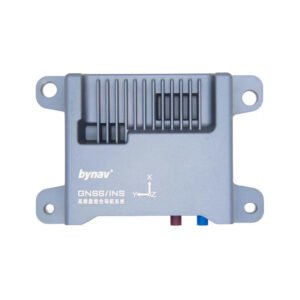
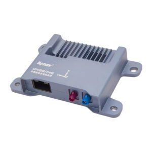
RTK+GNSS+IMU includes RTK GNSS IMU navigation modules for high-precision positioning, heading, inertial navigation and sensor fusion. Use this category to compare suitable models by range, interface, size, computing fit, installation needs and supply plan. Start with Bynav IMU Inertial Navigation Module Inertial Measurement Device North Seeking Integrated Inertial Navigation System Module and more LidarStar hardware for model-level details, then confirm specifications, quotation and export support with LidarStar. It is useful for engineers, dealers and project buyers who need a clear shortlist before sample testing or batch purchasing. For broader technical context, review GPS.gov GNSS reference information.
Showing the single result
Showing the single result
RTK+GNSS+IMU Selection Guide for Engineering Buyers RTK+GNSS+IMU are used when a project needs dependable hardware for high-precision positioning, heading, inertial navigation, sensor fusion and outdoor localization. In real procurement work, buyers rarely choose by one parameter alone. They compare range, field of view, frame rate, accuracy, data interface, software support, power consumption, mechanical size, heat dissipation and delivery availability. LidarStar keeps this category focused on practical comparison so engineers, dealers and purchasing teams can move from a general requirement to a realistic product shortlist. The right model depends first on the application environment. Indoor robots may need compact sensors with stable short-range data; vehicle platforms may need longer detection range and better resistance to outdoor conditions;…
RTK+GNSS+IMU Selection Guide for Engineering Buyers
RTK+GNSS+IMU are used when a project needs dependable hardware for high-precision positioning, heading, inertial navigation, sensor fusion and outdoor localization. In real procurement work, buyers rarely choose by one parameter alone. They compare range, field of view, frame rate, accuracy, data interface, software support, power consumption, mechanical size, heat dissipation and delivery availability. LidarStar keeps this category focused on practical comparison so engineers, dealers and purchasing teams can move from a general requirement to a realistic product shortlist.
The right model depends first on the application environment. Indoor robots may need compact sensors with stable short-range data; vehicle platforms may need longer detection range and better resistance to outdoor conditions; embedded computing projects may need enough I/O for cameras, LiDAR, radar and network modules. Products such as Bynav IMU Inertial Navigation Module Inertial Measurement Device North Seeking Integrated Inertial Navigation System Module, LiDAR sensors, NVIDIA Jetson platforms and related hardware represent different options in this category, helping buyers compare performance, integration effort and budget before requesting formal details.
For autonomous vehicle engineers, robotics teams, drone developers and mobile mapping integrators, the most important step is to describe the complete system rather than only the product name. A sensor, camera, Jetson board, navigation module or robot platform must match the machine structure, data pipeline and deployment environment. For example, a mobile robot project may need positioning hardware, obstacle detection, edge computing and a suitable communication interface at the same time. A vehicle or drone project may also require vibration resistance, cable planning, enclosure design and stable field testing.
LidarStar includes internal product links on this category page so visitors can move directly from the overview to model-level information. These links help buyers compare related products without leaving the site, and they also make the category more useful as a landing page for people researching RTK GNSS IMU navigation modules. For background reading, the page refers to GPS.gov GNSS reference information, an industry resource chosen for technical context rather than commercial competition.
When evaluating RTK GNSS IMU navigation modules, buyers should confirm the target range, interface, operating temperature, mounting method, software environment, expected order quantity and delivery plan. If the category is part of a larger system, it is also useful to share the main controller, camera layout, power supply and communication protocol. LidarStar can then help compare suitable models, provide quotation support and suggest a cleaner path from sample testing to batch procurement.
Key Points Before Ordering
- Define the working scene first: indoor, outdoor, vehicle-mounted, robot-mounted, handheld, laboratory or production use.
- Check interface requirements such as Ethernet, CAN, USB, GMSL, FPD-Link, MIPI, PCIe or serial communication.
- Compare not only headline performance, but also size, power, cooling, mounting, cable routing and software support.
- Review linked product pages and datasheets before confirming price, lead time and export shipping details.
FAQ
How do I choose the right product? Start with the application, then match range, accuracy, interface, environment and computing requirements. If you are not sure, send the use case and LidarStar can help narrow the selection.
Can LidarStar support project purchasing? Yes. LidarStar supports model comparison, sample supply, technical confirmation, quotation and export coordination for professional buyers, dealers and system integrators.









