
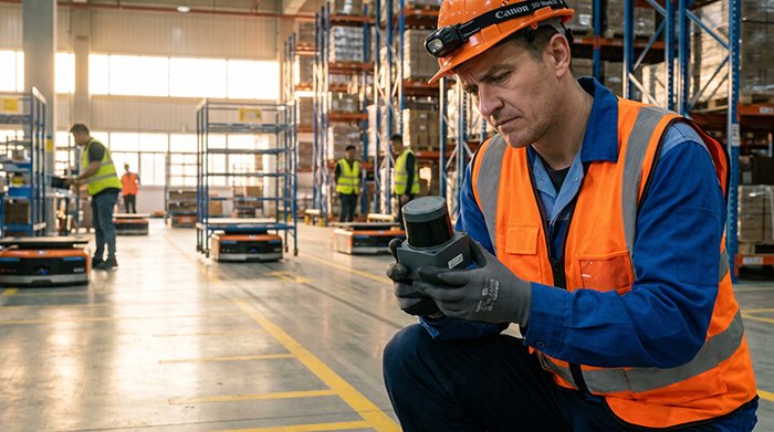
The robotics industry has a 3D obsession. More dimensions, more data, more capability — it sounds like an obvious win. But in the real world of factory floors, warehouse aisles, and logistics hubs, that assumption quietly falls apart every single day.
2D LiDAR is a single-plane laser scanner that fires a rotating laser beam across one horizontal plane, capturing high-speed distance measurements dozens of times per second. It’s deceptively simple by design. And that simplicity is precisely what makes it indispensable. According to Precedence Research, 2D LiDAR sensors account for the largest market share in the industrial automation sector, driven by their cost-efficiency and proven reliability in structured indoor environments — and the global LiDAR market itself is projected to reach $6.3 billion by 2032, with 2D sensors maintaining a dominant position in AGVs and AMRs.
The most powerful sensor isn’t always the most complex one — it’s the one that delivers the right data at the right speed for the task at hand.
This is where the concept of Foundational SLAM becomes critical. In GPS-denied environments like manufacturing plants and distribution centers, 2D LiDAR provides the core navigation layer that autonomous systems rely on. Its consistent, low-latency scan data feeds SLAM algorithms with exactly what they need — clean, high-frequency positional updates — without drowning the processor in unnecessary information. For a deeper look at how SLAM operates in GPS-denied environments, the architecture becomes even more compelling.
When the 2D LiDAR vs 3D LiDAR debate moves beyond marketing claims into actual technical performance, the picture shifts dramatically. The next section breaks down exactly where the real differences lie — and why more data doesn’t always mean better navigation.
2D LiDAR vs. 3D LiDAR: A Technical Performance Audit
The previous section established why simplicity often beats complexity in industrial autonomy. Now it’s worth putting hard numbers behind that argument. A direct technical comparison reveals why 2D LiDAR consistently outperforms its 3D counterpart in the environments where it matters most.
| Metric | 2D LiDAR | 3D LiDAR |
|---|---|---|
| Sampling Rate | Up to 50Hz+ | Typically 10–20Hz |
| Data Output | Single-plane point data | Dense 3D point clouds |
| Processing Overhead | Low | High |
| Typical Cost | $200–$2,000 | $5,000–$75,000+ |
| SLAM Suitability | Optimized for indoor use | Better for complex outdoor terrain |
Speed: Where Scan Rate Becomes a Safety Variable
According to the IEEE Xplore Digital Library, 2D sensors offer high sampling rates — often up to 50Hz or more — that are essential for robots moving at speed to navigate safely. In a busy warehouse where an AGV is traveling at 4–6 mph alongside human workers, that reaction-time advantage isn’t a nice-to-have. It’s a liability issue. As the same source notes, “2D LiDAR is the foundational layer for SLAM in mobile robotics, providing the high-speed scanning necessary for real-time spatial awareness.” For 2D lidar mapping applications in structured environments, this speed advantage is decisive.
Complexity: The Hidden Cost of Too Much Data
3D LiDAR generates rich point clouds — genuinely useful for aerial mapping and terrain reconstruction — but that density becomes a liability inside a flat-floored facility. Processing millions of 3D points per second to navigate a straight corridor is computational waste. This “Data Fatigue” effect means real-time SLAM algorithms slow down, latency creeps in, and edge-case failures become more likely. For AGVs operating in predictable 2D floor planes, a 270° to 360° single-plane scan captures everything relevant without taxing onboard processors.
Cost: ROI That’s Difficult to Ignore
The price gap between 2D and 3D LiDAR remains substantial. Deploying a fleet of 20 AGVs with 3D sensors versus 2D sensors could represent a $1M+ difference in hardware costs alone — before factoring in the beefier compute infrastructure 3D processing demands. For operations where the environment is structured and the navigation plane is flat, that premium delivers no measurable performance return.
Understanding how these sensors physically generate their data — and why certain technologies handle industrial conditions better than others — is the natural next question.
The Physics of Precision: Why ToF Technology Wins in Industrial Environments
Understanding what is 2D LiDAR at a fundamental level means understanding the measurement principle driving it. Most 2D laser scanners rely on Time-of-Flight (ToF) technology — emitting a laser pulse and measuring the time it takes to bounce back from a surface. Distance is calculated from that round-trip travel time. Simple in concept, extraordinarily reliable in execution.
The alternative, triangulation-based sensing, calculates distance by analyzing the angle at which a reflected beam hits an image sensor. It works well at short ranges and low cost, but it has a critical vulnerability: it depends heavily on consistent lighting conditions. Introduce a skylight, a high-bay lamp, or a sun-drenched loading dock, and triangulation accuracy degrades fast.
ToF doesn’t have that problem.
Ambient light immunity is where ToF earns its place in industrial automation. Warehouses are notoriously unpredictable optical environments — skylights flood aisles with shifting daylight, overhead LEDs cast harsh reflections off polished concrete, and seasonal changes alter the entire light profile of a facility. According to Terabee and supporting research on ScienceDirect, ToF-based sensors maintain measurement integrity across these conditions in ways triangulation simply cannot match.
Why ToF outperforms in demanding environments:
- Reflective surface handling — Polished floors, metallic shelving, and shrink-wrapped pallets scatter light unpredictably. ToF measures travel time, not reflected intensity, reducing false readings on high-reflectivity surfaces.
- Consistent indoor-to-outdoor transitions — AGVs and AMRs moving between loading bays and outdoor staging areas encounter dramatic light shifts. ToF maintains ranging accuracy through these transitions without recalibration.
- High sampling stability — ToF sensors deliver consistent point-cloud density regardless of ambient interference, which directly supports reliable obstacle detection.
Robust ambient light immunity isn’t a feature — it’s a prerequisite for any sensor trusted to protect both equipment and people on an active warehouse floor.
This physical reliability forms the foundation for everything that comes next — including how 2D LiDAR turns raw distance data into the detailed floor maps that power autonomous navigation.
2D LiDAR Mapping and SLAM: The Core of Mobile Robotics
Building on the ToF measurement precision covered earlier, that speed and accuracy doesn’t just detect obstacles — it actively constructs the environment around a robot in real time. This is where 2D LiDAR earns its reputation as the backbone of mobile robotics.
How a Floor Plan Emerges from a Spinning Sensor
A 2d laser scanner sensor works by emitting rapid pulse sequences across a single horizontal plane, typically 360 degrees. As each pulse returns, the sensor logs the distance and angle of every surface it contacts. Software aggregates these thousands of discrete distance readings per second into a 2D occupancy grid — essentially a digital floor plan where walls, doorways, and obstacles appear as filled cells on a coordinate map. What begins as raw point clouds becomes a navigable environment model in near real time.
Loop Closure: The Secret to Drift-Free Navigation
The real challenge in SLAM (Simultaneous Localization and Mapping) isn’t building a map — it’s maintaining accuracy over long operating cycles. As a robot traverses a facility, small sensor errors compound into positional drift. Loop closure corrects this by detecting when the robot has returned to a previously mapped location and reconciling the two overlapping scan segments. 2D LiDAR excels here because its clean, noise-reduced scan profiles make feature matching computationally straightforward. In practice, loop closure with 2D data runs reliably on the same embedded processors powering the AMR itself.
“2D LiDAR-based SLAM remains one of the most well-understood and production-proven approaches in mobile robotics, precisely because the data is structured, consistent, and low-bandwidth.” — Think Autonomous
Why Edge Devices Love 2D Data
3D point clouds can consume hundreds of megabytes per second, demanding dedicated GPUs to process. A 2D scan, by contrast, produces a fraction of that data volume while delivering everything a ground-level robot needs for localization. Computationally efficient SLAM pipelines built around 2D data run cleanly on ARM-based edge processors — no GPU required. For deeper implementation strategies around SLAM integration and algorithm selection, the architectural advantages become even clearer.
This same efficiency and precision that makes 2D LiDAR indispensable for mapping translates directly into another critical domain — one where a sensor’s reliability can mean the difference between a safe facility and a dangerous one.
Industrial Safety and Smart Infrastructure Applications
The mapping and navigation capabilities explored in previous sections only scratch the surface of what 2D LiDAR enables. Beyond mobile robotics, these sensors are quietly powering safety-critical infrastructure across factories, city streets, and logistics hubs — often outperforming far more expensive alternatives in the process.
Industrial Safety: Zone Monitoring and Emergency Stops
In manufacturing environments, 2D LiDAR sensors define safety curtains and protective zones with millisecond-level responsiveness. When a worker enters a restricted area, the sensor triggers an automated emergency stop through direct integration with industrial PLC systems — no human intervention required. This deterministic response is what makes LiDAR preferable to camera-based vision systems, which require image processing pipelines that introduce latency. In practice, a single sensor can monitor multiple configurable zones simultaneously, scaling protective coverage without multiplying hardware costs. As LiDAR evolves beyond automotive, this PLC-native compatibility is becoming a baseline expectation on factory floors.
Smart Cities: Intersections and Pedestrian Flow
Urban planners are increasingly deploying 2D LiDAR at intersections to monitor pedestrian volume, vehicle queue lengths, and crossing behavior in real time. Unlike cameras, LiDAR sensors collect no identifying imagery — an important distinction where public privacy concerns shape procurement decisions. The data feeds directly into traffic management systems, optimizing signal timing and flagging anomalies without reliance on lighting conditions.
Low-Light Performance: Why Mounting Height Matters
This is where physics and placement converge into a practical advantage. According to research published in the Journal of Sensors and Actuator Networks, 2D LiDAR sensors mounted at hip or chest height achieve a 270° to 360° field of view and detect pedestrians more reliably than camera-based systems — particularly in low-light scenarios. Cameras lose contrast; LiDAR doesn’t care about darkness.
| FOV Benefit | Industrial Safety | Smart Cities | Logistics |
|---|---|---|---|
| 270°–360° coverage | Full zone perimeter monitoring | Intersection-wide pedestrian detection | Aisle and dock coverage |
| Height-optimized placement | Human silhouette detection | Accurate occupancy counting | Forklift/pedestrian separation |
| Low-light reliability | 24/7 operation without lighting | Night traffic monitoring | Warehouse overnight shifts |
| PLC/system integration | Automated emergency stops | Signal timing optimization | Conveyor and gate control |
Understanding what 2D LiDAR delivers across these use cases naturally raises a practical question: how do you source the right hardware at scale without overpaying? 2D LiDAR price varies significantly depending on vendor model, certification level, and support structure — and those differences matter enormously when you’re moving from a single prototype to a full production deployment. That’s exactly where procurement strategy, covered next, becomes decisive.
Procurement Strategy: Balancing Performance and Factory-Direct Value
Selecting the right hardware is only half the battle — sourcing it intelligently determines whether a project scales or stalls. As covered in earlier sections, 2D LiDAR underpins everything from SLAM navigation to industrial safety systems, which means procurement decisions carry real operational weight.
What to Look for in a 2D LiDAR Supplier
Use this checklist when evaluating any hardware partner:
- ✅ Triple-certified hardware (CE, FCC, RoHS minimum) for seamless global deployment and regulatory compliance
- ✅ Factory-direct pricing that eliminates distributor markup — critical when scaling from prototype to production volumes
- ✅ 24-hour global technical support to minimize downtime across international time zones
- ✅ Consistent hardware across development stages, ensuring your prototype specs carry directly into mass production
- ✅ Broad sensor portfolio covering multiple scan ranges, frequencies, and IP ratings
Why Direct Sourcing Changes the Economics
The supplier relationship you choose at the prototype stage often defines your production ceiling. Middleman markups compound quickly at volume, and inconsistent hardware revisions between development and manufacturing introduce costly re-validation cycles.
LidarStar partners directly with leading manufacturers to deliver factory-grade quality to customers across 26+ countries — cutting the markup without cutting corners. For teams building multi-sensor fusion architectures, hardware consistency across the supply chain isn’t optional; it’s foundational.
Still have questions about specific performance trade-offs? The next section addresses the most common technical queries engineers raise before committing to a 2D LiDAR platform.
Frequently Asked Questions About 2D LiDAR
Can 2D LiDAR be used for 3D mapping?
Technically, yes — with a workaround. Mounting a 2D scanner on a tilting or rotating mechanism allows it to sweep across multiple vertical planes, stitching together a pseudo-3D point cloud. As Clearpath Robotics notes, this “spinning 2D” approach delivers reasonable 3D coverage at a lower cost, though it introduces mechanical complexity and scan latency compared to native 3D sensors.
What is the typical range of an industrial 2D laser scanner?
Most industrial-grade 2D LiDAR units cover 10 to 100 meters, depending on the application. Perimeter security and warehouse AGVs typically operate comfortably within 30 meters, while long-range models designed for outdoor infrastructure can reach beyond 80 meters.
How does weather affect 2D LiDAR performance?
Rain, fog, and dust scatter laser pulses, reducing effective range and increasing false returns. In practice, engineers often pair 2D LiDAR with redundant sensors or apply filtering algorithms — an approach explored in modern detection-focused designs — to maintain reliable performance across challenging conditions.
Is 2D LiDAR enough for obstacle avoidance in complex environments?
For most structured industrial environments, absolutely. A well-configured 2D scanner handles floor-level obstacle detection with speed and precision that more complex systems struggle to match on price. However, in environments with overhead hazards or irregular vertical geometry, supplementing with additional sensor layers — even a high-resolution option like a 360° long-range unit — delivers more robust coverage.
2D LiDAR remains the unrivaled workhorse of industrial autonomy
precisely because it solves the right problems at the right cost — and that reliability is what keeps it at the core of modern autonomous systems.
Key Takeaways
- High sampling stability — ToF sensors deliver consistent point-cloud density regardless of ambient interference, which directly supports reliable obstacle detection.
- ✅ Triple-certified hardware (CE, FCC, RoHS minimum) for seamless global deployment and regulatory compliance
- ✅ Factory-direct pricing that eliminates distributor markup — critical when scaling from prototype to production volumes
- ✅ 24-hour global technical support to minimize downtime across international time zones
- ✅ Consistent hardware across development stages, ensuring your prototype specs carry directly into mass production










