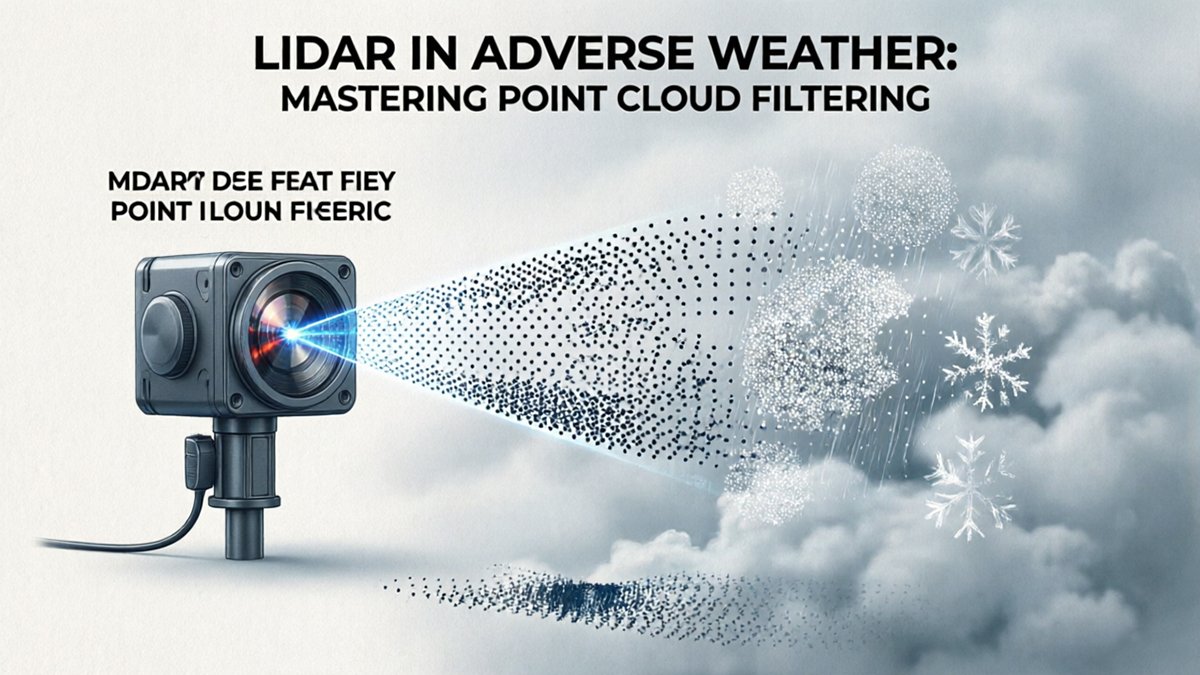
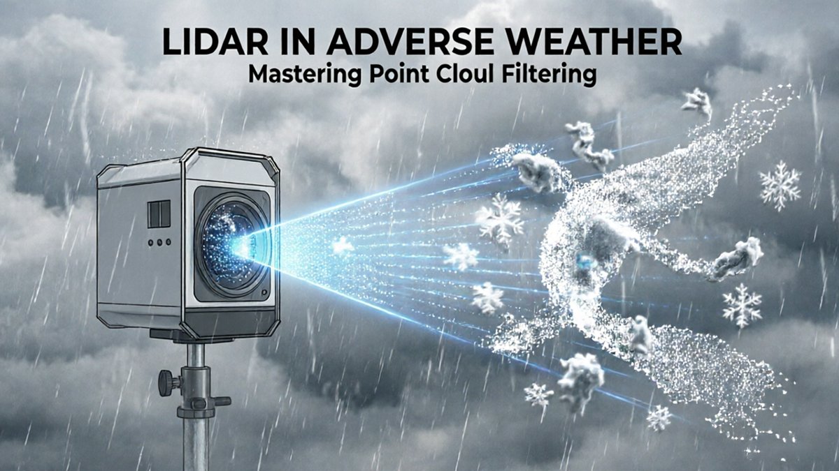
LiDAR in rain, fog, and snow isn’t simply a reliability inconvenience — it’s a fundamental physics problem rooted in how laser light behaves when it collides with airborne water particles.
When a LiDAR pulse travels through clear air, it reflects off solid surfaces and returns a clean, accurate distance measurement. Introduce precipitation, and two destructive processes begin immediately: absorption and scattering. Absorption occurs when water molecules convert laser energy into heat, permanently weakening the return signal. Scattering redirects photons away from the receiver, fragmenting what should be a coherent pulse into noise.
The severity of disruption depends directly on droplet size relative to laser wavelength. Most automotive and industrial LiDAR systems operate at 905nm or 1550nm wavelengths. When droplet diameters approach or exceed those wavelengths — as they do in heavy rain and wet fog — the interaction shifts from weak Rayleigh scattering into the far more disruptive Mie scattering regime, where energy loss becomes nonlinear and severe. According to research published in Nature Communications, heavy rainfall at just 30 mm/h can reduce a 905nm LiDAR system’s maximum detection range by 30–40%.
The three core physical challenges this creates are:
- Range collapse — attenuation cuts effective sensing distance well before hardware limits are reached
- Density loss — fewer valid returns mean sparse, unreliable point clouds
- Ghost objects — backscattered photons return from airborne droplets rather than solid surfaces, generating false positive detections that appear as phantom obstacles in the scene
Ghost objects are particularly dangerous. A sensor designed for 360° long-range detection can suddenly report walls of false returns in driving rain. Hardware improvements like stronger emitters reduce some attenuation, but they cannot eliminate backscatter noise at the source — which is why the real solution starts at the signal-processing layer. Understanding exactly how that filtering begins requires looking at what happens inside a single laser pulse.
Multi-Echo Technology: Seeing Through the Raindrops
Multi-echo technology is hardware’s first answer to the scattering problem — allowing a single laser pulse to return multiple data points from different depths simultaneously.
How a single pulse generates multiple returns: When a LiDAR sensor fires one laser pulse, that beam doesn’t always hit a single surface cleanly. In rain, a pulse might strike a falling droplet, partially scatter, continue forward, and then reflect off the road surface behind it. The sensor’s receiver captures each distinct return event separately — producing what engineers call first return, intermediate return, and last return data within one firing cycle.
- First return — the earliest echo, typically from the nearest object (a raindrop, dust particle, or fog droplet)
- Last return — the farthest echo, most likely the solid obstacle the sensor actually needs to detect
- Intermediate returns — mid-path reflections useful for characterizing the intervening medium
As documented by IEEE Xplore, multi-echo processing allows LiDAR sensors to distinguish between a pulse hitting a raindrop (first return) and that same pulse striking a solid object behind the rain (last return) — a capability that directly preserves obstacle detection integrity.
Why this matters before software ever runs: Multi-echo is a hardware-level defense. It segregates environmental noise at the acquisition stage, meaning downstream point cloud filtering algorithms receive cleaner, pre-sorted data to work with. Think of it as triage before surgery — the hardware categorizes returns by depth priority so software can make faster, more confident decisions. For autonomous systems where sensor architecture choices are critical, this pre-filtering step reduces the computational burden significantly.
Engineer’s Note: In heavy rain, relying solely on last-return data can suppress up to 90% of false positive points — but it also risks discarding valid near-field returns in mixed-density precipitation. Hardware alone isn’t enough.
This limitation sets the stage for fog — a far more insidious challenge where particle density creates an entirely different perceptual failure mode.
The Fog Challenge: Overcoming the Halo Effect
Fog is uniquely destructive to LiDAR performance — not simply because it reduces range, but because it generates a blinding noise wall directly in front of the sensor.
Particle size is the critical variable. Rain droplets typically measure between 0.5 mm and 5 mm in diameter, large enough that many laser pulses pass between them. Fog particles, by contrast, are microscopic — ranging from 1 to 100 micrometers — and dense enough to intercept nearly every outgoing pulse. This triggers Mie scattering, a regime where particle diameter is comparable to the laser wavelength, producing intense, forward-concentrated backscatter rather than diffuse reflection. The result is severe LiDAR signal attenuation in weather conditions that differ fundamentally from rain-related degradation.
The halo effect is the most operationally damaging consequence. When laser pulses scatter back from suspended fog droplets clustered near the sensor, the receiver interprets that returned energy as solid geometry — creating a dense, high-intensity noise cloud at close range. As SAE International notes:
“The primary challenge in fog is not just range reduction, but the ‘halo effect’ where backscattered light creates a high-intensity noise cloud immediately in front of the sensor, blinding the perception system.”
This near-field saturation is particularly dangerous because it doesn’t just degrade distant object detection — it actively prevents the sensor from perceiving the immediate environment, including pedestrians and stopped vehicles within braking distance. The sensor’s receiver, designed to detect faint return signals, becomes overwhelmed by the flood of close-range backscatter.
Firmware-level near-field suppression has emerged as a necessary countermeasure. By defining exclusion zones and applying receiver gain adjustments in real time, modern perception-grade sensors can partially suppress halo artifacts at the hardware level. However, firmware alone cannot fully resolve the problem — which is precisely why software-based filtering pipelines, working frame by frame, have become indispensable.
Spatio-Temporal Filtering: Software-Defined Visibility
Software-defined filtering is rapidly becoming as important as sensor hardware itself — transforming raw, noise-contaminated point clouds into reliable environmental maps even in heavy precipitation.
Comparing consecutive frames is the cornerstone of this approach. Because snowflakes and raindrops are transient, their reflected points appear in one frame and vanish in the next. Static geometry — a guardrail, a pedestrian, a parked vehicle — returns consistent point positions across multiple scans. By cross-referencing sequential frames, filtering algorithms flag and discard those ephemeral returns before they ever reach the perception stack.
Trajectory analysis takes this a step further. Rather than simply checking whether a point persists, modern algorithms model the motion signature of a detected return. A snowflake drifts along a predictable atmospheric path; a real object either holds still or moves with coherent, physics-consistent velocity. Anything whose trajectory matches typical precipitation behavior — gradual, wind-influenced drift with low reflectivity — gets classified as noise. This distinction is critical for systems relying on multi-echo LiDAR technology, where the same pulse may already return partial hits from both a raindrop and the surface behind it.
The efficiency gains from these methods are substantial. According to MDPI Sensors Journal research, advanced spatio-temporal filtering algorithms can remove over 95% of snow-induced noise points while retaining 99% of actual environmental geometry — a remarkable balance between aggressive cleaning and structural fidelity.
| Algorithm Type | Primary Benefit |
|---|---|
| Frame-to-frame differencing | Eliminates transient precipitation returns |
| Trajectory classification | Separates atmospheric scatter from real objects |
| CNN-based de-noising | Generalizes across diverse precipitation intensities |
| Adaptive threshold filtering | Preserves low-reflectivity edge geometry |
That 99% geometry retention figure is where the real story lies. Filtering aggressively without preserving fine structural detail — curb edges, lane markers, cyclists — creates a false sense of clarity. The best pipelines treat noise removal and detail retention as equally weighted objectives, not a trade-off. Understanding how that balance holds up when channel density changes is the next critical question.
Real-World Performance: A Case for High-Channel Density
Higher channel counts are one of the most decisive hardware advantages for autonomous vehicle perception adverse weather deployments — and the math behind why is straightforward.
Vertical resolution is the first variable to reconsider when rain enters the equation. A 32-channel sensor loses a measurable share of its active pulses to backscatter and attenuation. When that happens, the point cloud thins out in ways that compromise object boundary detection. A 128-channel unit, by contrast, maintains structural redundancy: according to LidarStar Technical R&D, higher channel counts provide redundant data paths, ensuring that even if 30% of pulses are attenuated, the remaining 70% still deliver sufficient density for reliable object detection. That’s not a marginal gain — it’s the difference between a system that degrades gracefully and one that fails abruptly.
Point density directly governs classification accuracy in rain. Sparse clouds force algorithms to interpolate geometry rather than measure it, increasing the error rate for edge cases like pedestrians partially obscured by rainfall or vehicles with low reflectivity. Denser inputs, typical of high-channel units, give 3D object detection models more signal to work with, shrinking the uncertainty envelope around each detected object.
Key Insight: In regions where precipitation is frequent — the Pacific Northwest, the Gulf Coast, or northern industrial corridors — the ROI case for 128-channel hardware becomes compelling quickly. Fewer missed detections mean fewer safety interventions, less system downtime, and lower long-term liability exposure.
Factory-direct quality control closes the loop. Sensor-to-sensor variability in channel calibration can quietly erode the performance gains that high channel counts are supposed to deliver. Sourcing through verified, factory-aligned channels ensures that the consistency seen in lab benchmarks translates to the field — an important consideration as multi-sensor stacks grow more complex, a point the next section addresses directly.
Integrating Multi-Modal Data for Environmental Resilience
No single sensor survives every weather condition — which is why pairing LiDAR with complementary modalities is becoming a non-negotiable design principle for resilient autonomous systems.
Sensor fusion isn’t a backup plan; it’s the architecture. When precipitation or dense fog degrades LiDAR’s return signal, Radar steps in as a stabilizing layer. Radar’s millimeter-wave transmissions pass through rain, snow, and fog with minimal attenuation, providing velocity and range data even when optical sensors are compromised. Spatio-temporal filtering LiDAR pipelines can then cross-validate this Radar data against surviving LiDAR returns — reinforcing detections rather than guessing in the gap. As explored in this breakdown of sensor redundancy edge cases, the failure modes of LiDAR operating in isolation underscore exactly why fusion architectures matter.
LiDAR’s geometric precision is what Radar lacks. Radar excels at weather penetration but delivers coarse spatial resolution. LiDAR’s high-density point clouds provide the fine-grained object geometry — edges, dimensions, surface normals — that Radar simply cannot replicate. Together, the two sensors cover each other’s blind spots: Radar confirms that something is present; LiDAR defines what shape it is and where precisely it sits.
Ongoing optimization demands expert-level support. Sensor fusion stacks are complex, and tuning them across shifting environmental conditions isn’t a one-time configuration. Access to 24-hour technical support ensures that calibration drift, firmware updates, and edge-case failures get resolved before they cascade into system-level failures in the field.
Hardware certification is the foundation everything else rests on. Triple-certified hardware — meeting rigorous standards for moisture ingress, thermal stability, and optical component integrity — ensures that both LiDAR and Radar sensors perform predictably under the same harsh conditions the fusion pipeline was designed to handle.
Understanding how these systems work in theory is one thing. Seeing it in action — point clouds being cleaned in real-time — makes the performance gap immediately obvious.
Visualizing the Data: LiDAR Performance in Action
Seeing raw versus filtered point cloud data side-by-side is the single fastest way to grasp why LiDAR backscatter noise mitigation matters in real-world deployments.
What to watch for: As the video plays, focus on the dense cluster of erroneous returns that appear near the sensor origin in the raw feed — those are backscatter artifacts generated by fog droplets, rain, or airborne particulates. When the filter engages, those phantom points disappear almost instantly, leaving a clean structural representation of the actual environment. The contrast is striking and immediate.
Raw vs. filtered comparison is more than a visual demo — it’s a validation tool. As Robotics Engineering Weekly notes, visualizing the “before and after” of point cloud filtering is the most effective way to validate algorithm efficacy for R&D leads. In practice, engineering teams use this comparison to benchmark competing filter configurations, confirming that true object geometry is preserved while noise density drops. A sensor operating in heavy fog without filtering can see detection accuracy fall dramatically — context that CNN-based denoising research has documented in depth.
Connecting to spatio-temporal filtering — the approach covered earlier — the video makes the temporal dimension tangible. Notice how noise points flicker inconsistently across frames, while genuine returns remain spatially stable. That behavioral difference is precisely what spatio-temporal algorithms exploit to separate signal from artifact. High-channel-density sensors, like those covered in this deep dive into 128-channel scanning systems, generate the data redundancy that makes this frame-by-frame discrimination reliable.
Understanding what good filtering looks like visually sets the stage for smarter procurement decisions — which the next section addresses directly.
The Bottom Line: Key Takeaways for LiDAR Procurement
Smart LiDAR procurement decisions made today directly determine whether your autonomous system survives tomorrow’s worst weather conditions.
As the previous sections have shown, neither hardware nor software alone closes the gap — it takes deliberate specification choices at the purchasing stage. Here are four criteria every procurement team should treat as non-negotiable:
- Prioritize multi-echo capability. Any outdoor autonomous deployment will encounter rain, fog, or dust. Multi-return hardware captures intermediate reflections that single-return sensors discard entirely, preserving obstacle data precisely when environmental noise is highest. This is the single most impactful hardware feature to confirm before signing a purchase order.
- Invest in high-channel density. In high-attenuation environments, a meaningful percentage of return pulses are corrupted or lost. High-channel sensors build in redundancy — enough overlapping scan lines that even significant data loss leaves a usable point cloud. For applications like level 3 autonomous driving, this redundancy isn’t optional.
- Validate firmware-level filtering support. Advanced spatio-temporal filtering must run at the edge, not just in post-processing. Confirm that the sensor’s onboard firmware supports configurable filtering pipelines before deployment, not after. Hardware with built-in multi-return support reduces software development overhead by up to 25%, according to Industrial Automation Insights — a figure that compounds quickly across fleet-scale rollouts.
- Source from engineering-backed distributors. Edge-case weather optimization — salt spray, wet snow, mixed precipitation — requires calibration guidance that standard documentation doesn’t cover. Distributors offering direct engineering support close that gap. The near-field data density required for low-visibility environments is another area where vendor expertise proves critical.
Procurement is where theoretical performance becomes real-world reliability. Getting these four decisions right is what separates systems that degrade gracefully from those that fail silently — and that distinction raises questions worth exploring further.
Frequently Asked Questions: LiDAR in Adverse Weather
Choosing the right LiDAR configuration for adverse weather demands answers to specific technical questions — not generic reassurances.
Does 905nm or 1550nm perform better in heavy rain?
In practice, 1550nm wavelengths scatter less in heavy rain and deliver stronger returns through water droplets compared to 905nm systems. However, 111550nm sensors carry higher component costs and stricter eye-safety power limits, which constrains maximum output. Neither wavelength eliminates rain-induced noise entirely — robust point cloud density management through filtering remains essential regardless of the wavelength chosen.
Can software filtering completely replace the need for multi-echo hardware?
Software filtering alone is not a substitute for multi-echo hardware — the two approaches are most effective when combined. Multi-echo hardware captures multiple return pulses per laser shot, preserving genuine target returns that single-echo systems discard. Software then removes residual false positives. Relying exclusively on software increases the risk of misclassifying real objects as noise, particularly at detection range boundaries.
How does snow accumulation on the sensor lens affect the point cloud?
Snow buildup on the lens surface creates a near-field scattering wall, flooding the point cloud with high-intensity ghost returns that obscure everything beyond the sensor housing. This effect compounds rapidly — even a thin layer can degrade detection range by a meaningful margin. Heated lens enclosures and hydrophobic coatings are the primary hardware countermeasures, supplemented by accumulation-detection algorithms.
What is the impact of salt spray in coastal or winter road environments?
Salt spray poses a long-term threat that goes beyond momentary signal noise. According to LidarStar Technical Support, salt spray and road grime can cause permanent lens degradation if the sensor housing is not properly rated for corrosive environments. Procurement teams operating in coastal or winter road conditions should verify IP ratings and housing material specifications before deployment — reactive maintenance after corrosion sets in rarely restores original performance.