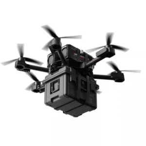
Most robotics developers waste weeks chasing hardware-specific quirks when the real power of ROS is that it was designed to make the sensor almost irrelevant.
That design philosophy is what makes ROS LiDAR integration so compelling in practice. Rather than building your navigation stack around a specific sensor’s SDK, ROS abstracts the hardware behind standardized message types. The two workhorses are sensor_msgs/LaserScanfor 2D ranging data and sensor_msgs/PointCloud2for dense 3D point clouds — and once your LiDAR publishes to either, every downstream algorithm treats it identically regardless of which manufacturer built the hardware.
This abstraction layer is the foundation of hardware-agnostic robotics. As ROS.org documents, unified abstraction layers in ROS and ROS2 allow developers to swap LiDAR hardware without rewriting core SLAM or navigation logic. In practical terms, that means a SLAM stack tuned on one sensor can migrate to a different unit — different beam count, different range, different vendor — with nothing more than a driver swap and a topic remap. For teams iterating on hardware budgets or scaling to different robot platforms, this is enormously valuable. It’s also why modern SLAM systems have evolved into sensor-agnostic pipelines rather than tightly coupled, brand-specific implementations.
The shift from ROS1 Noetic to ROS2 Humble sharpened this further. According to Open Robotics, ROS2 Humble delivered significant gains in real-time performance reliability for high-bandwidth LiDAR data compared to ROS1 — a critical improvement for sensors streaming millions of points per second. The DDS-based communication model in ROS2 reduces latency jitter that previously caused dropped scans under load. However, that capability only materializes when the integration workflow is configured correctly from the start. That’s where permissions, device naming, and udev rules become the first real obstacle most developers encounter.
Solving the 90% Failure: Serial Port Permissions and Udev Rules
Any LiDAR ROS tutorial worth its salt will tell you the same thing upfront: getting your sensor physically recognized by Linux is where most projects stall before they even start.
The reality is that 90% of “LiDAR no data” problems trace back to serial port permissions and incorrect device mapping — not broken drivers, not bad hardware. The fix is straightforward, but doing it wrong costs hours of debugging.
Identifying the device is your first move. Plug in your LiDAR over USB and run:
ls -l /dev | grep ttyUSB
You’ll see output like crw-rw---- 1 root dialout 188, 0 /dev/ttyUSB0. That dialout group is the key — your user account must belong to it. Add yourself with sudo usermod -aG dialout $USER, then log out and back in for the change to take effect.
The chmod trap is where developers lose production readiness. Running sudo chmod 666 /dev/ttyUSB0 unblocks the Permission Denied error immediately, and it feels like a clean win. However, according to the LidarStar Engineering Guide, this is a temporary fix only — the permission resets on every reboot. For any deployment beyond a desktop prototype, including mobile platforms in structured environments, you need a persistent udev rule.
Writing the udev rule takes about two minutes. Create a new rules file:
sudo nano /etc/udev/rules.d/99-lidar.rules
Add the following line, substituting your sensor’s actual vendor and product ID (found via lsusb):
SUBSYSTEM=="tty", ATTRS{idVendor}=="10c4", ATTRS{idProduct}=="ea60", SYMLINK+="rplidar", MODE="0666"
Then reload the rules:
sudo udevadm control --reload-rules && sudo udevadm trigger
⚠️ Warning: Always use your sensor’s specific
idVendorandidProductvalues. Generic rules can accidentally remap unrelated USB-serial devices, causing silent conflicts that are notoriously difficult to trace.
With the symlink /dev/rplidar now persistent across reboots, your ROS launch files can reference a stable device path — the essential foundation before you write a single line of driver configuration.
ROS Noetic Workflow: From Workspace to LaserScan
With serial port permissions sorted, the next blocker is workspace structure — and getting this right in ROS Noetic determines whether your sensor publishes clean data or stays silent.
A properly sourced catkin workspace is the foundation every subsequent ROS Noetic step depends on.
Setting up catkin_ws starts with creating and initializing the workspace, then sourcing the environment so every terminal session can find your packages:
mkdir -p ~/catkin_ws/src
cd ~/catkin_ws
catkin_make
source devel/setup.bash
That last line is non-negotiable. Forgetting to source setup.bash in a new terminal is one of the most common reasons nodes silently fail to launch. Many teams add it to ~/.bashrc to avoid the oversight entirely.
Cloning manufacturer drivers from source is typically necessary because binary packages lag behind sensor firmware updates. For RPLIDAR ROS Noetic, the process follows a predictable pattern: clone the driver into src/, return to the workspace root, and rebuild:
cd ~/catkin_ws/src
git clone https://github.com/Slamtec/rplidar_ros.git
cd ~/catkin_ws
catkin_make
source devel/setup.bash
This pattern generalizes across most 2D sensors. The LiDAR integration guide on Hackster.io confirms this source-build approach works reliably on constrained hardware like Raspberry Pi, which matters given how often mobile robots use single-board computers as compute platforms.
Launching the rplidar_ros node uses roslaunch with the appropriate launch file:
roslaunch rplidar_ros rplidar_a3.launch
Verifying the /scan topic is the final confirmation step. In a separate terminal (sourced), run:
rostopic echo /scan
A healthy output streams sensor_msgs/LaserScan messages with populated ranges arrays. No output — or an empty ranges field — points back to the udev rules covered earlier, or an incorrect serial port parameter in the launch file.
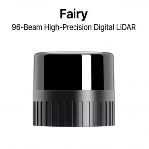
The role of accurate scans in GPS-denied navigation illustrates exactly why verifying this data stream matters: downstream algorithms like SLAM consume every value in that array. As the International Federation of Robotics notes, the shift from 2D to 3D LiDAR in industrial mobile robots is driven by robust obstacle detection in dynamic environments — which is precisely the limitation the ROS2 ecosystem addresses through higher-bandwidth architectures covered next.
ROS2 Humble & Jazzy: Leveraging DDS for High-Bandwidth 3D Data
ROS2 rewrites the integration rulebook — and for teams tackling ROS2 Humble LiDAR configuration, the shift from catkin to colcon is where that rewrite begins.
The colcon build system fundamentally changes how workspace dependencies resolve across packages.
Setting up the workspace starts with a clean directory structure. Unlike ROS Noetic’s catkin_ws, ROS2 uses ros2_ws:
mkdir -p ~/ros2_ws/src
cd ~/ros2_ws
colcon build --symlink-install
source install/setup.bash
The --symlink-install flag is worth noting: it lets you edit Python nodes without rebuilding, which cuts iteration time during driver configuration.
Binary vs. source installation is the first real decision point. For widely-supported sensors, apt-get binary installs are faster and more stable:
sudo apt-get install ros-humble-rplidar-ros
Building from source — cloning into ~/ros2_ws/src and running colcon build — gives access to unreleased firmware fixes and custom message types, but adds dependency management overhead. In practice, start with binaries and only drop to source builds when a specific feature or patch demands it.
The setup.bash problem catches nearly every developer moving from ROS1. ROS2 requires sourcing ~/ros2_ws/install/setup.bash in every new terminal session. A missed source means ros2 run throws “package not found” errors that look deceptively like installation failures. Adding the source line to ~/.bashrc eliminates this entirely.
Launching 3D point cloud nodes in ROS2 uses the new launch system syntax:
ros2 launch ouster_ros driver.launch.py sensor_hostname:=192.168.1.1
This matters because Open Robotics Performance Reports show DDS middleware reduces latency and packet loss when handling dense 3D point clouds at 10–20Hz — the frequency range where mapping algorithms like those used in autonomous spatial reasoning demand consistent throughput. DDS replaces ROS1’s single-master architecture with a decentralized pub-sub model, meaning a node crash no longer cascades into full system failure.
Once your point cloud is publishing cleanly, the next challenge isn’t data volume — it’s geometry. Getting ROS2 to understand where that data originates in physical space requires a correctly configured TF tree, and that’s where most integration projects either solidify or unravel.
The TF Tree: Aligning LiDAR Data with Robot Geometry
Getting a LiDAR driver running is only half the battle — without a correctly configured TF tree, your sensor_msgs/LaserScan data floats in space, untethered from the robot it belongs to.
An incorrect TF tree is the single most common cause of ‘ghosting’ in SLAM maps, where the same wall appears twice because the system can’t reconcile where the sensor is relative to the robot’s center of mass. As noted in Gazebo Simulation Documentation, achieving a plug-and-play experience requires developers to define the precise spatial coordinates — x, y, and z — of the sensor relative to the robot base. Skip this step and your mapping algorithm is essentially working with a broken ruler. For teams investing in accurate indoor localization, the TF tree is non-negotiable.
Static transform definition is the foundational starting point. The static_transform_publisher node broadcasts the rigid offset between base_link and your sensor’s laser_frame. A minimal launch-file entry looks like this:
<node pkg="tf2_ros" type="static_transform_publisher"
      name="lidar_broadcaster"
      args="0.15 0.0 0.25 0 0 0 base_link laser_frame" />
The six numeric arguments represent x, y, z in meters followed by roll, pitch, yaw in radians. Even a 2 cm positional error here propagates into SLAM drift over distance.
URDF and Xacro files offer a more maintainable long-term solution. Rather than hardcoding transforms in launch files, you declare the <joint> and <link> elements inside your robot description, letting the robot_state_publisher node manage the entire transform chain automatically. Xacro macros make this reusable across sensor variants without copy-pasting XML.
Tip:
frame_idconsistency is critical. Theframe_idfield in your LaserScan message header must exactly match the child frame name in your TF broadcast — a mismatch silently drops data in ROS, with no error thrown.
Once the tree is correctly wired, the next natural step is confirming it visually — which is exactly where RViz becomes an indispensable diagnostic tool.
Visual Debugging: Mastering RViz and RViz2
A correctly wired LiDAR integration isn’t truly verified until you can see clean, consistent data rendering in RViz — every configuration detail becomes visible the moment you open the visualizer.
With your TF tree in order and your driver publishing, the next step is confirming the data stream is actually healthy. RViz and RViz2 are the fastest diagnostic tools available for this, but they surface problems only when configured correctly. A misconfigured display will show nothing — and silence looks identical to a hardware failure.
Start with these configuration checkpoints before drawing any conclusions about your sensor:
- Set the Fixed Frame correctly. In the RViz “Global Options” panel, the Fixed Frame must match your LiDAR’s
frame_idexactly — typically something likelaserorlidar_link. A mismatch here produces the “No transform from…” error and a blank viewport, even when data is flowing. - Add the right display type. Use LaserScan for 2D sensors and PointCloud2 for 3D units. Set the topic to match what your driver is publishing, then confirm the status indicator turns green.
- Adjust QoS settings in ROS2. In RViz2, each display panel exposes a QoS profile. Set Reliability to Best Effort when your driver publishes with that profile — a Reliable subscriber receiving Best Effort data will drop every single message silently.
- Verify your udev rules LiDAR setup. If the display type shows green but data is choppy or absent, confirm your udev rules granted the correct device permissions — a partial permission failure causes intermittent drops that look like a QoS problem.
- Watch the visual pattern for hardware clues. A consistent arc or ring indicates healthy operation. Radial streaks, frozen sectors, or a collapsing point cloud ring often signal a motor stall or encoder fault that no log message will catch as clearly.
As Generation Robots notes, “whenever you can see a complete 360-degree point cloud ring in RViz, your hardware-to-software handshake is officially successful.” That visual confirmation is meaningful — it validates the driver, the TF tree, and the transport layer simultaneously. For teams working on low-latency scan applications, RViz pattern analysis is often faster than parsing raw topic output.
[Video Reference Placeholder: “Install and Run Lidar In ROS2, Ubuntu, and Raspberry Pi” — youtube.com/watch?v=ao13F-L_TAI]
Once your visualization is clean and stable, the next challenge shifts from confirming data to sustaining it — which means diving into QoS tuning, network buffer sizing, and diagnosing latency that RViz alone won’t expose.
Advanced Troubleshooting: QoS, Latency, and Network Buffers
Production LiDAR deployments surface a class of bugs that never appear on a developer’s bench — and most trace back to QoS mismatches, starved network buffers, or misconfigured environments.
Q: My RViz LiDAR visualization shows no point cloud despite an active topic. The first thing to check is the QoS Reliability Profile. As noted on Robotics Stack Exchange, RViz2 defaults to Reliable, but most 3D LiDAR drivers publish on Best Effort to reduce overhead. Mismatched profiles cause silent data loss — no warnings, just an empty viewport. Set RViz2’s topic subscriber to Best Effort and the points will typically appear immediately.
When to use Best Effort vs. Reliable: Use Best Effort for high-frequency sensor streams (spinning LiDARs at 10–20 Hz) where a dropped packet is less damaging than backpressure-induced lag. Switch to Reliable for low-frequency diagnostic topics or critical state messages where every packet must arrive.
Q: My high-resolution 3D sensor shows massive latency spikes. Run ros2 topic hz /your_lidar_topic alongside ros2 topic delay to isolate whether the problem is publish-side or network-side. A common culprit for Ethernet LiDARs is an undersized Linux kernel receive buffer. Increase it with:
sudo sysctl -w net.core.rmem_max=26214400
sudo sysctl -w net.core.rmem_default=26214400
For sensors generating dense point clouds — relevant when operating in GPS-denied environments — these buffer values can mean the difference between smooth SLAM and dropped frames.
Q: ROS2 throws ‘Package not found’ after a fresh driver install. Check your environment variables first. A missing source install/setup.bash is the single most common cause. Verify with echo $ROS_PACKAGE_PATH and confirm your workspace overlay appears.
Pro-Tip: Add
source ~/your_ws/install/setup.bashto your.bashrcpermanently — chasing environment errors in production wastes more time than any other single ROS mistake.
These patterns form a consistent picture worth consolidating into a repeatable checklist — which is exactly where the key takeaways ahead come in.
The Bottom Line: Key Takeaways for LiDAR Integration
A clean LiDAR integration comes down to four decisions made early — and getting even one wrong compounds into hours of debugging downstream.
The fastest path to a stable, hardware-agnostic robotics stack is to treat these four principles as non-negotiable defaults.
- Persistent udev rules over chmod shortcuts. Temporary permission fixes feel fast, but they evaporate on reboot. Writing a properly scoped udev rule — matched to your sensor’s vendor and product IDs — ensures the serial or USB device node is available and correctly permissioned every time the system starts. It’s a five-minute task that eliminates an entire category of frustrating, intermittent failures.
- Standardize on sensor_msgs. As the ROS Wiki makes clear, standardizing on message types like
sensor_msgs/LaserScanandsensor_msgs/PointCloud2is the foundation for modular robotics development. When every node in your stack speaks the same message language, swapping one LiDAR model for another becomes a driver-level change — not a pipeline rewrite. Whether you’re building a 2D scanning solution or scaling up to dense 3D point clouds, this abstraction layer is what keeps your SLAM pipeline hardware-agnostic. - Verify the TF tree first. Before blaming a SLAM algorithm or a navigation stack, confirm that
tf2_tools view_framesproduces a complete, cycle-free tree. A single missing or misspelled frame ID silently corrupts sensor fusion without throwing an obvious error. - Commit to ROS2 Humble or later for 3D LiDAR work. High-bandwidth sensors generating millions of points per second push the limits of older middleware. ROS2’s DDS transport, refined lifecycle management, and improved QoS controls — topics covered in depth in the previous section — provide the reliability headroom that production 3D autonomy applications genuinely require.
In practice, integrators who internalize these four principles spend far less time in reactive debugging and far more time advancing their actual application logic. The questions that remain — latency handling, ROS1-to-ROS2 bridging, IMU fusion — are exactly the kind of scenario-specific challenges worth exploring in detail. The FAQ section that follows addresses the most common of those directly.
LiDAR Integration FAQ
Getting LiDAR working in ROS is rarely a single-step process — these four questions come up repeatedly in forums, GitHub issues, and engineering channels.
How do I handle LiDAR data latency in real-time applications?
Latency compounds fast when scan data passes through multiple nodes before reaching your planner. In practice, the most effective fix is setting QoS history depth to a shallow value (1–5 messages) so stale scans are dropped rather than queued. Pairing that with /use_sim_time false on hardware deployments keeps timestamps honest and prevents downstream fusion nodes from choking on out-of-order data.
Can I run ROS1 LiDAR drivers in a ROS2 environment?
Yes — the ros1_bridge package proxies topics between both middleware layers, but it adds measurable overhead and is best treated as a migration tool, not a permanent architecture. The cleaner path is adopting a native ROS2 driver directly; manufacturers including Ouster now publish first-party ROS2 packages that support both distros from a single codebase, removing the bridge entirely.
What is the difference between 2D LaserScan and 3D PointCloud2?
LaserScan encodes a single horizontal plane as range and intensity values — lightweight, fast, and sufficient for corridor navigation. PointCloud2 carries full volumetric data across multiple scan layers, enabling obstacle detection above floor level. If your application involves uneven terrain or 3D volumetric navigation, PointCloud2 is the correct message type, though it demands significantly more processing bandwidth. The quickstart integration guide from Generation Robots covers both message types in practical context.
How do I fuse LiDAR data with IMU for better localization?
Sensor fusion is where localization becomes robust. Algorithms like Kalman Filters combine LiDAR point clouds with IMU acceleration and gyroscope data to smooth pose estimates through scan gaps and dynamic environments, as noted by LidarStar Technical Support. The robot_localization package implements an Extended Kalman Filter that subscribes to both data streams natively — configuring odom0 for LiDAR odometry and imu0 for your IMU topic is the standard starting point.
If your integration is hitting walls that logs alone can’t explain, consulting a hardware-software specialist early saves far more time than debugging in isolation.