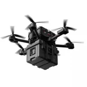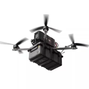
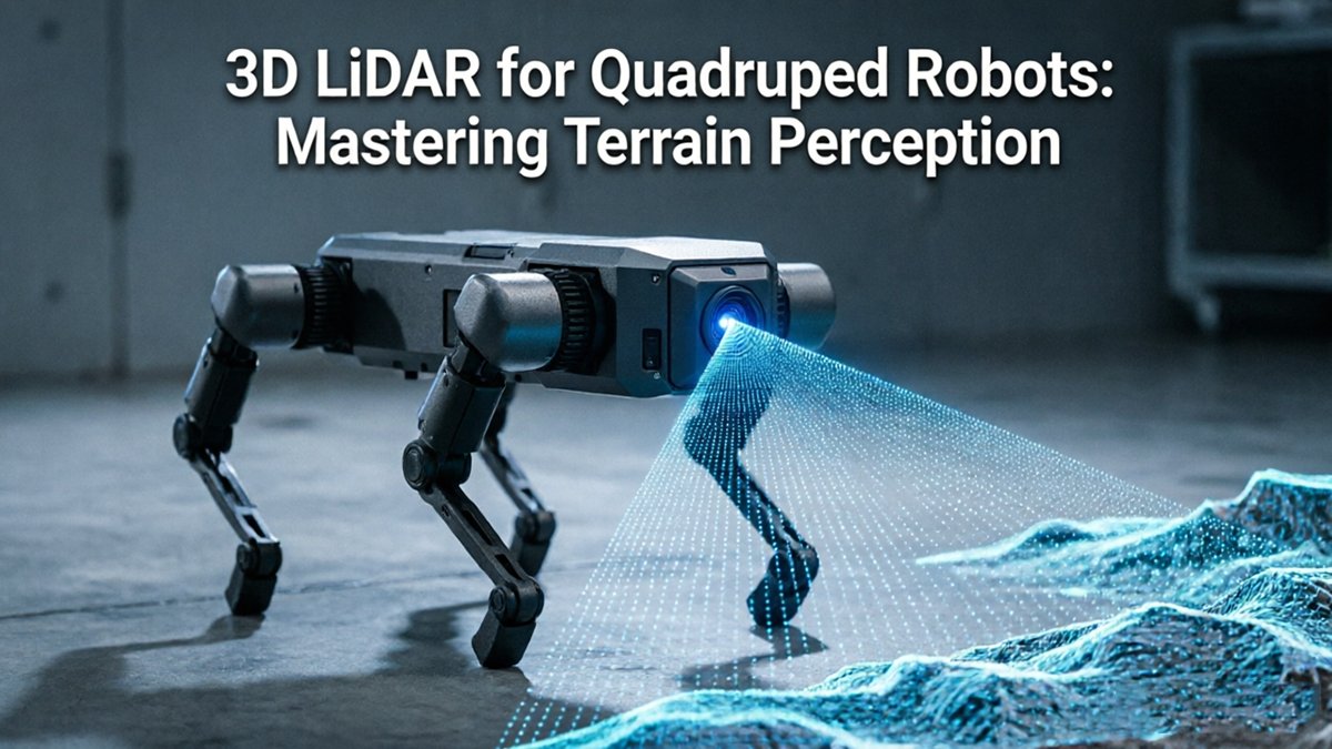
Modern quadruped robots are crossing a fundamental threshold — moving from stumbling through environments reactively to reading terrain before a single foot falls.
Early legged systems operated in what researchers simply called “blind” locomotion. Without any external sensory input, robots relied entirely on proprioceptive sensing — inertial measurement units (IMUs) and leg odometry — to estimate body posture and react to disturbances after contact. This approach, while impressive for controlled environments, carries hard limitations: it cannot anticipate a step edge, a loose gravel patch, or a sudden incline. The robot discovers the obstacle by hitting it.
“The primary challenge for legged robots is not just seeing the ground, but understanding its structural integrity through real-time geometric analysis.” — MIT Biomimetic Robotics Lab
The gap between reactive and proactive locomotion is exactly where informed locomotion emerges. Rather than correcting mid-stride, perception-aware systems pre-calculate viable footholds from a geometric model of the terrain ahead. Research from ETH Zurich and other institutions demonstrates that whole-body control paired with terrain adaptation dramatically improves stability on unstructured surfaces — but only when the robot carries a reliable map of what lies ahead.
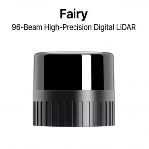
That map-building requirement is where 3D LiDAR becomes indispensable. Unlike cameras, LiDAR provides accurate geometric data that feeds simultaneous localization and mapping pipelines — allowing the robot to build, update, and navigate a precise 3D world model in real time. In industrial settings — warehouses, construction sites, underground tunnels — this capability separates functional autonomy from controlled-lab demonstrations.
The shift from blind proprioception to LiDAR-informed perception isn’t incremental. It’s architectural. And understanding why LiDAR often outperforms vision-based alternatives in demanding environments reveals just how deep that architectural difference runs.
Why 3D LiDAR Outperforms Vision in Complex Industrial Terrains
Active sensing is the defining advantage that makes quadruped robot LiDAR technology superior to camera-based perception in demanding real-world environments.
Active vs. passive sensing is the core distinction. Stereo cameras are passive — they depend entirely on ambient light to construct depth estimates. LiDAR, by contrast, emits its own laser pulses and measures the time-of-flight return, making it completely independent of environmental lighting. As the MIT Biomimetic Robotics Lab highlights, this active sensing capability enables true 24/7 operation in environments where cameras simply cannot function — tunnels, underground utilities, and windowless warehouses included.
Key Advantage: Because LiDAR actively emits laser pulses, a quadruped can navigate a pitch-dark industrial facility as accurately at 2 AM as it does at noon — no lighting infrastructure required.
Environmental interference is where camera-based systems reveal their most critical failure points. High-dust mining environments, smoke-filled factories, and fog-laden outdoor sites scatter and diffuse the light that stereo cameras rely on, degrading depth maps dramatically or producing complete perception blackouts. LiDAR pulses are generally less susceptible to particulate interference at typical industrial ranges, maintaining reliable point cloud generation where vision pipelines fail. This robustness is one reason modern robotics perception systems increasingly treat LiDAR as a primary sensor rather than a supplement.
Computational efficiency adds another layer of practical advantage. Generating depth from stereo imagery requires intensive algorithms — disparity computation, feature matching, triangulation — all of which introduce latency and demand significant processing headroom. LiDAR delivers direct, metric depth measurements per point, removing that conversion step entirely. For a legged robot making rapid foothold decisions on uneven terrain, lower latency translates directly into safer, more responsive locomotion.
That precision in depth measurement becomes especially critical when the robot needs to identify features as small as a stair tread edge — a challenge that depends entirely on the spatial resolution the sensor can deliver.
The Geometry of a Foothold: Achieving Sub-2cm Spatial Resolution
Precise terrain perception method determines whether a quadruped plants its foot safely or pitches into a catastrophic fall — and the margin for error is measured in millimeters.
According to Science Robotics, LiDAR-based terrain mapping systems can achieve spatial resolution around 2 centimeters — the exact threshold required for a quadruped to reliably identify stair treads. That number isn’t arbitrary. A point cloud denser than one return per 2cm² gives the robot enough geometric data to distinguish the usable surface of a step from its drop edge. Anything coarser and the boundary blurs into noise.
Point cloud density is the core variable here. Higher pulse rates and tighter beam spacing produce denser clouds, which directly improve foothold planning accuracy. The robot’s motion planner needs not just the average height of a surface, but its precise edge geometry — where load-bearing material ends and open air begins. Sparse data forces interpolation, and interpolated edges are guesses. For autonomous mobile robots navigating three-dimensional space, that distinction between measured and estimated geometry defines the operational reliability ceiling.
The risks compound quickly when edge detection fails. Miscalculating the lip of a step by even 3–4 centimeters can send a foot into a shear load it wasn’t designed to handle, bending actuators or triggering an unrecoverable lean. On rubble or gravel, the stakes shift: an underestimated void between two rocks means a leg drops further than the controller anticipated, destabilizing the gait cycle mid-stride.
Different terrain types impose distinct precision demands. A practical breakdown of minimum resolution requirements includes:
- Stairs and step edges: Sub-2cm resolution to define tread boundaries and riser height with enough fidelity for safe foot placement
- Gravel and loose aggregate: High point density to model surface irregularity and avoid overloading individual contact points
- Slopes and ramps: Accurate gradient measurement across a wide sweep to prevent center-of-mass shifts that exceed stability limits
- Rubble and debris fields: Dense returns that resolve void spaces and unstable surfaces before weight is committed
Reducing locomotion uncertainty is ultimately what high-resolution sensing buys. When the terrain model is geometrically faithful, the planner can commit to a foothold with confidence rather than hedging with conservative, slower gaits. That confidence translates directly into mission capability — faster traversal, access to tighter spaces, and sustained reliability across shift-length deployments. Of course, sensor resolution alone doesn’t complete the picture. The raw point cloud still needs to be fused with real-time motion data to account for the robot’s own dynamic movement — which is exactly where IMU integration and leg odometry become indispensable.
Multi-Sensor Fusion: Integrating LiDAR with IMU and Leg Odometry
Knowing the terrain’s exact geometry is only half the battle — a quadruped also needs to know where it is within that terrain at every millisecond of its gait cycle. That’s the core problem multi-sensor fusion solves, and it’s what separates truly autonomous legged robots from fragile proof-of-concepts.
IMU compensation is the unsung hero of clean point cloud generation. A rotating LiDAR sensor captures its environment over a finite sweep window — typically 10–25ms. During that window, a walking quadruped is vibrating, pitching, and rolling with each footfall. Without high-frequency IMU data running at 400–1000Hz to timestamp and dewarp each returning laser pulse, those motion artifacts compound into a blurred, distorted point cloud. The IMU acts as a continuous mechanical reference, correcting for body motion so that the resulting scan reflects terrain geometry, not locomotion noise.
“Multi-sensor fusion combining LiDAR with IMUs allows quadruped robots to maintain posture and velocity accuracy even when visual sensors are obscured by dust.” — IEEE Xplore (Robotics and Automation Letters)
Proprioceptive awareness fills the critical gaps when LiDAR is momentarily obscured — by a dust cloud, a tight corner, or sensor occlusion from the robot’s own body. During these blind intervals, leg odometry takes over. Each joint encoder tracks limb position and contact forces, feeding a kinematic model that estimates body displacement with surprising fidelity. Think of it as dead reckoning for legs: not perfect over long distances, but accurate enough to bridge a half-second LiDAR blackout without stumbling.
The integration of leg odometry with 3D point clouds feeds directly into a tightly coupled LiDAR-inertial SLAM framework. Unlike loosely coupled approaches — where each sensor’s output is fused after independent processing — tightly coupled SLAM jointly optimizes IMU pre-integration, leg kinematics, and LiDAR scan matching in a single factor graph. This produces a state estimate that is far more robust under aggressive maneuvers. For facilities deploying robots in dusty or cluttered environments, LiDAR-based SLAM architectures built on this principle represent a meaningful reliability leap over simpler alternatives.
Of course, fusing raw geometry into a stable map is only the beginning. The next challenge is teaching the robot to understand what that geometry actually represents — whether a surface is solid concrete, compressible grass, or something in between.
Semantic Segmentation: Differentiating Concrete from Tall Grass
Raw geometry alone isn’t enough — a capable environment perception system must also understand what each surface actually is before committing a foothold to it.
Point cloud segmentation is the intelligence layer that transforms raw distance data into actionable terrain classifications. Rather than treating every return as an undifferentiated obstacle, modern algorithms assign each point to a category — rigid ground, loose gravel, water, vegetation — and flag whether a given surface is traversable. As ETH Zurich and other institutions’s Robotic Systems Lab has demonstrated, semantic segmentation now enables systems to classify points so precisely that solid ground beneath light vegetation becomes reliably detectable, a capability that fundamentally changes how quadrupeds navigate naturalistic environments.
Soft obstacles present the most deceptive challenge. Tall grass, shallow puddles, and loose brush produce LiDAR returns that look like solid ground to a naive geometric interpreter. A 2D scanner, sweeping a single horizontal plane, may simply miss these surfaces entirely or misread them as passable floor. 3D LiDAR solves this by capturing vertical density profiles: grass returns a sparse, vertically distributed cluster of weak reflections, while concrete beneath it returns a dense, consistent horizontal plane. The segmentation layer uses that structural difference to mark the canopy returns as vegetation and infer the ground plane below — allowing the robot to step through rather than stall at the edge. For sensor deployments in challenging outdoor conditions, understanding how point clouds behave in complex environments is equally critical to maintaining this classification accuracy.
Real-time geometric analysis adds a second layer of intelligence: structural integrity checks. Even a surface correctly labeled “ground” may be a thin ledge, a crumbling edge, or a slope that exceeds safe loading angles. By analyzing surface normals, local curvature, and point density continuously within each control cycle, the system can reject geometrically suspect footholds before weight is transferred — the difference between a confident stride and a costly stumble.
All of this classification work feeds directly into how the robot decides where to go next — setting up the locomotion control strategies that translate terrain maps into real-time gait decisions.
Autonomous Locomotion Control Strategies for 3D Environments
Terrain perception only delivers value when it’s directly wired into the robot’s autonomous locomotion control strategy — the decision-making engine that translates map data into movement.
The critical insight: every footstep decision is the output of a closed-loop system that begins with a LiDAR scan and ends with a motor command.
Dynamic path planning sits at the heart of this loop. As the robot’s 3D map updates in real time, the path planner continuously recalculates the safest, most energy-efficient route forward. This isn’t a one-time computation at mission start — it’s a rolling re-evaluation that accounts for newly detected obstacles, surface deformations, and changing slope gradients. Research on environment perception systems confirms this is foundational to developing autonomous locomotion control strategies for quadrupeds navigating complex 3D environments, as detailed in this overview of quadrupedal robotics research.
Gait selection is where the strategy becomes most visible. LiDAR-measured slope angles feed directly into gait-switching logic:
- On flat, stable surfaces, the robot defaults to a trot — a diagonal two-beat gait that optimizes speed and energy efficiency.
- As slope angle increases beyond roughly 15–20 degrees, or when surface irregularity spikes, the controller shifts to a crawl gait — a slower, statically stable pattern where three legs always maintain ground contact.
- On highly unpredictable terrain, some systems deploy a bound or pronk pattern to manage dynamic instability.
A 360-degree sensor field of view is especially valuable here, since slope transitions can occur at any angle relative to the robot’s heading.
Latency is the non-negotiable constraint binding the entire system together. For legged robots moving at operational speeds, the perception-to-actuation pipeline must complete within 5–20 milliseconds to prevent the control loop from acting on stale geometry. Exceeding this window — even briefly — can cause missteps that cascade into falls. This tight timing budget is why dedicated onboard processors and efficient LiDAR hardware are not optional luxuries but core architectural requirements.
These control strategies reach their most impressive expression when robots tackle structured vertical challenges — which brings us to one of the most instructive real-world demonstrations available.
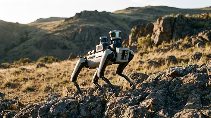
Visualizing the Tech: Real-World Stair Climbing and Navigation
Seeing a quadruped robot climb stairs in real time makes the underlying perception stack viscerally clear — no diagram communicates it quite as well.
[VIDEO EMBED: Learning Quadrupedal Locomotion over Challenging Terrain — https://www.youtube.com/watch?v=9j2a1oAHDL8]
Point cloud visualization is where abstract algorithms become visible decisions. In R&D demos, the live LiDAR feed appears as a dense, color-coded cloud surrounding the robot — each point assigned a height or surface-type value. Edges of stair treads register as sharp geometric discontinuities, standing out immediately against flat floor returns. What looks like noise to the untrained eye is actually structured elevation data updated in milliseconds, giving the planner a continuously refreshed model of the upcoming terrain. As stair-climbing robot deployments demonstrate, even tightly spaced industrial staircases become navigable when that point cloud is dense enough and the sensor refresh rate keeps pace with the robot’s stride cycle.
Foothold planning overlays — often rendered as colored contact patches projected onto the point cloud — show exactly where each foot is predicted to land on the next two to four steps. This visualization exposes the robot’s intent: it is not reacting blindly, it is selecting footholds from a ranked candidate set filtered by slope, contact area, and stability margin. The gap between a safe tread and a sloped riser is precisely the kind of sub-2 cm distinction that separates a clean ascent from a stumble. Understanding how 3D sensing outperforms 2D approaches in these confined, structured spaces clarifies why the industry upgrade path only runs in one direction.
In multi-level facility management — think warehouses, data centers, or industrial plants — these capabilities translate directly to autonomous inspection routes that span multiple floors without human escort. The same LiDAR-driven foothold logic that handles a demo staircase handles a real loading-dock ramp or a mezzanine access stair. Together, the sensing and locomotion layers covered throughout this article form a coherent system — one whose practical implications deserve a clear, consolidated summary for R&D decision-makers.
The Bottom Line: Key Takeaways for Robotics R&D Leads
Quadruped robots operating in unstructured environments demand perception systems that are precise, robust, and always-on — and 3D LiDAR now sets the baseline for all three.
Sub-centimeter foothold accuracy isn’t a luxury — it’s a load-bearing requirement. When a legged robot places a foot on irregular ground, the difference between a stable stance and a fall can be measured in millimeters. LiDAR’s ability to resolve terrain geometry at sub-2cm precision gives motion planners the dense, accurate point clouds they need to evaluate candidate footholds before committing to a step. Passive camera systems, by comparison, struggle to deliver that geometric fidelity in low-contrast or low-light conditions.
Multi-sensor fusion closes the gap that no single modality can bridge. Legged locomotion introduces continuous vibration and rapid attitude changes that corrupt any standalone sensor reading. Fusing LiDAR with an IMU — as covered in earlier sections — stabilizes the ego-motion estimate and keeps the terrain map coherent even during dynamic maneuvers like bounding or stair climbing. According to LidarStar Engineering Consulting, high-resolution 3D LiDAR is now the industry standard for industrial quadrupeds that must navigate reliably in dark or dusty environments where passive vision fails entirely.
Active sensing delivers the 24/7 operational window that camera-based systems cannot. LiDAR emits its own illumination, making performance independent of ambient light. Night shifts, underground inspections, and smoke-filled industrial settings are operationally identical to a sunlit warehouse floor.
Semantic segmentation of point clouds is what separates functional outdoor robots from proof-of-concept lab demos. Raw geometry is necessary but not sufficient for navigating rubble fields, vegetation, or mixed-material surfaces. Classifying each point by material type — gravel, mud, foliage, metal grating — allows the locomotion planner to apply terrain-appropriate stepping strategies, not just geometric clearance checks. Research into rough terrain navigation for legged platforms underscores that semantic awareness is increasingly integral to achieving reliable autonomy beyond controlled environments.
As these capabilities mature, the decisions R&D leads make at the hardware procurement stage — sensor grade, integration ecosystem, vendor support — will determine whether that potential translates into deployed, scalable systems.
Future-Proofing Your Quadruped: Procurement and Integration
Selecting the right LiDAR sensor isn’t just a technical decision — it’s a long-term investment that determines whether your quadruped fleet scales reliably or stalls at deployment.
Automotive-grade sensors are the baseline for serious industrial applications. Built to withstand vibration, temperature extremes, and continuous duty cycles, they deliver the consistency that warehouse, inspection, and field-deployment robots demand. Consumer-grade alternatives may pass a lab bench test but degrade unpredictably once exposed to real operating conditions. For quadruped platforms that already push compute and power budgets to their limits, sensor failure is not a recoverable edge case — it’s a mission abort.
Fleet scaling introduces a cost sensitivity that single-unit deployments never surface. When procurement moves from one unit to dozens, per-sensor pricing, lead times, and warranty terms compound quickly. A $200 difference per unit across a 50-robot deployment is $10,000 — before factoring in replacement logistics. R&D leads who lock in favorable unit economics early retain the flexibility to iterate on software without being constrained by hardware budget overruns.
Direct-to-factory procurement eliminates distributor markups and the ambiguity that multi-tier supply chains introduce. LidarStar provides direct factory pricing on automotive-grade LiDAR sensors with global shipping, removing intermediaries from a supply chain that already has enough complexity. Knowing exactly what you’re buying — and from whom — simplifies qualification, documentation, and vendor risk assessment.
24-hour technical support is a non-negotiable when integrating LiDAR and inertial systems. Calibration drift, timestamp synchronization issues, and ROS driver conflicts don’t surface on a schedule. Access to engineering support around the clock compresses debugging cycles from days to hours — a material advantage when a deployment deadline is fixed.
The path from prototype to production-ready quadruped perception is navigable. Contact LidarStar’s engineering team to discuss sensor specifications, pricing tiers, and integration support tailored to your platform’s requirements.
FAQ
Q: What makes a LiDAR sensor “automotive-grade” for robotics use?
Automotive-grade sensors meet stricter vibration, temperature, and reliability standards than industrial or consumer alternatives — typically validated to AEC-Q100 or equivalent, making them appropriate for continuous-duty robotic deployments.
Q: How does direct factory procurement affect lead time?
Bypassing distributors typically shortens lead times and provides clearer visibility into production schedules, which matters when coordinating hardware deliveries with software integration sprints.
Q: Is 24-hour support realistic for a hardware vendor?
For complex sensor integrations involving time-synchronized LiDAR and inertial stacks, round-the-clock access is a practical necessity. Vendors who commit to it signal that they understand deployment-stage challenges, not just pre-sale specifications.