Low-speed collisions are quietly draining billions from fleet budgets — and the sensors meant to prevent them often can’t see the threat clearly enough to act.
The so-called “fender bender” problem is no minor inconvenience. Across commercial fleets, low-speed scrapes in parking lots, loading docks, and tight urban corridors represent a disproportionate share of total collision costs. Repair bills, downtime, liability claims, and rising insurance premiums compound quickly at scale. Integrating short-range LiDAR sensors on vehicle corners can significantly reduce these repair costs, according to data from the Insurance Institute for Highway Safety (IIHS) — a figure that reframes perimeter sensing as a financial imperative, not just a safety feature.
Conventional radar is well-suited for highway-speed, long-range detection, but it lacks the lateral resolution required to catch a slow side-scrape against a bollard or a pedestrian edging along a vehicle’s flank. The angular precision simply isn’t there for the geometry of near-field threats.
This gap becomes critical as the industry shifts from passive driver-assist systems — the familiar beep warning a driver to brake — toward fully autonomous braking and maneuvering decisions. That transition demands higher data fidelity. A beep tolerates ambiguity; an autonomous action cannot. As explored in modern sensor fusion architectures, the quality and density of sensor data directly determines how confidently a system can act without human confirmation.
This near-field zone — broadly defined as 0 to 30 meters surrounding a vehicle or robot platform — is precisely where a short-range LiDAR blind spot becomes a liability. It’s a space legacy sensor suites were never designed to dominate.
Understanding why ultrasonics fall short in that zone is where the real engineering conversation begins.
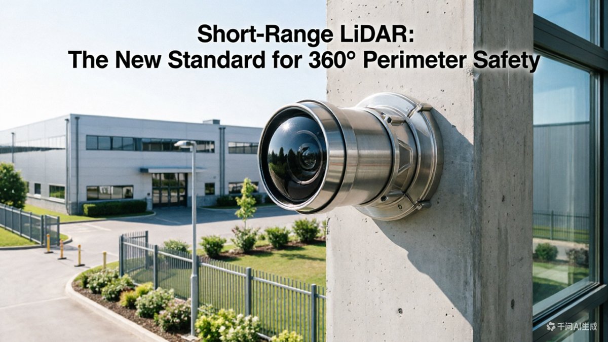
Why Ultrasonic Sensors Fail Where Short-Range LiDAR Excels
Ultrasonic sensors were never designed for the complexity of modern autonomous environments — and that fundamental mismatch is now a measurable safety liability.
Ghost echoes are among the most persistent problems with ultrasonic arrays. Sound waves bounce off multiple surfaces simultaneously, creating phantom readings that force control systems to either ignore valid alerts or trigger unnecessary stops. In dense operating environments — loading docks, narrow corridors, vehicle bays — cross-talk between adjacent sensors compounds this problem, degrading array-level reliability precisely where accuracy matters most. Wind and ambient industrial noise further distort the acoustic signal, making ultrasonics inherently unreliable in outdoor or high-traffic settings.
Resolution is the second critical failure point. Ultrasonic sensors return a single scalar value: distance. They cannot describe what is at that distance. Near-field LiDAR sensors, by contrast, generate dense three-dimensional point clouds that capture object shape, surface texture, and spatial extent in real time. That difference in data richness isn’t incremental — it’s categorical. Where an ultrasonic ping says “something is 0.4 meters away,” a LiDAR point cloud says “a cylindrical, hard-surface object 14 cm in diameter is positioned at these exact coordinates.”
Material Discrimination: A Key Advantage According to a Velodyne LiDAR white paper, LiDAR-based detection is superior to ultrasonic approaches because its high-resolution point clouds can distinguish between soft objects like foliage and hard hazards like bollards — a distinction ultrasonics physically cannot make.
Environmental resilience rounds out the comparison. Unlike sound waves, LiDAR pulses are unaffected by wind, engine noise, or ambient acoustic interference. Understanding how sensor architecture drives this resilience explains why LiDAR point clouds remain stable across conditions where ultrasonic arrays produce erratic, untrustworthy output.
That reliability advantage becomes even more consequential when the goal is full perimeter coverage — which requires not just better sensors, but smarter field-of-view geometry.
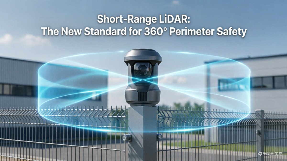
Achieving 360-Degree Perimeter Safety with High-Angle FoV
Vertical field of view is the hidden variable in the LiDAR vs ultrasonic parking debate — and it’s where short-range LiDAR decisively separates itself from legacy sensors.
A 90-degree vertical FoV allows LiDAR to effectively detect the ground plane. Conventional ultrasonic sensors fire in a narrow cone, making them nearly useless for detecting low-profile hazards — curbs, wheel stops, crouching children, or debris sitting just inches off the pavement. Short-range LiDAR units achieving a vertical FoV of up to 90° capture point cloud data from the surface directly beneath and around the vehicle, turning a traditional blind spot into actionable data.
Dead-zone elimination is the practical payoff. When a sensor is mounted on a vehicle’s bumper or corner pillar, the zone directly beneath the mounting point has historically returned no usable data. A steep downward vertical angle closes that gap, ensuring the ground immediately adjacent to the vehicle is continuously sampled — not assumed to be clear.
The horizontal picture is equally important. Key advantages of combining high-angle FoV with multi-sensor fusion include:
- True 360° horizontal coverage achieved by positioning sensors at all four vehicle corners, each responsible for a defined arc segment
- Overlapping detection zones at corner handoff points, eliminating seams where threats could slip through
- Simultaneous ground and mid-height scanning within a single sensor sweep cycle
- Scalable fusion architecture that allows point clouds from multiple units to be merged into one unified spatial model
Corner-mounted placement is the geometry that makes this work. When sensors are angled outward at roughly 45 degrees from each vehicle corner, their individual arcs overlap sufficiently to create seamless perimeter coverage. Understanding how multi-sensor fusion is architected at the hardware level explains why spatial alignment — not just sensor count — determines whether dead zones truly disappear.
This geometry becomes even more critical in GPS-denied environments, which leads directly into how automated valet parking systems depend on exactly this kind of perimeter precision.
The Role of LiDAR in Automated Valet Parking (AVP)
Automated Valet Parking represents one of the most demanding real-world tests for autonomous sensing — and short-range LiDAR is what makes it possible.
Multi-story parking garages are GPS-denied environments. Satellite signals degrade or disappear entirely inside concrete structures, making GPS-reliant localization useless. Without an active sensing layer, a vehicle has no reliable way to determine its position, track lane markings, or identify open spaces. Short-range LiDAR fills that gap by building real-time point cloud maps of the immediate environment — no external signal required.
As Autonomous Vehicle International notes:
“Short-range LiDAR is the ‘eyes’ of the vehicle for low-speed maneuvers, providing the high-density spatial data necessary to navigate tight urban spaces where GPS signals are often unavailable.”
Centimeter-level precision is non-negotiable in AVP. Parking a vehicle autonomously within a standard stall — often less than 8.5 feet wide — demands spatial accuracy that ultrasonic sensors simply cannot deliver at the resolution and update rate required. Short-range LiDAR routinely achieves positioning accuracy within 2–5 centimeters, enabling confident, repeatable maneuvers even in the tightest configurations. This is where 360 degree perimeter coverage becomes a functional requirement, not a marketing specification: blind spots in a parking garage can mean a collision with a pillar, a cart, or a pedestrian stepping between rows.
Dynamic obstacle detection adds another layer of complexity. Garages are active environments — pedestrians walk unpredictably, doors open, and other vehicles reverse without warning. Real-time LiDAR mapping continuously refreshes the spatial model, flagging moving objects and updating safe path corridors within milliseconds. For a deeper look at how multi-sensor architectures handle these environments at the hardware level, the engineering tradeoffs go well beyond any single sensor.
That interplay between near-field awareness and broader system coordination points directly to why AVP doesn’t operate in isolation — it depends on how short-range sensors hand off to the wider sensor fusion stack.
Sensor Fusion: Integrating Short-Range and Long-Range Systems
Short-range and long-range LiDAR aren’t competing systems — they’re complementary layers that together create a seamless autonomous sensing stack.
The “hand-off” problem is where many sensor architectures stumble. As a vehicle transitions from highway cruising to urban docking, the primary long-range LiDAR — optimized for 200+ meter detection — progressively loses relevance. Short-range sensors, including the automated valet parking sensors discussed earlier, must smoothly assume primary authority below roughly 10 meters. A poorly timed or unsynchronized hand-off creates detection gaps precisely when proximity risk is highest.
Data synchronization compounds the challenge. Long-range and short-range units frequently operate on different wavelengths and scan patterns, producing point clouds with mismatched densities and timing offsets. Effective fusion pipelines use time-stamping at the hardware level — aligning returns before they reach the perception stack — so the vehicle never acts on stale near-field data while processing a fresh long-range sweep.
Redundancy through sensor diversity is the third pillar. Cameras are a cost-efficient complement, but as Autonomous Vehicle International notes, Level 4 and Level 5 automation cannot rely on cameras alone — lighting variability in parking structures, tunnels, and nighttime conditions makes active sensing non-negotiable for 24/7 reliability. Understanding why redundancy matters at the physics level reinforces why LiDAR-to-LiDAR redundancy outperforms camera-dependent fallback modes.
Compute load balancing closes the loop. Near-field processing demands low-latency pipelines — reaction times measured in milliseconds — while long-range path planning tolerates slightly longer compute cycles. Well-designed architectures partition these workloads across dedicated processors, preventing near-field obstacle data from competing with route optimization for the same compute resources.
Getting that architecture right, however, depends heavily on the physical form factor and integration design of the sensors themselves — which is where hardware engineering decisions become critical.
Engineering Considerations for Blind Spot LiDAR Integration
Smart hardware selection upfront saves months of costly redesign — especially when integrating short-range LiDAR for blind spot detection in robotics and automotive platforms.
The form factor decision alone can determine whether your integration succeeds or fails at the vehicle corner.
- Mechanical vs. solid-state: Mechanical spinning units offer wider vertical field-of-view but introduce moving parts susceptible to vibration. Solid-state sensors, with no rotating components, suit tight corner-mounting brackets where shock tolerance is non-negotiable. For most perimeter safety applications, solid-state wins on durability — though mechanical systems remain compelling for full 360° coverage in open-platform deployments.
- Weatherproofing and lens cleaning: Rain, mud, and road spray directly degrade near-field point cloud density. Specify IP67 or IP69K-rated housings as a baseline. Heated lens covers or pressurized air-blast cleaning systems are increasingly standard on production vehicles operating in harsh climates.
- Thermal management: Compact housings trap heat aggressively. Without proper thermal dissipation — whether passive aluminum heatsinking or active micro-fan arrangements — sensor performance degrades and lifespan shortens. This is especially critical in enclosed wheel-arch or bumper-integrated mounting positions.
- Direct-to-factory procurement: Sourcing sensors through direct OEM or distributor channels rather than spot markets meaningfully reduces Bill of Materials cost at scale. Automotive-grade LiDAR sensors must be triple-certified to withstand industrial vibration and environmental stressors, per LidarStar Technical Specs, so validating supplier certification documentation before committing volume is essential.
In practice, the teams that compress integration timelines are those who treat mounting geometry, thermal envelope, and procurement strategy as a unified design constraint — not three separate workstreams.
As the hardware landscape matures, these once-specialized decisions are becoming far more accessible to mainstream development teams — a shift the next section explores in depth.
Future Trends: The Democratization of Near-Field Sensing
Short-range LiDAR is crossing a critical threshold — moving from a niche R&D tool into a mainstream industrial component that any well-funded startup can deploy at scale.
The shift from lab to production floor is accelerating faster than most engineers anticipated. What once required six-figure procurement budgets and long lead times is now available through streamlined, catalog-style purchasing. This mirrors the broader spatial intelligence evolution underway across robotics and AV platforms, where modular sensor stacks are replacing custom-built, one-off solutions.
Factory-direct procurement is the clearest driver of this shift. LidarStar provides direct factory pricing on automotive-grade LiDAR sensors, eliminating intermediaries for global developers. The practical result: compressed development cycles, predictable BOM costs, and faster iteration.
The ‘Supermarket Model’ of hardware procurement — browsing, comparing, and ordering production-ready sensors with transparent pricing — is removing the gatekeeping that once made LiDAR an enterprise-only technology.
128-channel systems entering the short-range space represent the next performance leap. Higher channel density means richer high-resolution point cloud parking geometry — capturing wheel-level obstacles, curb edges, and pedestrian foot placement with unprecedented fidelity at distances under 30 meters. What was previously reserved for highway-speed forward sensing is now being reengineered for low-speed, close-quarters environments.
Data format standardization is the quieter revolution running in parallel. Emerging consensus around formats like ROS2-compatible point cloud structures and unified driver APIs means teams spend less time on sensor integration plumbing and more time on perception stack development.
Taken together, these trends signal that the barriers to deploying robust near-field LiDAR are collapsing rapidly — and the engineering tradeoffs that define the best implementations are worth examining closely as final design decisions approach.
Key Takeaways for Robotics and AV Engineers
Short-range LiDAR is no longer a premium add-on — it is the foundational sensing layer that separates reliable perimeter safety from costly guesswork. As the previous sections have established, the shift away from ultrasonics is driven by measurable performance gaps that accumulate into real operational risk. Here are the four principles every engineer should carry forward.
- 40% reduction in low-speed collision costs is achievable. Collision events at low speeds — parking maneuvers, dock approaches, narrow corridor transits — are disproportionately expensive when aggregated across a fleet. Active LiDAR sensing dramatically reduces these incidents by delivering centimeter-accurate object detection where ultrasonic dead zones create vulnerability. The savings on insurance, downtime, and liability quickly offset hardware investment.
- Vertical FoV is the metric that cannot be compromised. A 90° vertical field of view is the engineering threshold for eliminating ground-level blind spots. Hesai Technology notes that high-angle detection is critical for identifying low-lying obstacles and small children — scenarios where flat-scanning sensors simply fail. If a sensor cannot see what’s directly beneath or beside a moving platform, it cannot guarantee perimeter safety.
- Active sensing is non-negotiable for GPS-denied AVP. Automated Valet Parking and indoor logistics environments offer no fallback to satellite positioning. LiDAR’s self-contained, environment-mapping capabilities make it the only viable primary sensor for L4 operations in structured indoor spaces, as covered in the flash LiDAR sensing overview.
- Factory-direct procurement is the scaling lever. BOM costs at volume are determined by sourcing strategy as much as hardware selection. Engaging factory-direct relationships early in the design cycle prevents margin stacking that makes L4 deployment economically unsustainable.
Still have questions about range specifications, sensor comparisons, or weather performance? The next section addresses the most common technical queries engineers raise when evaluating short-range LiDAR for the first time.
Frequently Asked Questions About Short-Range LiDAR
Engineers evaluating near-field sensing upgrades consistently raise four core questions — here are direct, technically grounded answers.
What is the typical detection range of a “short-range” LiDAR sensor?
Short-range LiDAR is specifically optimized for high-angle detection within the 0–30 meter envelope, making it purpose-built for perimeter safety, robotic obstacle avoidance, and parking assistance. Some near-field units are optimized for dense point-cloud resolution at close distances rather than long-range target acquisition.
Can short-range LiDAR replace ultrasonic sensors entirely?
In most structured environments, yes — but with important caveats. LiDAR consistently outperforms ultrasonics on angular resolution, update rate, and multi-target discrimination, while ultrasonic units retain a cost and power advantage in highly constrained, single-axis detection tasks. For 360° perimeter coverage, short-range LiDAR is generally the superior choice; ultrasonic sensors may remain valid as low-cost backup triggers in specific zones.
How does rain or fog affect near-field LiDAR performance?
Adverse weather introduces backscatter that reduces effective range and can generate false returns. In practice, most near-field LiDAR systems apply point-cloud filtering algorithms that flag or suppress low-intensity returns characteristic of rain droplets. Performance degradation is a concern but manageable — intelligent LiDAR platforms designed for security and safety applications increasingly bundle on-device filtering to sustain reliable detection in challenging conditions.
What is the advantage of 3D LiDAR over 2D for parking applications?
A 2D scanner produces a single horizontal plane, missing objects that cross above or below that slice. 3D LiDAR generates volumetric point clouds that capture height, shape, and object classification simultaneously — critical for distinguishing a pedestrian from a bollard or detecting a low-profile curb before a wheel makes contact.