Payload weight is one of the most consequential variables in multi-rotor UAV design — and the engineering community has the data to prove it.
Every 100 grams of additional payload can reduce flight time by 2% to 5% depending on battery capacity and rotor configuration, according to Drone-OSS. That figure compounds quickly when you consider that a typical industrial drone may already carry a gimbal, camera, communication modules, and now increasingly, a LiDAR sensor.
The lift equation isn’t forgiving. To maintain altitude, rotor RPM must increase proportionally with total aircraft mass. Higher RPM draws more current from the battery pack, and under sustained load, that current draw accelerates voltage sag — a condition where cell voltage drops below optimal thresholds mid-mission, forcing an early return or risking a brownout. On long-duration surveys, voltage sag doesn’t just shorten flight time; it degrades sensor data quality in the final minutes when the drone is operating at reduced stability.
This is where the concept of SWaP — Size, Weight, and Power — becomes central to industrial UAV procurement decisions. SWaP is an engineering framework borrowed from defense electronics that evaluates a component not just on what it does, but on what it costs the overall platform in mass, volume, and energy draw. A sensor that weighs 1 kg and draws significant power continuously fails the SWaP test regardless of its scanning resolution.
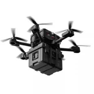
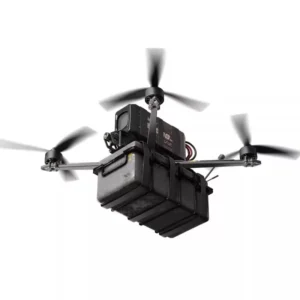
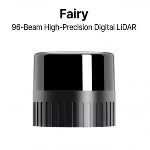
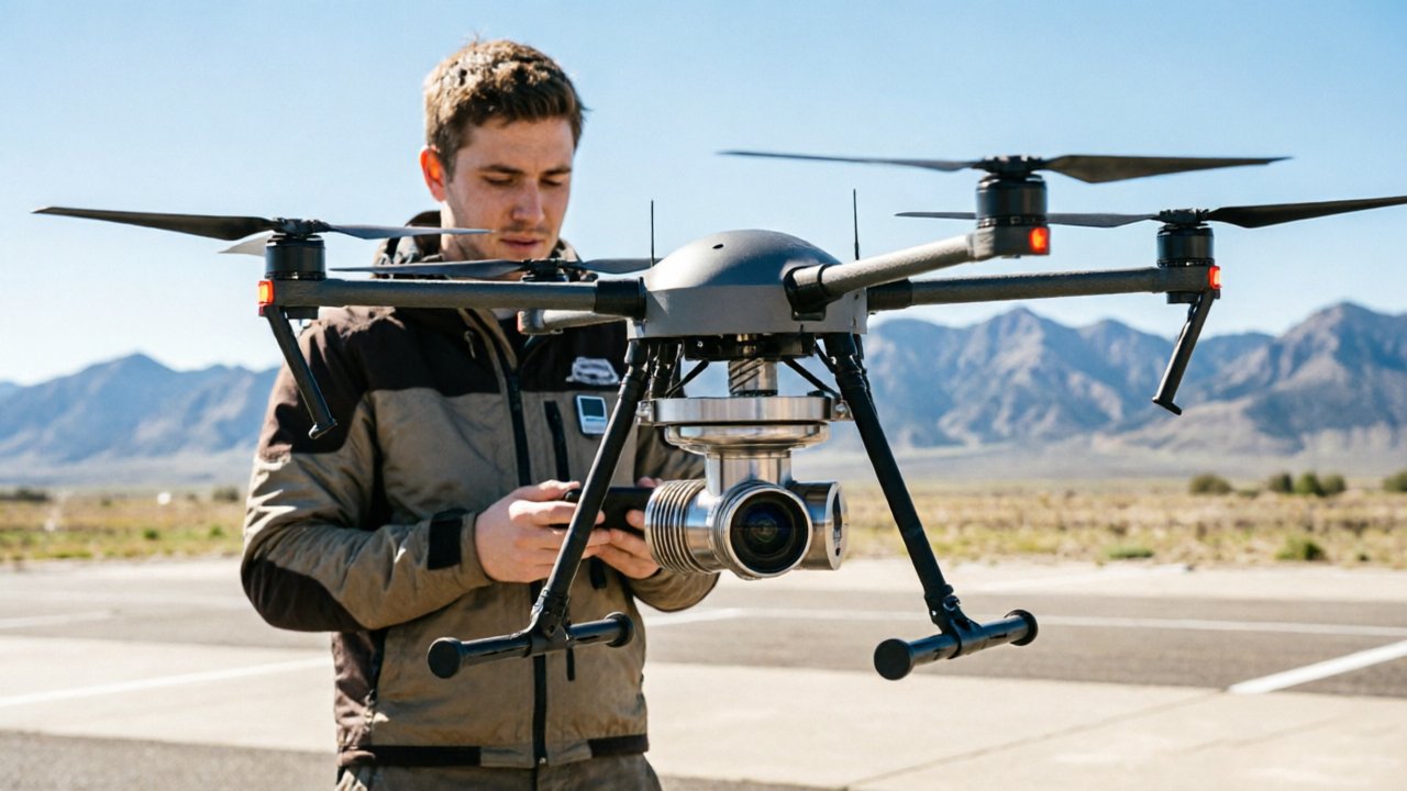
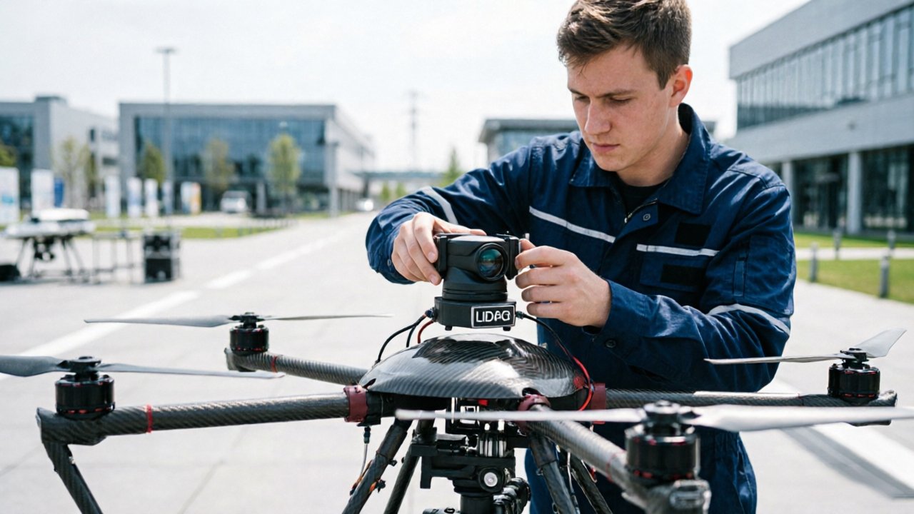
Mechanical LiDAR units — the rotating, multi-beam sensors that dominated early UAV mapping workflows — sit at the wrong end of the SWaP spectrum for small-scale drone operations. Units often weigh between 600g and 1.5kg before mounting hardware, cables, or vibration dampeners are factored in. For a drone with a 2 kg payload budget, that leaves almost no room for redundancy. The growing interest in solid-state LiDAR drone integrations stems directly from this weight problem, and understanding why solid-state units draw fundamentally less power starts with examining how their internal architecture differs from mechanical designs.
Solid-State vs. Mechanical: A Power Consumption Breakdown
Switching to lightweight drone LiDAR isn’t just about cutting grams — it’s about eliminating an entire category of energy waste that mechanical sensors carry by design.
Traditional mechanical LiDAR units are power-hungry by necessity. Their defining feature — a spinning assembly that rotates 360 degrees to sweep laser beams across the environment — requires dedicated internal motors running continuously throughout a mission. Those motors don’t just consume electricity; they generate heat, introduce vibration, and demand robust housings to protect precision components. The result is a sustained power draw that routinely exceeds 30 watts, and in some multi-channel units, climbs significantly higher. On a UAV where every watt translates directly to reduced flight time, that overhead is difficult to justify.
Solid-state sensors take a fundamentally different approach. Instead of spinning hardware, they steer laser pulses electronically — either through optical phased arrays (OPA), which shift the phase of light across an emitter array to direct the beam, or through flash illumination, which floods the entire field of view simultaneously. Both approaches are explained in more depth in this breakdown of optical phased array steering. Because there are no motors to spin and no rotating joints to power, IEEE Xplore research indicates solid-state architectures reduce sensor power draw to under 10–15 watts — a reduction of more than 50% compared to mechanical equivalents.
Here’s a direct component-level comparison:
| Component | Mechanical Draw | Solid-State Draw |
|---|---|---|
| Rotation motor assembly | 10–18W | 0W |
| Laser emitter array | 8–12W | 5–8W |
| Signal processing board | 5–8W | 4–6W |
| Cooling / thermal management | 4–6W | 1–2W |
| Typical total | 30W+ | <15W |
Heat dissipation is a hidden weight penalty that this table makes visible. Mechanical units generate enough thermal output to require dedicated heat sinks, and occasionally active cooling elements — both of which add mass to the sensor payload. Solid-state units run cooler by design, meaning lighter thermal management hardware and a leaner overall system. That compounding effect — less power draw, less heat, less cooling hardware — is precisely why the architecture shift matters far beyond the spec sheet. Understanding the underlying sensing principles, including how time-of-flight measurements function at the hardware level, helps clarify why these efficiency gains don’t come at the cost of range accuracy — a point the next section addresses directly.
Drone LiDAR Explained: Beyond the Point Cloud
Lightweight solid-state LiDAR is far more than a distance sensor — it’s a tightly integrated measurement system that converts raw photon timing into actionable 3D spatial data.
Time-of-Flight (ToF) is the foundational mechanism. Solid-state emitters fire precisely timed laser pulses toward a target surface. The sensor measures the interval between emission and return, then multiplies that duration by the speed of light to calculate exact distance. Because solid-state designs replace spinning mirrors with fixed optical arrays or MEMS-based beam steering, this entire process happens across thousands of points per second with no moving parts to introduce mechanical latency or failure. You can explore how ToF principles apply to modern sensor design in depth — the underlying physics directly shapes why miniaturized units perform so competitively.
High-density mapping without the bulk is what distinguishes modern lightweight drone LiDAR from legacy systems. Current compact sensors achieve point densities that rival earlier full-size units, largely because integrated photonics and ASIC-level signal processing have replaced discrete component chains. According to SPH Engineering, today’s airborne LiDAR systems routinely deliver centimeter-level accuracy even at altitude — a benchmark once reserved for survey-grade equipment weighing several kilograms.
IMU and GNSS fusion closes the accuracy gap that miniaturization might otherwise create. Raw point clouds carry inherent positional ambiguity — every reading needs to know exactly where and at what orientation the sensor was when it fired. By tightly coupling inertial measurement unit data with GNSS positioning, onboard processors can georeference each return in real time, producing georeferenced 3D maps even across fast, dynamic flight paths. As POB Online notes, “the shift toward miniaturized, integrated sensing is the primary driver for enabling small-scale UAVs to perform complex industrial inspections” — a statement that underscores how integration, not size, defines capability.
Smaller does not mean less accurate — it means differently engineered. The misconception persists because early compact sensors genuinely did sacrifice range and resolution. Modern solid-state units address this through precision time-measurement architectures that extract maximum fidelity from each pulse return. That accuracy, maintained at reduced weight and power draw, is precisely what makes these sensors so consequential for autonomous flight — including the demanding task of detecting and tracking other objects in shared airspace, a challenge the next section addresses directly.
LiDAR Technology for UAV Detection and Tracking
Lightweight solid-state LiDAR is redefining what’s possible in UAV autonomy — particularly when a drone needs to detect, classify, and respond to moving objects in real time.
Sense-and-avoid capability is only as good as the sensor powering it. In autonomous flight, a UAV must continuously scan its environment, identify potential collision threats, and execute evasive maneuvers — all within milliseconds. Mechanical sensors carry too much weight and draw too much power to make this practical at scale. Solid-state units, by contrast, deliver high-frequency environmental snapshots at a fraction of the energy cost, making them the natural backbone of modern sense-and-avoid architectures. Understanding how time-of-flight principles drive this helps explain why solid-state designs are so well suited to dynamic airspace.
UAV lidar tracking demands rapid refresh rates that mechanical systems often can’t sustain during extended missions. Solid-state sensors with no rotating parts can cycle through full scene captures at consistently high rates without the mechanical fatigue or vibration artifacts that degrade tracking accuracy over time. This stability is critical when the target — whether a rogue drone, a moving vehicle, or airspace traffic — is accelerating or changing direction unpredictably.
“Lightweight 3D LiDAR-based UAV tracking utilizes adaptive algorithms to maintain lock on dynamic targets in complex environments.” — arXiv / Lightweight 3D LiDAR-Based UAV Tracking
Adaptive tracking algorithms are what transform raw point cloud data into actionable flight decisions. Rather than processing every return with equal weight, these systems prioritize regions of interest, applying predictive modeling to anticipate target movement. This computational efficiency directly reduces processing latency — a factor that becomes critical when a drone is maneuvering at speed. Even a 50ms delay in obstacle response at 60 km/h translates to nearly a meter of uncontrolled travel. Low-latency pipelines, enabled by lean solid-state sensor outputs, compress that gap significantly.
That performance advantage doesn’t exist in isolation. As sensors shrink and power demands drop, freed payload capacity opens the door to something even more powerful: pairing LiDAR with complementary sensors to build a complete aerial intelligence platform.
The Impact of Sensor Miniaturization on Multi-Sensor Fusion
Solid-state LiDAR’s weight savings don’t just extend flight time — they unlock an entirely new tier of multi-sensor payload configurations that were previously impractical on smaller UAVs.
According to Commercial UAV News, solid-state LiDAR sensors can weigh as little as 200g to 500g, compared to traditional mechanical units that often exceed 1.2kg to 2kg. That 1kg difference isn’t trivial. It’s the difference between a drone carrying a single sensor and one carrying a complete, redundant sensing suite.
When weight is recovered, operators gain meaningful choices about what else to add:
- High-resolution RGB cameras can be paired with LiDAR to overlay photorealistic texture onto point clouds — critical for asset documentation and regulatory reporting on infrastructure inspections.
- Thermal imaging sensors enable simultaneous detection of heat anomalies and geometric defects, a combination that’s particularly valuable when inspecting power lines, pipelines, and solar arrays where invisible faults matter as much as visible ones.
- GNSS/IMU modules benefit from the freed weight budget too, supporting tighter georeferencing without competing for payload capacity.
Power distribution is the hidden constraint that weight savings alone don’t solve. Running LiDAR, RGB, and thermal sensors concurrently draws significantly more current from the battery, and poorly managed power allocation can cause voltage sag that introduces timing errors in the LiDAR data stream. Well-designed payload architectures address this with dedicated power rails and filtering — but it requires deliberate engineering.
This is where lidar technology for uav detection reveals its structural role: solid-state LiDAR functions as the anchor sensor in any fused payload. It provides the 3D spatial backbone that all other sensors reference. Without reliable geometric context, RGB and thermal data lose their positional precision. Understanding how solid-state capture works at the pixel level helps explain why spatial accuracy doesn’t degrade as additional sensors come online.
These payload combinations aren’t theoretical — they’re actively transforming how industries deploy drones in the field, which the next section examines in detail.
Real-World Applications: From Mapping to Autonomous Navigation
Solid-state LiDAR benefits are most visible not in spec sheets, but in the field — where flight time, safety clearances, and centimeter-level precision determine mission success or failure.
Forest canopy mapping is one of the most demanding tests of UAV endurance. Large-scale surveys covering hundreds of acres require sustained flight at consistent altitude while capturing dense, overlapping point clouds. With traditional scanning LiDAR adding 500g or more to the payload, battery reserves drain fast — sometimes too fast to complete a single transect without landing to recharge. Lightweight solid-state units change that calculus entirely. According to LiDAR drone surveying guides, reduced sensor weight directly extends usable flight windows, letting operators cover significantly more terrain per sortie without sacrificing point density.
Indoor warehouse navigation presents a completely different challenge. Here, the constraint isn’t battery — it’s physical clearance. Drones operating between rack rows, under conveyor systems, or around human workers must remain compact. A bulky mechanical LiDAR is simply incompatible with those tight spaces. According to Blickfeld Research, solid-state LiDAR enables real-time 3D mapping and inspection in GPS-denied environments like indoor warehouses — where satellite positioning is unavailable and every obstacle detection decision happens in milliseconds. A compact unit like a 270-degree scanning sensor fits neatly into sub-250g drone frames without compromising safety margins.
Infrastructure inspection — bridges, dams, and retaining walls — demands something different again: high-precision proximity sensing at very short range. Drones must hold position within inches of concrete surfaces while capturing structural detail. Solid-state sensors with stable, repeatable range accuracy perform reliably in these conditions, where vibration and close-range reflectivity would challenge older sensor designs.
[YouTube Video Embed Placeholder — Real-time solid-state LiDAR mapping from a UAV platform]
Bold callout: In GPS-denied, space-constrained, or endurance-critical missions, solid-state LiDAR isn’t just a sensor upgrade — it’s what makes the mission possible at all.
Choosing the right sensor for these scenarios, however, is only half the challenge. Where and how you source that hardware can be equally consequential — a point worth examining closely before any procurement decision is made.
Procurement Strategy: Why Factory-Direct Hardware Matters
Sourcing LiDAR hardware through the right channel is just as critical as choosing the right sensor — and in complex UAV integration projects, the wrong procurement path can cost far more than money.
“Black box” sensors — units sold through gray-market distributors with no direct manufacturer relationship — are one of the most underappreciated risks in UAV system design. When a sensor fails mid-project or returns unexpected data, engineers need immediate access to firmware documentation, calibration specs, and application support. Without a direct factory relationship, that access simply doesn’t exist. Troubleshooting becomes guesswork, replacement timelines stretch into weeks, and flight operations stall.
Triple certification is the procurement filter that separates industrial-grade hardware from consumer-adjacent components. For UAV deployments in regulated industries — precision agriculture, infrastructure inspection, public safety — sensors must meet recognized CE, FCC, and RoHS compliance standards simultaneously. Certification isn’t just about regulatory paperwork; it’s a signal that a manufacturer has subjected their hardware to rigorous, independent validation. Skipping this checkpoint to save cost at the sourcing stage routinely leads to higher costs downstream, particularly when equipment is rejected at permitting or audit.
24-hour technical support deserves equal weight in any procurement decision. Integration projects rarely fail during business hours. Sensor fusion architectures — like those discussed in the hardware quality context explored earlier — involve tight timing dependencies between LiDAR, IMU, and GNSS subsystems. When an edge-case anomaly surfaces at 11 PM before a dawn survey, direct access to engineers who built the sensor is the only reliable resolution path.
Factory-direct procurement models eliminate intermediaries, reducing lead times for critical drone hardware replacements — a compounding advantage for teams managing active fleets. LidarStar bridges this gap by offering factory-direct pricing alongside global technical support, giving UAV engineers both cost efficiency and the integration confidence that complex deployments demand. With procurement strategy covered, the next step is consolidating what all of this means for engineers building or scaling a LiDAR-equipped UAV program.
The Bottom Line: Key Takeaways for UAV Engineers
Solid-state LiDAR isn’t just a hardware upgrade — it’s the single most impactful systems decision a UAV engineer can make to extend mission capability without compromising payload capacity or safety margins.
After covering real-world applications and procurement strategy, the core argument distills into four interconnected advantages that compound on each other in practice:
- Weight reduction up to 75% compared to mechanical LiDAR systems means multi-rotor platforms carry more useful payload — or shed dead weight entirely to keep airframes smaller and more maneuverable. As Tangram Vision explains, the absence of rotating parts is what makes this miniaturization structurally possible.
- Sub-15W power consumption directly buys flight time. According to Commercial UAV News, reducing payload weight allows operators to extend flight time by 15–20 minutes on average — a gain that translates to larger survey coverage, fewer battery swaps, and lower operational cost per acre.
- Smaller drones become viable for industrial tasks. When the sensor stack weighs under 200g, sub-3kg airframes handle complex environments — confined infrastructure, urban corridors, agricultural canopies — without requiring the safety buffers or operator certifications that heavier platforms demand.
- Factory-direct procurement scales the economics. As discussed in the previous section, sourcing hardware directly removes reseller margins, shortens lead times, and ensures firmware consistency across a fleet — a non-negotiable advantage when deploying at scale.
The compounding effect is the key insight: each gram saved and each watt not consumed feeds back into longer missions, smaller platforms, and lower cost-per-flight. These aren’t isolated wins.
For engineers still weighing tradeoffs — sensor resolution, weather tolerance, integration complexity — the next section addresses the most common questions that arise at the specification stage.
Frequently Asked Questions About Drone LiDAR
Solid-state LiDAR is reshaping what’s possible in UAV missions — and these common questions cut straight to what engineers and operators need to know.
Q: What is the difference between solid-state and mechanical LiDAR for drones?
Mechanical LiDAR units rely on spinning components to sweep laser beams across a scene, which introduces vibration, wear, and added mass. Solid-state LiDAR sensors use non-moving optical phased arrays, making them significantly more durable and lighter than their mechanical counterparts — a critical advantage confirmed by IEEE Xplore research. In practice, that translates directly to longer flight times and lower maintenance overhead on commercial UAV platforms.
Q: How much does LiDAR weight affect drone battery life?
Every gram added to a UAV payload increases motor load and accelerates battery drain. A common pattern is that reducing sensor payload by 200–400 grams can extend flight endurance by 10–20% on multi-rotor platforms, depending on frame design and battery capacity. Lightweight solid-state units — many now weighing under 200 grams — are specifically engineered to minimize this tradeoff without sacrificing point cloud density.
Q: Can solid-state LiDAR work in low-light or adverse weather conditions?
Yes. Unlike cameras, LiDAR operates on active laser pulses rather than reflected ambient light, so performance remains consistent at night or in overcast conditions. However, heavy rain and dense fog can scatter laser returns and reduce effective range — a real-world limitation worth planning for in mission design. Pairing LiDAR with terrain-following applications helps maintain safe altitude even when visual cues are degraded.
Q: What are the best lightweight LiDAR sensors for multi-rotor UAVs?
The right choice depends on mission requirements — mapping, obstacle avoidance, and inspection each demand different range and resolution profiles. Prioritize sensors under 300 grams with a range exceeding 30 meters and a wide field of view for most commercial multi-rotor use cases. Reviewing manufacturer specs alongside flight controller compatibility is the most reliable path to matching hardware to mission goals.