
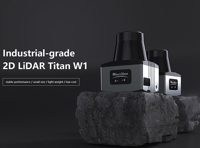
Mechanical spinning LiDAR delivers unmatched spatial awareness because physics — not software workarounds — guarantees complete environmental coverage on every single rotation.
The core principle is straightforward. A mechanical lidar scanner works by physically rotating its entire laser-emitter and receiver assembly, sweeping through a full 360-degree horizontal field of view (FOV). This isn’t beam steering through electronic phase manipulation — it’s optics moving through real space, which means every degree of that sweep receives identical optical performance. Systems with up to 128 vertical channels can resolve objects with extraordinary density, producing point clouds rich enough to support demanding AI model training.
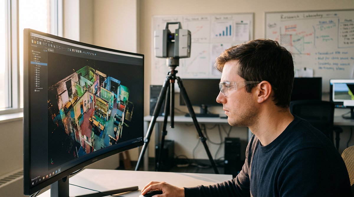
Physical rotation vs. electronic steering comes down to coverage guarantees. Solid-state sensors use methods like optical phased arrays or MEMS mirrors to steer beams electronically. The tradeoff is a narrow aperture — typically 120 degrees or less — creating what engineers often call a “keyhole” view of the world. That limitation might work for a front-facing highway camera, but it fails the moment a robot, vehicle, or research platform needs situational awareness in every direction simultaneously.
The FOV comparison breaks down clearly:
- Mechanical (spinning): True 360-degree horizontal coverage, consistent angular resolution throughout
- Solid-state (typical): 60–120-degree FOV, resolution that degrades toward field edges
- Hybrid architectures: Partial improvements, but still constrained by design trade-offs (explored further in this breakdown of emerging sensor designs)
For Level 4 and Level 5 autonomy, the stakes of incomplete coverage are non-negotiable. A vehicle operating without a human safety driver cannot afford blind zones. Regulatory frameworks and safety validation protocols for full autonomy are built around the assumption that the sensing suite perceives the entire surrounding environment — a requirement that mechanical LiDAR meets by design, not by exception.
Understanding why this hardware advantage matters so deeply requires looking at what these rich, full-sphere point clouds actually feed: the emerging frontier of AI for Science.
LiDAR Point Clouds as the Fuel for AI for Science (AI4S) in 2025
High-fidelity 3D laser scanning data is no longer just a navigation input — it’s the foundational raw material powering the next generation of AI-driven scientific discovery.
AI for Science (AI4S) refers to the application of machine learning and deep learning frameworks to accelerate research across physical, biological, and engineering domains. In robotics and physical modeling specifically, AI4S depends on one non-negotiable ingredient: dense, geometrically accurate environmental data. That’s exactly where mechanical LiDAR’s full-surround point clouds become indispensable.
The AI for Science (AI4S) Global Development Observation and Outlook identifies 2025 as a pivotal year — AI4S is driving a paradigm shift in how research data is collected, structured, and fed into simulation models. The demand isn’t for approximate spatial data. It’s for centimeter-accurate, semantically rich point clouds that AI models can use to reconstruct physical environments in full fidelity.
This shift has fundamentally changed what engineers ask LiDAR to do:
- Simple obstacle detection — flagging objects in a vehicle’s path
- Scene segmentation — classifying objects by type, size, and motion state
- Physical simulation — reconstructing environments accurate enough to train AI agents without real-world risk
- Scientific modeling — enabling fluid dynamics, structural stress, and terrain analysis from captured geometry
The transition from detection to simulation is the defining leap of 2025 R&D. A point cloud dense enough for navigation is not necessarily dense enough for physics-based AI modeling. The latter demands layered spatial context that only high-channel mechanical sensors reliably provide — a reality well-documented in aerial mapping research comparing LiDAR capture methods.
Platforms like Baidu AI Studio have emerged as critical infrastructure, offering the GPU-accelerated pipelines needed to ingest, label, and train on massive point cloud datasets. These environments transform raw sensor output into structured scientific intelligence.
That raw output, however, arrives at a scale most engineers underestimate — which raises an urgent question about data throughput.
Data Throughput: Managing 2.4 Million Points Per Second
Mechanical LiDAR’s defining capability is raw data volume — and that volume is precisely what makes centimeter-level precision mapping possible at scale.
High-performance mechanical sensors can generate up to 2.4 million data points per second, according to the IEEE Xplore Digital Library. For automotive LiDAR applications, this throughput isn’t excess — it’s the minimum threshold for reliably detecting a pedestrian stepping off a curb at 60 mph, or mapping a dynamic warehouse floor where forklifts reroute every few minutes. Density at this level encodes the physical world with enough resolution that AI models can distinguish a traffic cone from a fire hydrant without additional sensor confirmation.
Point cloud density directly determines what downstream algorithms can accomplish. A sparse cloud forces models to interpolate — and interpolation introduces error. A dense cloud gives AI pipelines ground truth. That distinction matters enormously when R&D teams are training perception models where even a two-centimeter ambiguity can cascade into a navigation failure.
The challenge, of course, is computational. Processing nearly 2.5 million points per second in real time places significant demand on autonomous vehicle R&D stacks. Engineers typically address this through a combination of approaches:
- Voxel grid downsampling — reducing point density in low-priority regions while preserving resolution around detected objects
- GPU-accelerated processing pipelines — parallelizing point cloud computation to meet sub-100ms latency requirements
- Region-of-interest filtering — dynamically prioritizing data from sectors where motion is detected
- Lossy compression with lossless object preservation — reducing storage load without degrading object-level accuracy
In practice, the goal is to preserve semantic richness while shedding redundant spatial data — a balance that shapes the entire perception stack in modern robotics platforms.
What this throughput challenge reveals is a deeper infrastructure question: how sensor placement affects data efficiency. When sensors carry blind spots, systems compensate by adding more units — and that redundancy compounds the processing burden. That’s where the true cost of incomplete coverage begins to show.
The Real-World Cost of Blind Spots in Industrial Automation
Choosing a sensor with coverage gaps in high-stakes industrial environments isn’t a minor trade-off — it’s an operational liability with measurable financial consequences.
Fixed-orientation sensors carry an architectural flaw: their limited field of view creates predictable blind zones where obstacles, personnel, and structural changes go undetected. In a busy warehouse aisle or an urban construction corridor, that undetected zone is exactly where incidents happen. Patching those gaps requires deploying multiple redundant units, each adding hardware cost, calibration overhead, and data fusion complexity.
360-degree mechanical LiDAR eliminates that patchwork approach. A single rotating unit generates a continuous, omnidirectional lidar point cloud — a dense, real-time map of every surface within range. As McKinsey & Company notes, “The primary advantage of mechanical LiDAR is its ability to provide high-resolution, long-range detection in all directions simultaneously, which is essential for complex urban navigation.” That all-in-one coverage directly reduces the sensor count per deployment, and fewer sensors means simpler integration, lower maintenance schedules, and a tighter total cost of ownership.
The ROI case becomes even clearer when you factor in environmental complexity. Consider the key risk factors when organizations opt for cheaper, limited-FOV alternatives in demanding settings:
- Coverage gaps that require compensatory sensor arrays, multiplying procurement and support costs
- Sensor fusion errors introduced when stitching data from mismatched units with different calibration drift rates
- Downtime exposure when a single fixed sensor fails and leaves a critical zone completely unmonitored
- Regulatory risk in safety-critical environments where incomplete spatial awareness can trigger compliance violations
On the reliability side, mechanical LiDAR’s track record in manufacturing environments is well-established. Modern units are engineered for extended duty cycles, and their rotating assemblies — while more complex than solid-state alternatives — benefit from decades of refinement in industrial-grade bearing and motor technology. You can explore how this durability shapes autonomy decisions across robotics and vehicle platforms.
That same density and reliability also makes mechanical scans the ideal raw input for the next layer of the AI pipeline — high-definition map generation and digital twin construction.
Integrating LiDAR with Digital Twins and Baidu AI Studio
Mechanical LiDAR’s dense point clouds are only as powerful as the software ecosystems built to receive, process, and act on them — and today’s AI research stack is increasingly purpose-built for exactly this workflow.
HD map creation begins with the scan. A single mechanical LiDAR pass across an environment generates structured point cloud data that downstream tools convert into georeferenced, centimeter-accurate HD maps. These maps serve as the geometric foundation for digital twins — virtual replicas that mirror physical spaces in real time. Unlike photogrammetry or structured-light alternatives, full 360-degree mechanical scans eliminate the gap-filling interpolation that erodes twin accuracy. What typically happens in high-fidelity robotics labs is a direct pipeline: raw .las or .pcd point cloud files feed into reconstruction software, which outputs .stl meshes ready for simulation environments.
The role of Baidu AI Studio in this pipeline is substantial. As an all-in-one AI development and training platform, Baidu AI Studio provides the compute infrastructure needed to process complex, high-volume LiDAR datasets and train robotics perception models at scale. Research teams working in the AI for Science domain routinely use the platform to label point cloud sequences, fine-tune object detection models, and validate localization algorithms — tasks that demand both data volume and annotation precision that only dense mechanical scans can reliably supply.
Format standardization is a practical bottleneck most teams underestimate. Bridging 3D laser scanning output with digital twin platforms requires consistent use of open formats — .stl for mesh-based physical restoration workflows, .pcd or .e57 for raw cloud interchange. Teams that standardize early avoid costly re-processing cycles. For applications spanning autonomous navigation and structural inspection, sensor configurations built around 360-degree coverage provide the spatial completeness that partial-scan sensors simply cannot match.
One often-cited consideration in research procurement is lidar cost relative to the data quality returned — a ratio that mechanical systems continue to win at the dataset scale AI training demands. As the software ecosystem matures, that value equation is only becoming more relevant — a shift the next section examines in the context of how automotive-grade development is reshaping sensor manufacturing priorities.
Automotive LiDAR Evolution: From 2024 Trends to 2025 Realities
The decade from 2015 to 2024 wasn’t just growth for LiDAR — it was a fundamental redefinition of what sensors are expected to do in AI for Science applications.
Research adoption tells the story clearly. Data from the Journal of Knowledge Management Research confirms a steady, accelerating uptick in AI for Science deployments across global industries between 2015 and 2024 — with sensor-driven perception at the center of nearly every workflow. Mechanical LiDAR rode that wave, proving indispensable in autonomous vehicles, robotics labs, and geospatial research alike.
“The maturation of LiDAR technology mirrors the maturation of AI itself — both moved from proof-of-concept novelty to mission-critical infrastructure within the same decade.”
Procurement models are shifting fast. What began as distributor-heavy, multi-tier supply chains is consolidating. In 2025, the dominant pattern is factory-direct procurement — buyers establishing relationships with sensor manufacturers to lock in consistent specs, dedicated support, and faster iteration cycles. For R&D teams running long-horizon experiments, supply chain predictability is no longer optional.
Automotive-grade certification is now a longevity signal. Sensors built to automotive standards — vibration tolerance, thermal cycling, ingress protection — outlast lab-grade alternatives significantly in field deployments. As explored in full 360-degree sensing for autonomous platforms, the mechanical architecture that enables complete surround coverage also benefits from automotive-grade durability requirements baked in at the design stage.
Craftsmanship is making a quiet comeback. With sensor commoditization threatening data quality, leading manufacturers are doubling down on precision assembly — tighter beam divergence tolerances, hand-calibrated channel alignment, rigorous end-of-line validation. The point cloud isn’t just a data product; it’s a reflection of manufacturing discipline.
These converging forces — smarter procurement, certified durability, and precision-first manufacturing — set the foundation for what comes next: the highly technical calibration and optimization decisions that determine whether a sensor truly performs in the field.
Technical Deep Dive: Optimizing 3D Laser Scanning for Robotics
Getting the most from 3D mechanical LiDAR demands more than unboxing and mounting — it requires deliberate calibration, power management, and data hygiene practices that separate reliable R&D results from noisy, inconclusive datasets.
Proper calibration is the foundation everything else rests on. For 128-channel mechanical sensors, extrinsic calibration against a known ground-truth target board must account for each channel’s individual angular offset. Even a 0.1° per-channel error compounds dramatically across a 100-meter detection range. In practice, running multi-target calibration routines — using at least three planar targets at varied distances — yields the spatial consistency that downstream AI models require. As MicroPort’s digital manufacturing research confirms, precise control of physical restoration parameters directly determines model accuracy, a principle that applies equally to point-cloud-based 3D reconstruction.
Power vs. scan frequency is a genuine engineering trade-off in mobile robotics. Consider these optimization strategies:
- Reduce rotation speed (e.g., 10 Hz → 5 Hz) during slow navigation phases to cut power draw without sacrificing obstacle detection.
- Dynamic duty cycling — pausing the sensor briefly during predictable non-critical intervals — can reduce average consumption by 15–20%.
- Reference multi-unit LiDAR power budgeting guidance when designing platforms that carry four or more sensors, where total draw can reach 100W.
Noise filtering in high-density point clouds is equally critical for clean model training. A common pattern is applying statistical outlier removal (SOR) paired with voxel-grid downsampling before ingesting data into any neural network pipeline. Skipping this step inflates training time and degrades precision on edge-case geometry.
Sensor selection deserves deliberate thought:
- Blind-spot compensation: Prioritize wide vertical FOV (±25° or greater) and shorter minimum detection range (<0.5 m).
- Long-range detection: Favor sensors with higher peak laser power and narrow beam divergence for reliable returns beyond 150 m.
These hardware-level decisions ripple through every downstream workflow — which is exactly why the procurement choices explored next carry such significant consequences.
The Bottom Line: Key Takeaways for LiDAR Procurement
Mechanical LiDAR isn’t just a legacy technology holding its ground — it remains the most reliable “truth” sensor available for high-fidelity R&D, and the evidence across every application domain supports that conclusion.
As outlined throughout this article, the case for 360-degree mechanical LiDAR distills into four clear decision-making pillars:
- Mechanical LiDAR is the essential ground-truth sensor. As Geospatial World confirms, mechanical spinning LiDAR remains the gold standard for mapping and surveying due to its consistent, calibrated laser power. No other sensor type matches its spatial fidelity at range.
- Full 360-degree FOV is non-negotiable for Level 4+ autonomy. Partial-coverage sensors introduce blind spots that are unacceptable in safety-critical deployments. For autonomous vehicle R&D teams pushing toward full self-driving capability, sensor fusion strategies built around 360-degree mechanical units provide the perception baseline everything else depends on.
- High-density point cloud data drives AI for Science outcomes. The AI4S revolution isn’t fueled by approximations — it requires dense, repeatable 3D datasets for training, validation, and real-world inference. Mechanical LiDAR’s rotating multi-channel architecture consistently delivers that density in ways solid-state alternatives still struggle to match at equivalent price points.
- Factory-direct procurement is the sustainable cost strategy. Intermediary markups quietly erode R&D hardware budgets. Sourcing directly from certified manufacturers eliminates those layers without compromising build quality or post-sale support.
The core principle is straightforward: cutting corners on the primary perception layer undermines everything built on top of it. Whether the application is robotics navigation, autonomous mapping, or scientific data collection, the sensor’s reliability determines the reliability of every downstream decision.
For procurement teams evaluating multi-year R&D investments, these four pillars aren’t just guidelines — they’re risk management. The next step is finding a supply partner that aligns with that standard from day one.
Future-Proofing Your R&D with LidarStar’s Factory-Direct Solutions
360-degree mechanical LiDAR remains the definitive sensor for R&D teams that refuse to compromise on data fidelity, reliability, or long-term scalability.
Triple-certified, automotive-grade hardware is non-negotiable for serious research applications. Sensors that meet ISO, CE, and FCC certifications aren’t just checking regulatory boxes — they’re delivering the signal integrity, thermal stability, and shock resistance that lab and field environments demand equally. When a dataset powers a peer-reviewed study or a safety-critical autonomy stack, the hardware underneath it must be held to automotive production standards.
In practice, procurement overhead erodes R&D budgets faster than most teams anticipate. By sourcing directly from the factory, LidarStar eliminates distributor markups and regional intermediaries — delivering automotive-grade sensors at transparent, factory-direct pricing with global shipping to over 26 countries. That cost efficiency translates directly into more sensors deployed, more experimental iterations funded, and faster research cycles.
Around-the-clock technical support is a force multiplier for global teams. R&D doesn’t pause for business hours, and sensor troubleshooting at 2 a.m. in a different time zone can stall an entire experiment. LidarStar’s 24-hour support infrastructure means calibration questions, integration challenges, and firmware concerns get resolved when they arise — not when a regional office opens.
Frequently Asked Questions
- What makes mechanical LiDAR still relevant alongside emerging solid-state options? Mechanical LiDAR delivers true 360-degree coverage and proven long-range accuracy that most solid-state alternatives haven’t yet matched at scale.
- How does factory-direct pricing benefit R&D budgets? Removing intermediaries reduces per-unit cost, allowing teams to deploy more sensors or allocate savings toward additional research phases.
- What certifications should I require for R&D-grade LiDAR? Look for ISO 9001, CE, and FCC compliance as a minimum baseline for automotive-grade reliability.
- Is 24-hour support available for international research institutions? Yes — LidarStar supports global R&D teams across all time zones without geographic restrictions.
The future of AI-driven science runs on trustworthy spatial data. Partner with a supplier that treats sensor quality as seriously as your research does.










