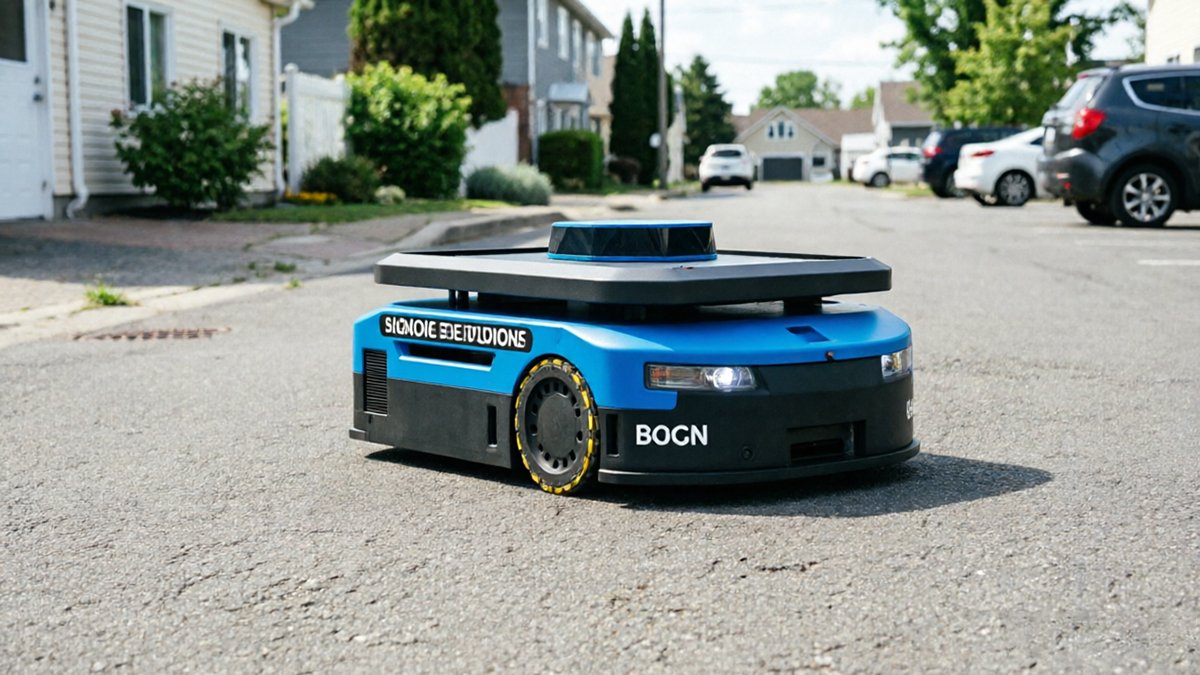
Port automation AGV LiDAR systems are operating in one of the most punishing industrial environments on earth — yet most are built to standards that assume a factory floor.
The shift from manual to automated horizontal transport has reshaped modern port logistics. Where dockworkers once guided straddle carriers and terminal tractors by hand, automated guided vehicles now move containers around the clock across sprawling, weather-exposed terminals. Port automation is projected to grow at a CAGR of 6.4%, reaching $6.48 billion by 2030, a figure that reflects enormous capital investment in robotic infrastructure. But that investment rests on a fragile assumption: that the sensors powering these machines can actually survive the environment they’re deployed in.
“Industrial-grade” is frequently a misnomer in maritime settings. A sensor rated for a controlled warehouse — protected from humidity spikes, chemical exposure, and wind-driven particulate — is not the same as one built for a coastal terminal battered by salt air, fog banks, and diesel exhaust. In practice, the gap between those two environments is significant enough to cause failures that standard procurement checklists simply don’t anticipate. Understanding how LiDAR anchors the perception stack of a mobile robot makes it clearer why a compromised sensor doesn’t just degrade performance — it can halt operations entirely.
The financial stakes are high. A single AGV sensor failure in a 24/7 terminal can cascade into blocked lanes, missed vessel windows, and unplanned maintenance shutdowns — each hour of downtime carrying costs that reach into the tens of thousands of dollars. That reality is driving a harder look at what a genuine maritime-industrial standard for LiDAR actually requires, starting with one of the most destructive forces any coastal sensor faces: salt spray.
Combating Salt Spray: The ISO 9227 Standard
Salt fog is one of the most insidious threats to heavy-duty AGV navigation sensors deployed in port environments — corroding optical surfaces and circuit traces long before any visible damage appears.
As Port Technology International notes, salt spray and high humidity in maritime environments cause rapid corrosion of non-industrial grade optical components. The degradation isn’t always dramatic. Instead, it’s cumulative — a slow clouding of lens coatings, oxidation on PCB contacts, and creeping resistance on signal pathways. By the time performance drops noticeably, internal damage is already significant.
A common misconception is that IP67-rated enclosures are sufficient protection in port deployments — they are not. IP ratings only measure resistance to dust ingress and liquid submersion under static conditions. They say nothing about sustained exposure to salt-laden aerosols that penetrate seals through capillary action and pressure cycling during normal AGV operation. A LiDAR unit can pass IP67 testing and still fail within months on an active container terminal.
That’s exactly where ISO 9227 becomes non-negotiable. This international standard defines the salt spray (fog) test methodology, exposing hardware to a continuous saline mist environment — typically 5% NaCl at 35°C — to simulate years of coastal exposure in an accelerated timeframe. For port applications, vendors should demonstrate compliance with the following:
- Neutral Salt Spray (NSS) test — baseline corrosion resistance for metallic housings and connector hardware
- Acetic Acid Salt Spray (AASS) test — evaluates organic coatings and anodized aluminum surfaces common in LiDAR enclosures
- Lens coating durability — optical windows must maintain transmission clarity after prolonged saline exposure
- Internal PCB conformal coating — circuit boards require moisture-blocking treatment validated under salt-fog conditions
Protecting lens coatings specifically deserves attention. Anti-reflective coatings optimized for LiDAR wavelengths — typically 905nm or 1550nm — can degrade under salt exposure, scattering return signals and reducing detection range. Understanding how sensor architecture and signal processing choices affect long-term performance is essential when evaluating sensors for harsh maritime use. Chemical resistance must be part of the specification review from day one, not an afterthought.
This chemical durability challenge is serious — but it isn’t the only threat a port AGV sensor faces. The physical shock of container handling operations introduces a completely different failure mode, one that standard LiDAR mechanical designs are equally ill-equipped to handle.
Surviving the Shock: 5G+ vibration resistance
Mechanical shock is the silent killer of precision sensing in port environments — and it’s one of the most underestimated threats facing industrial LiDAR for autonomous terminals today.
As noted by the Maritime Journal, “the primary challenge for automated horizontal transport in ports is the extreme vibration and mechanical shock experienced during container loading operations.” That observation cuts to the core of why standard LiDAR units — designed for relatively stable warehouse floors — routinely fail in terminal environments.
Mechanical shock during container drop operations is the trigger event most likely to knock a sensor out of alignment. When a spreader releases a 40-ton container onto an AGV chassis, the resulting impact can generate shock loads exceeding 5G. Traditional mechanical LiDAR units rely on rotating mirrors or moving internal components to sweep their field of view. Under repeated 5G shock loads, those mirrors physically shift — by fractions of a millimeter, but enough to corrupt distance measurements and throw off safety zone boundaries. What looked like a clear lane moments before may register as an obstacle, or worse, and a real crane leg may go undetected. Solid-state and automotive-grade internal architectures solve this problem by eliminating the moving parts that misalign under shock. Flash LiDAR and MEMS-based designs use fixed optical arrays, making them far more resilient to sudden force events. Research into sensor fusion for autonomous platforms consistently shows that pairing robust solid-state sensors with IMU data further stabilizes localization when the physical sensor itself is being jostled.
Maintaining calibration across uneven pier surfaces adds another layer of complexity. Concrete expansion joints, rail crossings, and waterlogged pavement create continuous low-frequency vibration between major shock events. Over a long shift, accumulated micro-vibrations can drift a mechanically mounted sensor’s baseline just enough to degrade mapping accuracy — a compounding problem that solid-state designs handle significantly better by holding their optical geometry fixed.
Of course, surviving vibration is only part of the environmental battle. Even a perfectly calibrated sensor can be fooled by what it sees — and in a marine terminal, sea spray and fog introduce an entirely different category of optical interference worth examining closely.
Multi-Echo Technology vs. Sea Spray and Fog
Standard LiDAR struggles to tell the difference between a steel crane and a wall of sea spray — and in a busy port terminal, that confusion has real operational consequences.
The physics of “ghost” obstacles is straightforward but damaging. When a LiDAR pulse hits a dense fog bank or heavy rainfall, it returns a partial echo at a shorter distance than the actual target behind it. Single-return sensors register this scattered energy as a solid object, triggering emergency braking on an AGV that is, in reality, navigating open space. In high-throughput terminals where vehicles run near-continuous cycles, repeated false-positive stops cascade into hours of lost productivity.
Multi-echo pulse evaluation solves this by capturing every return from a single transmitted pulse — not just the strongest or the first. When a beam passes through sea spray before striking a container wall, the sensor logs a weak near-field return (the spray) and a strong far-field return (the container). The processing algorithm weights return intensity and temporal spacing to classify the near return as atmospheric scatter and the far return as a genuine obstacle. According to the Global Port Automation Report via PEMA, advanced LiDAR sensors using multi-echo evaluation are specifically engineered to distinguish between solid obstacles and atmospheric interference — a capability that single-echo designs simply cannot replicate.
Signal-to-noise optimization becomes equally critical in high-moisture zones. Salt spray resistant LiDAR sensors pair multi-echo logic with adaptive gain control, dynamically adjusting receiver sensitivity so that low-reflectivity returns from mist don’t saturate the signal chain. The result is a cleaner point cloud even when humidity exceeds 95% — conditions that would render standard sensors operationally blind. This kind of sensor-level intelligence also lays the groundwork for the more complex challenge discussed next: maintaining positional accuracy when the environment itself offers almost no geometric landmarks to lock onto.
The LiDAR-IMU Fusion Advantage for Heavy AGVs
Sensor fusion closes the localization gaps that LiDAR alone cannot solve — and in port terminals, those gaps can mean misplaced containers worth hundreds of thousands of dollars.
LiDAR-only navigation breaks down in featureless environments. Wide terminal corridors lined with uniform concrete walls return point clouds with almost no distinguishing geometry. Without distinct landmarks to anchor against, a standalone LiDAR scanner struggles to determine whether an AGV has moved ten meters or twelve. This “perceptual aliasing” problem compounds at scale — across a terminal running dozens of AGVs simultaneously, small positional errors cascade into dangerous alignment failures at crane handoff points.
Integrating an Inertial Measurement Unit (IMU) solves this by enabling dead reckoning between LiDAR scan cycles. While the LiDAR maps the environment at discrete intervals, the IMU continuously measures acceleration and angular velocity, bridging positional estimates in real time. LiDAR-IMU fusion navigation systems are now a recognized standard for solving localization challenges across smart industrial environments — and ports represent one of the most demanding deployments of that approach. Critically, this fusion architecture also pairs naturally with anti-vibration LiDAR for heavy machinery, since the IMU can compensate for scan distortion introduced by chassis vibration during load movement.
The SLAM dimension adds another layer of precision. Research into SLAM algorithms for port AGVs has explored both 2D and 3D LiDAR configurations, with findings showing that fused systems maintain consistent mapping accuracy even in low-feature zones where geometry-only approaches fail. As discussed in earlier sections, vibration and sea spray already stress the sensor hardware — fusion architecture ensures the software stack stays reliable when physical conditions degrade signal quality.
For a deeper look at how combined IMU and LiDAR mapping maintains centimeter-level accuracy under real-world conditions, the principles carry directly into port AGV deployments. This positioning precision becomes especially critical when you examine exactly what happens in the final meter of container placement — which is where the next section picks up.
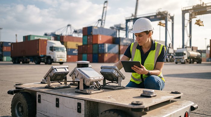
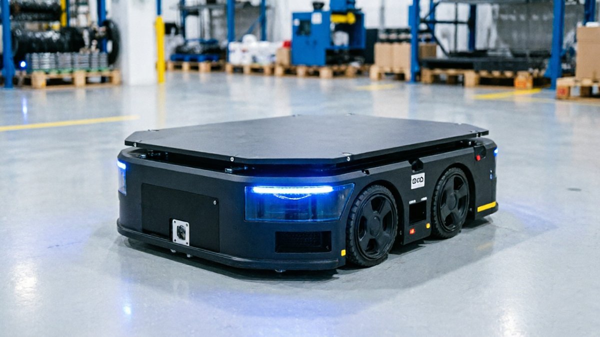
Visualizing Port Automation in Action
Automated container terminals reveal exactly why a LiDAR IMU fusion navigation system is no longer optional — it’s the operational backbone holding precision logistics together.
The video below captures the scale of modern port automation, showing how AGVs, STS cranes, and terminal management systems work in continuous coordination across vast, dynamic yards.
What the footage makes immediately clear is that these environments leave zero margin for positional error. Every AGV path intersects with crane lift zones, pedestrian corridors, and adjacent vehicle lanes — often simultaneously.
AGV-to-crane handoffs represent the most technically demanding moment in container terminal operations. When a Ship-to-Shore crane lowers a 40-foot container onto a waiting AGV, the vehicle must hold its target position to within centimeters. A misaligned receiver causes container drop failures, equipment damage, or worse. In practice, the LiDAR system isn’t just navigating the AGV toward the crane — it’s actively recalculating position during the final approach as the crane’s shadow, wind-driven sway, and ground vibration all introduce localization noise simultaneously. The role of redundant sensor fusion becomes especially critical here, where a single sensor stream is genuinely insufficient.
The “last meter” problem is where raw navigation capability gives way to placement precision. According to Hesai’s analysis of port LiDAR applications, LiDAR provides the real-time point cloud data needed to confirm exact container slot alignment before a load is committed. Without it, terminal operators fall back on manual confirmation — an expensive bottleneck that erases the throughput gains automation is designed to deliver.
LiDAR-defined safety perimeters add another operational layer visible throughout automated terminal footage. AGVs broadcast dynamic exclusion zones that expand or contract based on load weight, travel speed, and proximity to crane footprints. The HHLA Hamburg AGV development program demonstrates how these perimeters are maintained in real time, keeping human workers protected without halting vehicle flow. These behaviors raise questions that port robotics engineers encounter constantly — around sensor ratings, recalibration intervals, and environmental degradation — all of which deserve direct answers.
Critical FAQ for Port Robotics Engineers
Port robotics engineers face a tight cluster of recurring technical questions — and the answers directly determine whether a sensor deployment succeeds or becomes a costly replacement cycle.
Can 2D LiDAR handle heavy-duty AGV navigation in a port environment?
2D LiDAR can support basic lane-following and obstacle detection, but it falls short for full port AGV autonomy. The core limitation is planar scanning — a single horizontal slice of the environment misses stacked containers, uneven quay surfaces, and overhanging crane structures. Research into port AGV navigation using 2D LIDAR-based SLAM confirms that while 2D approaches are viable for controlled indoor paths, the dynamic, multi-level geometry of container terminals pushes most deployments toward 3D sensor configurations. In practice, 2D LiDAR is often retained as a supplementary safety scanner rather than the primary navigation source.
What is the minimum IP rating for port LiDAR sensors?
Nothing below IP67 should be considered — IP69K is the operational benchmark for wash-down and high-pressure spray zones. According to Port Technology International, industrial-grade LiDAR for port AGVs must meet IP67 or IP69K ratings to ensure long-term structural integrity under constant humidity, salt mist, and routine pressure cleaning. Sensors that only meet IP54 or IP65 ratings degrade faster and introduce localization errors as internal components corrode.
How often do LiDAR sensors need recalibration in high-vibration environments?
Vibration from heavy AGV chassis, uneven dock surfaces, and crane proximity creates cumulative mechanical stress that gradually shifts sensor alignment. In practice, port-deployed LiDAR units operating without vibration-dampening mounts may require recalibration every 3–6 months, compared to annual cycles in warehouse settings. IMU integration — as covered in earlier sections — helps compensate between scheduled service windows, but it does not eliminate the need for periodic physical recalibration.
Does salt spray affect the laser’s wavelength absorption?
Salt aerosol does measurably attenuate near-infrared laser returns, particularly at 905 nm wavelengths common in lower-cost units. Accumulated salt crystallization on optical windows compounds the problem by scattering outbound pulses before they reach targets. 905 nm sensors are more susceptible than 1550 nm alternatives, which is one reason marine-grade specifications prioritize longer wavelengths and sealed optical housings. Understanding how sensor hardware choices cascade into system performance is essential before finalizing any port AGV sensor stack.
Answering these four questions honestly narrows the field considerably — and sets up the practical selection criteria that follow.
The Bottom Line: Selecting Port-Ready LiDAR
Choosing LiDAR for a port AGV fleet comes down to four non-negotiable criteria — and raw resolution isn’t the one that matters most.
Prioritize certifications over spec sheets. The first filter any procurement team should apply is environmental and mechanical compliance. According to the Maritime Journal, heavy-duty AGVs routinely carry loads exceeding 40 tons, exposing every onboard sensor to constant 5G+ mechanical shock. A sensor without a verified ISO 9227 salt-spray rating and a confirmed 5G shock tolerance will degrade quietly — long before a failure is obvious on the operations dashboard. Certifications aren’t paperwork formalities; they’re a proxy for how a sensor performs after 18 months dockside.
Implement LiDAR-IMU fusion as a baseline architecture, not an upgrade. As covered earlier in this article, localization drift is the silent killer of AGV throughput. Research on LiDAR-IMU fusion confirms that tightly coupled sensor fusion maintains positional accuracy where single-sensor systems fail — in dynamic yards, featureless aisles, and vibration-heavy loading zones. Understanding how fusion resolves geometric ambiguity is essential before finalizing any hardware stack.
Demand multi-echo capability without compromise. Fog, sea spray, and container exhaust aren’t edge cases at a working terminal — they’re daily operating conditions. Multi-echo processing separates genuine obstacle returns from atmospheric interference, enabling reliable 24/7 operations regardless of weather. A sensor that performs at noon in clear air but degrades at 3 a.m. during a fog advisory is not port-ready.
Source through distributors with direct factory support lines. Technical problems at scale — firmware conflicts, calibration drift across a 50-unit AGV fleet — require engineers who have direct access to sensor design documentation, not just a reseller FAQ. The difference between a 4-hour resolution and a 4-day ticket queue is often simply the supply chain structure behind the sensor.
Selecting a port-ready LiDAR system means weighting durability, fusion compatibility, and vendor accountability as heavily as any performance specification — and that sourcing decision is where the next consideration becomes critical.
Future-Proofing Your Terminal with LiDARStar
Selecting the right LiDAR partner for port AGV deployment is as consequential as selecting the sensor itself — because hardware quality and procurement support determine long-term operational reliability.
Triple-certified, automotive-grade sensors are the baseline requirement for any serious port deployment. LiDARStar supplies hardware that meets the IP, EMC, and safety certifications outlined throughout this article, sourced directly from verified manufacturing lines. There’s no rebranding layer, no spec ambiguity, and no intermediary inflating margins between the factory and your fleet. For terminals operating dozens or hundreds of AGVs, that direct-access model translates into measurable cost control at scale — a critical factor when sensor procurement compounds across a full robotics-grade fleet deployment.
Eliminating intermediaries does more than reduce cost — it compresses the support chain. When a sensor in a live terminal environment raises an alert at 02:00, the path to resolution needs to be short. LiDARStar’s 24-hour technical support is structured around exactly that reality: global port operations don’t pause for business hours, and troubleshooting a maritime-rated sensor requires engineers who understand salt fog ingress, vibration resonance from crane proximity, and the specific failure modes that standard datasheets don’t document.
That depth of domain knowledge matters beyond the support desk. In practice, the highest-value conversations happen before procurement — during the constraint-mapping phase where scan range, mounting geometry, and environmental exposure interact. LiDARStar engineers bring that maritime-specific context to the table, helping terminals avoid the common miscalculations that result in costly mid-deployment sensor swaps.
With factory-direct pricing and certified hardware reaching customers across more than 26 countries, LiDARStar operates at the intersection of commercial accessibility and engineering rigor. If your terminal is evaluating marine-grade LiDAR for an AGV program, the right move is to connect with a sensor specialist before finalizing any procurement decision.