
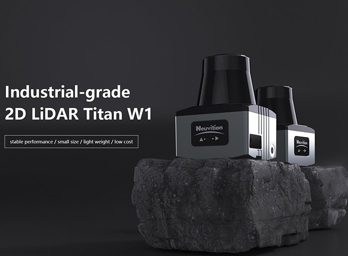
2D LiDAR is the backbone of industrial AGV navigation — not because engineers haven’t explored alternatives, but because it consistently delivers what warehouse automation actually demands: reliable, real-time spatial mapping at a cost that makes large-scale deployment feasible.
According to Grand View Research, 2D LiDAR sensors account for more than 60% of total global LiDAR market volume — a statistic that tells a clear story about where the industry has placed its confidence.

The infrastructure shift is where this dominance becomes most visible. Legacy AGV systems depended on magnetic tape, floor-embedded wires, or reflective marker grids — all of which required significant upfront installation and punished any facility reconfiguration. Modern 2D LiDAR-based systems enable what the industry calls Natural Navigation: AGVs build and update maps of their environment autonomously, using ambient architectural features like walls, shelving units, and doorways as reference points. This shift in how robots understand space eliminated the dependency on fixed infrastructure and dramatically reduced deployment timelines.
For warehouse floor-plan mapping, 2D LiDAR offers a particularly clean solution. Scanning a single horizontal plane — typically at mid-body height — captures exactly the data an AGV needs to navigate aisles, avoid obstacles, and dock with load stations. There’s no extraneous data from overhead beams, ceiling structures, or elevated inventory racks cluttering the sensor feed. The result is a lean, interpretable point cloud that localization algorithms can process with minimal overhead.
The reliability-to-cost ratio is what closes the argument for most R&D teams. 2D sensors are mechanically proven, widely supported across robotics middleware ecosystems like ROS, and available at price points that allow redundant sensor configurations without budget strain. In practice, teams can instrument an entire AGV fleet for what a single high-density 3D unit might cost.
That cost-efficiency advantage, however, raises a more nuanced question: when does the data simplicity of 2D become a limitation — and how does it compare to 3D in real-time obstacle avoidance?
2D vs. 3D LiDAR: Solving the ‘Data Noise’ Problem
Choosing between 2D and 3D LiDAR isn’t about capability alone — it’s about matching sensor output to what an AGV actually needs to process in real time.
Computational load is the first differentiator. A 3D LiDAR sensor generates dense, multi-layer point clouds — sometimes millions of data points per second. Processing that volume requires significant onboard compute resources and introduces latency that flat-floor AGV applications simply don’t need. By contrast, 2D LiDAR sweeps a single horizontal plane, producing a compact data stream that onboard processors can parse in milliseconds. For obstacle avoidance, that speed margin matters.
Environmental noise is the second problem 3D sensors create in warehouse settings. According to IEEE Xplore / Robotics and Automation Society, 2D LiDAR is superior for indoor floor-plan mapping precisely because it eliminates data noise from ceilings, overhead conveyor systems, lighting rigs, and mezzanine structures. A 3D sensor faithfully captures all of it — and then your navigation stack has to filter it out anyway. For standard AGV applications operating on level surfaces, that overhead data is wasted computation, not useful intelligence.
Real-time latency is where 2D sensors earn their keep. When an AGV needs to stop, reroute, or slow down, the decision pipeline runs faster on a leaner data model. The lower the point-cloud density, the faster the collision-detection loop cycles.
Here’s where 2D LiDAR delivers clear efficiency wins over 3D for typical AGV deployments:
- Processing speed: Single-plane scans require far less compute than multi-layer point clouds
- Noise rejection: Horizontal-only 2D LiDAR mapping ignores irrelevant overhead structures by design
- Latency: Faster obstacle detection cycles improve real-time safety response
- Cost-to-value ratio: 3D sensor hardware and compute infrastructure add expense without proportional benefit on flat floors
- System reliability: Simpler data pipelines mean fewer failure points in production environments
3D LiDAR becomes genuinely valuable when AGVs navigate multi-level environments, handle stacked inventory, or operate outdoors — scenarios explored further in this sensor comparison breakdown. For the vast majority of warehouse AGV deployments, however, 3D is overkill.
Understanding why 2D data is leaner leads naturally to the next question: how do AGV systems actually use that data to navigate without fixed infrastructure?
Implementing 2D LiDAR SLAM for Natural Navigation
SLAM with 2D LiDAR transforms ordinary facility walls and pillars into a precise, self-updating navigation system — no reflective tape, no floor markings, no infrastructure overhaul required.
SLAM mechanics work by having the sensor continuously emit laser pulses across a single horizontal plane. As the AGV moves, it correlates each new scan against its accumulated map, simultaneously refining its position estimate and updating the environment model. The result is a coherent, real-time 2D representation of the facility that the vehicle uses to localize itself to within centimeters.
Landmark extraction is where 2D LiDAR earns its place on the factory floor. Structural features — columns, walls, shelving uprights, loading dock frames — serve as reliable geometric anchors. Unlike reflector-based systems that require physical installation and ongoing maintenance, natural landmark SLAM exploits what’s already there. In practice, this means a new facility can be mapped in a single AGV pass, and that map becomes the digital backbone for every subsequent route.
The operational impact of this approach is significant. As noted by Logistics Management Magazine, the transition from magnetic tape navigation to 2D LiDAR-based Natural Navigation allows facilities to reconfigure layouts in hours rather than weeks. When comparing 2D LiDAR vs 3d lidar for this specific application, the leaner data output of a 2D sensor actually accelerates SLAM convergence — there’s simply less noise to filter before a reliable map emerges.
Digital twin creation is an underappreciated byproduct of continuous SLAM operation. Every scan cycle refines the facility map, meaning the AGV’s onboard representation stays synchronized with real-world changes. These high-fidelity floor-level maps can be exported and layered with warehouse management data, giving operations teams a live spatial reference without dedicated survey equipment. You can explore how sensor data shapes spatial models across different robotics contexts to understand just how far this capability extends.
As sensing technology continues to mature, the next frontier isn’t just better maps — it’s sensors that communicate while they perceive.
Integrated Sensing and Communication (ISAC) in Robotics
ISAC represents a fundamental shift in how robotic systems will perceive and communicate — merging radar-like sensing with data transmission into a single unified architecture.
Defining ISAC. Traditional AGV lidar navigation treats sensing and wireless communication as separate subsystems. ISAC collapses that distinction. According to Huawei Research, ISAC’s core mechanisms involve joint waveform design and spectrum efficiency balancing — the same signal that transmits positional data to a fleet management system simultaneously functions as a sensing pulse. Less hardware overhead, tighter latency, stronger coordination.
The 6G and THz connection. Emerging 6G networks operating at terahertz frequencies carry enormous implications for 2D sensing precision. THz wavelengths are measured in fractions of a millimeter, which translates directly into sub-centimeter positioning resolution. For a 2D sensor plane, that kind of frequency fidelity means sharper edge detection, finer reflectivity mapping, and dramatically reduced ambiguity in cluttered industrial environments. The waveform architectures driving solid-state advances already hint at this convergence — FMCW designs share conceptual DNA with ISAC’s joint signal philosophy.
Waveform design as a precision lever. In practice, high-precision positioning under ISAC depends on how carefully waveforms balance sensing bandwidth against communication throughput. Narrow pulses improve range resolution; wider spectral allocation supports data-rich communication. Engineers optimizing multi-agent AGV fleets must navigate that tradeoff deliberately — a misconfigured waveform favoring comms over sensing degrades obstacle discrimination at the exact moment a fleet is most congested.
Multi-agent fleet coordination. This is where ISAC’s value compounds. A single AGV broadcasting its position is useful. A fleet where every unit simultaneously senses surrounding geometry and shares that data over the same signal creates a distributed spatial awareness layer. Each vehicle’s 2D scan becomes a node in a collaborative map — latency drops, redundancy rises, and coordination tightens without additional infrastructure.
As AGV deployments scale into high-density fulfillment environments, that kind of integrated intelligence becomes less futuristic and more operationally necessary.
Optimizing AGV Navigation for E-commerce Fulfillment
E-commerce fulfillment has become the single most powerful force driving 2D LiDAR adoption in industrial robotics — and the numbers back it up.
The demand for Goods-to-Person (GTP) systems has made reliable, cost-efficient navigation non-negotiable, and 2D LiDAR SLAM has emerged as the practical backbone of that movement. Fulfillment centers operate at relentless throughput, with AGVs navigating dense aisles, dynamic pick zones, and unpredictable human traffic around the clock. In that environment, sensor accuracy and real-time responsiveness aren’t optional — they’re operational requirements.
Market growth reflects this urgency. According to Mordor Intelligence, the global market for 2D LiDAR in industrial applications is projected to grow at a CAGR of 12.5% through 2030 — a trajectory driven largely by fulfillment automation investment.
Four factors explain why 2D LiDAR specifically dominates this space:
- Safety compliance. 2D sensors are the standard tool for ISO 3691-4–compliant obstacle detection zones. As Balyo notes, properly configured 2D LiDAR creates layered protective and warning fields that allow AGVs to operate safely alongside human workers without costly physical barriers.
- Cost predictability. High-quality 2D units remain significantly cheaper than 3D alternatives, making fleet-scale deployment economically viable for mid-market fulfillment operators.
- Sensor interoperability. Most warehouse management systems and AGV platforms are designed around standardized 2D sensor interfaces, allowing operators to scale fleets without re-architecting their navigation stack.
- Processing efficiency. As covered in earlier sections, 2D-based navigation runs effectively on embedded processors — a critical advantage when deploying dozens or hundreds of units simultaneously.
However, no technology is without limits. As fulfillment environments grow more complex — multi-level mezzanines, irregular stock configurations, and mixed-autonomy fleets — standard 2D mapping approaches face real pressure. That raises a broader question: what happens when the mapping challenge extends beyond a flat floor plane? The technical challenges waiting at that boundary are worth examining closely.
Technical Challenges: Beyond Standard 2D Mapping
Even reliable 2D LiDAR systems face real-world data complexity that standard mapping pipelines weren’t designed to handle alone — and that gap is widening as fleets scale.
Natural navigation environments — unstructured warehouses, dynamic aisles, mixed human-robot zones — expose the core limitation of 2D sensors: they generate continuous point-cloud streams that become unwieldy without intelligent data management. A single AGV operating across a shift can produce thousands of scan updates, each requiring accurate timestamping, calibration offsets, and environmental context tags before the data is actionable.
JSON-structured sensor metadata has emerged as the practical solution here. When calibration parameters, scan ranges, and environmental flags are serialized in structured JSON formats, fleet management software can query, update, and validate sensor state across hundreds of units without manual intervention. What typically happens in large-scale deployments is that unstructured metadata creates bottlenecks — technicians spend hours diagnosing sensor drift that a well-organized data schema would have surfaced in seconds.
AI-assisted query resolution is changing how operators handle technical support at scale. LLaMA-based and similar fine-tuned language models, trained on Supervised Fine-Tuning (SFT) datasets in JSON format, are increasingly being integrated into sensor management platforms to handle “question retrieval” — automatically surfacing the right calibration procedure or fault-resolution path when a sensor anomaly is flagged. This reduces mean time-to-resolution and keeps fleets running during overnight autonomous operations when human support isn’t available.
Complex environment retrieval remains the hardest problem. Reflective surfaces, repetitive shelving geometry, and crowded scan profiles can degrade map-matching accuracy. As modern SLAM implementations have matured, multi-layer data fusion — pairing 2D LiDAR returns with IMU inputs and structured environment databases — has become the standard mitigation strategy, as supported by LiDAR-IMU fusion research.
These data-layer challenges make hardware selection only half the equation — which leads directly to a broader question about what it takes to future-proof the entire robotics stack from the sensor up.
Future-Proofing Your Robotics Stack with 2D Sensors
Selecting the right industrial automation sensors today means choosing hardware that performs reliably not just in current deployments, but across the operational demands of the next decade.
Automotive-grade 2D LiDAR sensors are rapidly becoming the benchmark for industrial reliability — and for good reason. Designed to survive temperature extremes, vibration, and continuous duty cycles far exceeding typical warehouse conditions, these components bring automotive manufacturing tolerances directly into logistics environments. What typically happens is that facilities running 24/7 operations experience far fewer unplanned shutdowns when they specify sensors originally engineered for road-going vehicles rather than repurposing consumer-grade alternatives.
Triple certification matters more than many procurement teams initially recognize. Hardware carrying simultaneous CE, FCC, and RoHS certifications doesn’t just satisfy regional compliance checklists — it eliminates the customs friction and regulatory rework that can delay global rollouts by months. According to LidarStar Technical Consulting, triple-certified hardware combined with direct factory partnerships is critical for scaling robotics deployments across international borders at pace.
Direct procurement strategy is where robotics teams often leave significant value on the table. Every intermediary layer between sensor manufacturer and end user introduces markup, slower lead times, and diffused technical accountability. Working directly with factory sources — or a dedicated procurement partner who maintains those relationships — compresses the supply chain while ensuring version control, firmware traceability, and consistent hardware revisions across large fleets. For engineers sourcing sensors for automation projects, this direct-access model is increasingly non-negotiable at scale.
24/7 technical support is the final, often underweighted criterion. An AGV fleet going offline at 2 AM on a peak fulfillment night isn’t a theoretical risk — it’s an operational certainty at some point. Sensor vendors without round-the-clock engineering support essentially transfer that risk entirely to the operator. One practical approach is to formalize support SLAs during the procurement process, not after deployment complications arise.
Taken together, these considerations form a procurement framework that serves immediate project goals while building a resilient, scalable robotics stack — key insights worth consolidating before drawing final conclusions.
The Bottom Line: Key Takeaways for Robotics Engineers
2D LiDAR remains the dominant sensor choice for industrial AGV navigation because it delivers the right combination of speed, reliability, and cost-efficiency that 3D alternatives simply can’t match at scale.
As covered throughout this article — from SLAM performance to future-proofing your stack — the evidence points consistently in one direction. For engineers making sensor decisions today, the case for 2D LiDAR is built on concrete operational advantages, not convention.
- 2D LiDAR leads indoor SLAM performance. Its narrow scan plane produces low-noise point clouds that standard SLAM algorithms process with minimal computational overhead. According to research on sensor fusion in smart factories, LiDAR-based localization achieves the real-time responsiveness that structured warehouse environments demand — a benchmark 3D systems struggle to meet at equivalent cost.
- Natural Navigation slashes facility downtime. Landmark-based navigation powered by 2D LiDAR eliminates physical infrastructure like magnetic tape or QR codes. In practice, route changes that once required weeks of facility reconfiguration can be completed in hours — a critical advantage in high-throughput fulfillment operations where layout flexibility directly impacts throughput.
- Market momentum confirms the technology’s staying power. The industrial 2D LiDAR segment is growing at a 12.5% CAGR, driven primarily by e-commerce fulfillment demand. This growth signals continued investment in firmware updates, ecosystem tooling, and sensor refinement — meaning the hardware you specify today benefits from an expanding support base.
- Automotive-grade sensors deliver 24/7 durability without 3D pricing. Choosing sensors built to automotive reliability standards ensures consistent performance across multi-shift manufacturing environments. As Neuvition’s analysis of robotics LiDAR notes, this tier of 2D hardware offers industrial-grade mean time between failures at a fraction of the total system cost of comparable 3D deployments. For teams exploring where the technology is headed next, resources on emerging sensor architectures for robotics provide useful context on how 2D foundations evolve into tomorrow’s hybrid systems.
Still have questions about specific deployment scenarios? The next section tackles the most common engineering questions head-on.
Frequently Asked Questions About 2D Navigation LiDAR
2D LiDAR is purpose-built for structured indoor environments, but understanding its boundaries helps engineers deploy it with confidence and precision.
Can 2D LiDAR work outdoors? In practice, 2D LiDAR can function in outdoor settings, but with meaningful caveats. Direct sunlight introduces noise into time-of-flight measurements, and weather conditions like rain or fog scatter laser pulses unpredictably. Most industrial 2D units are rated for semi-sheltered environments — loading docks, covered yards, or controlled outdoor lanes. For fully exposed outdoor AGV operation, sensor fusion with IMU or GPS is strongly recommended, as explored in this LiDAR-IMU fusion research.
Mechanical vs. solid-state 2D LiDAR — these terms describe fundamentally different hardware architectures. Mechanical units use a rotating mirror or motor assembly to sweep the laser across a 270°–360° field of view, delivering dense, consistent scan data. Solid-state designs use no moving parts, relying instead on optical phased arrays or MEMS mirrors, which improves shock resistance but typically narrows the field of view. For engineers weighing long-term reliability trade-offs, how rotating assemblies enable robust SLAM is worth reviewing in depth.
How does 2D LiDAR SLAM handle dynamic obstacles like humans? This is where algorithm design matters as much as hardware. Modern SLAM implementations separate the static map layer from a dynamic obstacle layer. When a pedestrian enters the scan field, the system flags those points as transient — they don’t corrupt the reference map. Safety-certified LiDAR systems typically combine this logic with zone-based speed reduction, stopping the AGV when a dynamic object occupies a defined safety boundary.
Watch: 2D LiDAR Mapping Techniques Explained
The bottom line: 2D navigation LiDAR rewards engineers who understand both its capabilities and its constraints — that knowledge is what separates reliable deployments from costly redesigns.










