
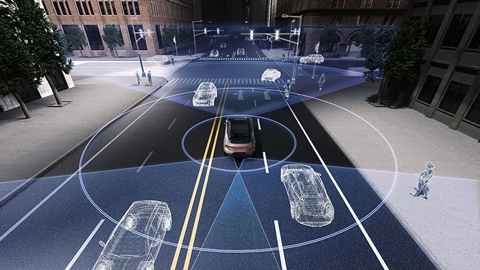
Autonomous systems don’t see the world — they reconstruct it, and the fidelity of that reconstruction determines whether a vehicle stops in time or doesn’t.

3D refers to any geometric representation defined across three spatial coordinates: X, Y, and Z. As defined by industry leaders, 3D modeling involves creating a geometric representation of an object through specialized software — a precise, measurable structure that exists in virtual space.
CAD modeling vs. live environment capture — the critical distinction:
- CAD and design software produce static 3D assets. A designer defines vertices, edges, and surfaces manually. The model is fixed until someone edits it.
- Real-time 3D capture — the domain of LiDAR — samples physical space continuously, generating geometry from the world as it actually exists right now.
That gap between “modeled once” and “measured constantly” is where autonomous perception lives. A 3D model of a parking garage built in design software tells you nothing about the pedestrian who just stepped off the curb. A live point cloud does.
The live point cloud is best understood as a dynamic 3D model — one that rebuilds itself dozens of times per second. Every pulse of laser light returns a data point with X, Y, Z coordinates and intensity values, and the aggregate of millions of those returns forms a real-time spatial map the vehicle can reason about. It’s the conceptual heir to static 3D databases: the geometry logic is identical, but the source is the physical world, not a designer’s intent.
This lineage matters because it explains how perception stacks are architected. The same geometric principles that make a 3D model useful in manufacturing — precise coordinate relationships, surface normals, object boundaries — are exactly what 3D forward LiDAR exploits to detect obstacles, classify objects, and navigate intersections at speed. The question isn’t whether 3D geometry matters. It’s whether your sensor captures it fast enough and in the right direction — which is precisely where forward-facing architectures are rewriting the rules.
Why Forward-Facing LiDAR is Overtaking 360-Degree Mechanical Systems
Dedicated forward-facing LiDAR for autonomous vehicles is outperforming all-around spinning systems by concentrating resolution exactly where threats emerge first — directly ahead.
360-degree mechanical scanners spread their angular budget evenly across the full sweep, which sounds comprehensive until you consider the cost: resolution in any one direction gets diluted by the obligation to cover everything else. In urban environments where the most critical decisions happen in a narrow forward arc, that trade-off is genuinely dangerous. Add mechanical wear from thousands of rotating parts cycling continuously, and the reliability gap becomes untenable for production vehicles.
Forward-facing solid-state units solve both problems simultaneously. As noted in industry insights, the transition is driven by the need for automotive-grade reliability — removing moving parts eliminates mechanical wear entirely. That’s not an incremental improvement; it’s a fundamental redesign of what lidar for autonomous vehicles can tolerate over a 10-year vehicle lifespan.
The resolution advantage matters most in two specific scenarios: intersection navigation and urban obstacle detection. At a complex intersection, a vehicle needs to resolve pedestrians, cyclists, and turning vehicles within a compressed decision window. According to industry analysis, forward-facing sensors typically require a horizontal Field of View between 90° and 120° to handle urban navigation effectively — a specification that, when combined with concentrated angular resolution, outperforms any diluted 360-degree scan.
The practical advantages of this shift are clear:
- Higher point density in the forward arc, improving detection of small or low-profile obstacles
- No rotating components, enabling automotive-grade reliability and longer service life
- Reduced data overhead, since processing is focused rather than distributed across irrelevant rear quadrants
- Better integration with forward-camera and radar sensor fusion pipelines
- Lower latency in critical-path object detection, where milliseconds determine braking outcomes
As explored in research on sensor dimensionality trade-offs, the geometry of what you choose to scan is as important as how you scan it. The next question is what wavelength you use to do it — and that choice has far-reaching consequences for detection range and eye safety.
The 1550nm Advantage: Solving the Long-Range Detection Gap
Wavelength is not a minor technical footnote — it’s the single biggest determinant of how far, how safely, and how reliably a LiDAR system can see at highway speeds.
905nm and 1550nm are the two dominant laser wavelengths in automotive LiDAR, and the differences between them are consequential at a system level:
| Characteristic | 905nm | 1550nm |
|---|---|---|
| Eye safety threshold | Lower — limits pulse energy | Higher — permits stronger pulses |
| Detection range | Typically 100–150m | Exceeds 200m |
| Low-reflectivity object detection | Degraded at range | Reliable at distance |
| Silicon detector compatibility | Yes | Requires InGaAs detectors |
| Solar interference susceptibility | Higher | Lower |
Eye safety is the multiplier effect. The human retina absorbs 905nm light far more readily than 1550nm wavelengths, which are absorbed by the cornea before reaching the retina. This physical property allows 1550nm systems to emit significantly higher pulse energy without exceeding eye-safe thresholds — and that extra energy is what closes the long-range detection gap.
As detailed in research, 3D forward LiDAR using 1550nm fiber lasers can detect low-reflectivity objects — dark clothing, wet asphalt, black rubber tires — at distances exceeding 200 meters. For a vehicle traveling at 70 mph, that detection margin translates directly into viable braking distance for Level 3 and Level 4 autonomous systems.
Braking distance is physics. A Level 4 system needs roughly 5–7 seconds of reaction runway at highway speeds. Detecting a pedestrian in dark clothing at 150 meters isn’t enough. At 200+ meters, the system gains the processing time to decelerate smoothly rather than trigger emergency stops — a critical distinction for both safety and passenger comfort.
The expanding role of 1550nm in aerial sensing further validates this architectural direction. What makes 1550nm compelling across platforms is its combination of range, safety, and low solar noise — the same attributes that are now pushing automotive engineers toward solid-state LiDAR designs built around this wavelength.
Solid-State and Flash LiDAR: The Future of Sensor Architecture
Solid-state LiDAR is redefining what automotive-grade sensing looks like — eliminating the mechanical fragility that has long blocked LiDAR from reaching production vehicles at scale.
Solid-state LiDAR removes all rotating components from the equation. Traditional spinning systems rely on motors and bearings that wear down over time, making them poorly suited for the vibration, temperature swings, and longevity demands of real-world vehicles. Solid-state designs replace those moving parts with fixed optical elements, dramatically improving durability. According to McKinsey & Company, solid-state architectures meet the 100,000-mile durability standards required by Tier 1 automotive manufacturers — a threshold that spinning systems struggle to hit consistently.
Flash LiDAR takes a particularly elegant approach. Rather than scanning a laser beam across a scene point by point, flash lidar illuminates the entire field of view simultaneously with a single pulse — functioning much like a camera, but capturing depth data for every pixel at once. This makes it exceptionally fast and mechanically simple. The trade-off is range and resolution; flooding a wide area with light distributes energy more thinly, which can limit detection distances compared to focused-beam alternatives.
The three dominant solid-state approaches each carry distinct trade-offs:
- MEMS (Micro-Electromechanical Systems): Uses tiny mirrors to steer laser beams. Offers high resolution but retains micro-scale moving parts that can still degrade under sustained stress.
- OPA (Optical Phased Array): Steers light electronically with no moving parts whatsoever. Highly scalable but currently limited in range and still maturing in production readiness.
- Flash LiDAR: Fastest frame rates, simplest architecture, best for short-to-medium range object detection in dense environments.
Bold callout: Solid-state LiDAR isn’t just a durability upgrade — it’s the prerequisite for mass-market automotive adoption. No automaker can commit to millions of units without sensors that survive the full vehicle lifecycle. As OEMs push toward series production, evolving hybrid approaches are also emerging that blend these architectures for optimized performance.
Understanding which architecture wins at the hardware level sets the stage for the next critical question: how densely can these systems sample the world around them — and does that density hold up when detecting a child-sized object at highway speeds?
Maximizing Point Cloud Density for Small Object Detection
A 3D LiDAR point cloud is only as useful as its density — and in autonomous driving, density is the difference between detecting a child at a crosswalk and missing them entirely.
The anatomy of a 3D LiDAR point cloud starts with millions of individual laser returns, each carrying precise X, Y, and Z coordinates. Together, these returns construct a real-time spatial map of everything surrounding the vehicle. The richness of that map depends directly on how many data points the sensor generates per second.
According to IEEE Xplore, high-performance 3D forward LiDAR systems can generate over 1.5 million data points per second — a rate that enables the kind of fine-grained environmental modeling that autonomous decision-making demands.
> At 1.5M+ points per second, a 3D LiDAR point cloud captures spatial detail that no camera or radar system can independently replicate.
Data processing at this scale creates immediate AI perception advantages. Higher point density means the system can separate geometrically similar objects that occupy the same general space — distinguishing a pedestrian’s silhouette from a roadside sign pole, for example, based purely on dimensional profile and reflectivity signature. What typically happens at lower densities is that small objects fall below the detection threshold, generating false negatives at the worst possible moments.
Small Object Detection has become the defining benchmark for Level 4 autonomy certification. Regulatory frameworks and safety bodies increasingly evaluate sensor suites on their ability to reliably identify objects under 50cm in height — think debris, cyclists at distance, or a child crouching between parked vehicles. Sparse point clouds simply cannot meet this bar. This is one reason high-channel sensor architectures have become central to production-grade autonomous platforms.
Point cloud quality also varies significantly by implementation. Leading OEM programs have demonstrated that maximizing vertical channel count and angular resolution together produces the detection fidelity regulators expect.
Of course, point cloud data alone only tells part of the story — which is exactly why the most capable perception stacks pair LiDAR with camera systems to unlock a fuller picture of the environment.
LiDAR-Camera Fusion: The Ultimate Perception Stack
No single sensor tells the complete story — and in autonomous systems, an incomplete story can be fatal. Lidar camera fusion is the architectural answer: combining the textural richness of cameras with the geometric precision of 3D LiDAR to build a perception stack that’s greater than the sum of its parts.
Cameras excel at what LiDAR cannot do. They capture color, contrast, and fine texture — critical for reading traffic signs, identifying lane markings, and classifying object types by appearance. LiDAR, on the other hand, delivers something cameras never can: accurate depth measurement and distance data, independent of lighting conditions. Neither sensor is redundant. Both are essential.
“Camera data gives us context. LiDAR gives us geometry. Without both, the system is guessing at least half the time.” — Embedded Perception Engineer, Autonomous Logistics Platform
Environmental conditions stress-test every sensor differently. Cameras degrade significantly in fog, heavy rain, and low light — precisely the scenarios where autonomous systems face the greatest risk. 3D forward LiDAR cuts through these conditions with active laser pulses, delivering reliable returns where passive optics fail. As IEEE Xplore research confirms, LiDAR-camera fusion allows AI perception stacks to differentiate between stationary objects and dynamic hazards with higher confidence — a margin that matters most in adverse weather.
“In rain tests, camera-only pipelines lost confidence on dark, wet pavement. Adding LiDAR ground truth restored detection accuracy almost immediately.” — Robotics Safety Engineer, Urban AV Development Program
3D forward sensors serve as the ground truth anchor for camera-based AI. When a neural network flags a potential obstacle, LiDAR confirms or corrects the spatial estimate in real time. This closed-loop validation is now a core requirement in safety certification frameworks for Level 3 and above. You can explore how spatial awareness has evolved to meet these demands across the full sensor stack.
“Redundancy isn’t a backup plan — it’s the primary plan. Fusion is non-negotiable for certification.” — Systems Architect, Autonomous Vehicle Safety Consortium
Redundancy through sensor fusion isn’t a premium feature — it’s the baseline for any autonomous system pursuing real-world certification. How you source the hardware to build that stack, however, is a decision with significant cost and quality implications.
Procurement Strategy: Direct-to-Factory vs. Traditional Intermediaries
Sourcing high-performance LiDAR — especially units built around 1550nm fiber lasers — through the wrong channel can silently drain a robotics budget before a single prototype ships.
Traditional distributors add markup layers that have nothing to do with sensor performance. Warehousing fees, regional reseller margins, and slow-moving inventory all inflate unit costs. For a scaling startup ordering 50–200 sensors, that overhead compounds fast. What looks like a manageable per-unit price often becomes a budget bottleneck by the third hardware iteration.
Factory-direct procurement eliminates those intermediaries entirely. Direct factory partnerships provide access to high-end sensors with global shipping and 24-hour technical support — meaning engineering questions don’t stall production timelines waiting for a distributor to relay information back to the source. For teams moving from R&D prototypes toward series production volumes, this direct line to the manufacturer isn’t a convenience — it’s a competitive advantage.
Certification standards deserve equal attention during vendor evaluation. Hardware carrying triple certification — CE, RoHS, and SGS — signals that the sensor has been independently verified for electromagnetic compliance, hazardous materials restrictions, and general safety testing. Skipping this checkpoint creates downstream risk: uncertified hardware can fail import compliance checks, void insurance coverage, or introduce liability exposure during field deployment.
A practical procurement checklist for robotics teams:
- Verify certifications upfront — CE, RoHS, and SGS documentation should be readily available, not requested after purchase
- Confirm global logistics capability — ask whether the supplier ships direct to your country and what typical lead times look like
- Assess technical support access — 24-hour direct support matters when you’re debugging sensor integration at crunch time
- Request volume pricing tiers — factory-direct suppliers typically offer structured pricing for scaling orders
- Evaluate hardware iteration flexibility — can the supplier accommodate spec changes as your system design evolves?
Global logistics and dedicated technical support are increasingly the differentiators that separate a productive hardware partnership from a frustrating one. The right procurement decision shapes everything downstream — which is exactly why the final takeaways for robotics teams deserve careful consideration.
The Bottom Line: Key Takeaways for Robotics Teams
Forward-facing 3D LiDAR isn’t a nice-to-have upgrade — it’s the foundational sensor layer that separates credible autonomous systems from prototypes that stall at validation. According to McKinsey and IEEE research, forward-facing LiDAR is the critical component for Level 3 and Level 4 autonomous systems. If your perception stack can’t reliably handle small object detection at speed, your safety case doesn’t hold.
Here are the four decisions that matter most as you move from design to deployment:
- Prioritize 3D forward LiDAR for high-speed safety. Long-range detection isn’t optional at highway or industrial speeds. A 3D forward sensor gives your system the reaction distance it needs — 2D alternatives simply can’t provide the vertical resolution required to classify obstacles accurately before it’s too late.
- Select 1550nm sensors for eye-safe, high-performance sensing. The 1550nm wavelength allows higher transmitted power without eye-safety constraints, translating directly into longer detection range and better performance in rain, dust, and low-light conditions. For any deployment that involves humans in the operational environment, this isn’t a tradeoff — it’s the right choice by default.
- Move toward solid-state architectures. Spinning mechanical units have a role in certain applications, but automotive-grade solid-state designs deliver the vibration resistance, MTBF figures, and production scalability that real-world deployment demands. The Stanford Solid-State LiDAR seminar makes clear that this architectural shift is already underway across the industry.
- Source directly to protect your budget. As covered earlier, direct procurement keeps high-spec hardware accessible without inflating program costs through unnecessary intermediary margins.
In practice, teams that align these four decisions early — sensor wavelength, architecture, fusion strategy, and procurement — compress their path to reliable autonomy considerably. If questions remain about specific performance parameters, range trade-offs, or sensor compatibility, the next section addresses the most common technical queries head-on.
Frequently Asked Questions About 3D Forward LiDAR
3D forward LiDAR raises specific technical questions that directly shape sensor selection, system architecture, and real-world deployment outcomes.
What is the difference between 2D and 3D LiDAR?
A 2D LiDAR scans a single horizontal plane, producing a flat cross-section of the environment — useful for basic obstacle detection but blind to height variation. A 3D LiDAR fires across multiple vertical channels simultaneously, generating a volumetric point cloud that captures object shape, elevation, and spatial context. For autonomous systems navigating complex terrain or mixed traffic, 3D point cloud data is the difference between seeing a wall and understanding a world.
How does weather affect 3D forward LiDAR performance?
Weather is a genuine performance variable, not a theoretical concern. Rain, fog, and dust scatter laser pulses, degrading range and point density — particularly in shorter-wavelength 905nm systems. 1550nm sensors are measurably less affected by atmospheric conditions than their 905nm counterparts, according to research, because the longer wavelength interacts differently with airborne particulates. In practice, this atmospheric resilience is one of the primary reasons forward-facing systems have shifted toward fiber laser architecture.
Can 3D forward LiDAR replace 360-degree sensors entirely?
Not on its own. Forward-facing sensors are optimized for long-range detection along the primary axis of travel — exactly where resolution matters most at speed. However, lateral and rear blind zones still require supplemental coverage. A common architecture pairs a high-resolution forward sensor with wider field-of-view units at lower range thresholds to cover the full perimeter without over-specifying every sensor position.
What is the typical range for a 1550nm forward sensor?
Production-grade 1550nm forward LiDAR units commonly achieve reliable detection at 200–250 meters on high-reflectivity targets, with some automotive-grade sensors exceeding 300 meters under favorable conditions. That range envelope supports highway-speed decision windows, giving autonomous systems the processing time needed to respond safely — which is the entire point of investing in forward sensor performance.










