
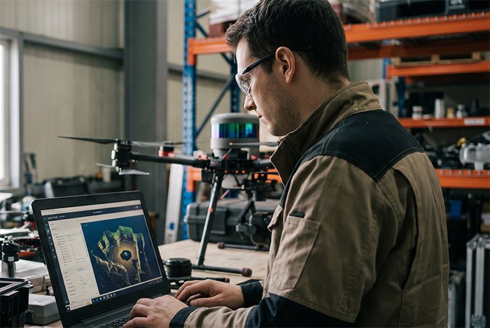
Drone accessories used to mean ND filters, carry cases, and spare propellers. That era is over. The most consequential drone upgrades today are happening inside warehouses, on power line corridors, and above construction sites — and they look nothing like the consumer gear that built the industry.
The drone market has crossed a critical threshold. The global drone sensor market is projected to reach $2.92 billion by 2029, with LiDAR standing out as one of the fastest-growing segments — a clear signal that industrial operators are prioritizing spatial intelligence over aesthetics.
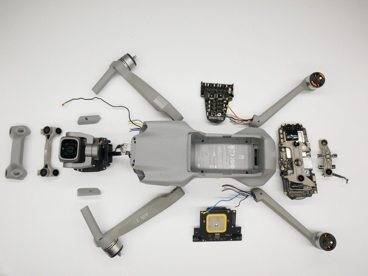
The real question isn’t just how to extend drone battery life or swap a gimbal — it’s how to build a drone that thinks.
This is where the concept of the Autonomy Stack becomes essential. The Autonomy Stack refers to the layered combination of sensors, compute, and software that allows a drone to perceive, navigate, and act without constant human input. At the foundation of that stack, autonomous drone sensors does the heavy lifting.
Within that stack, LiDAR has emerged as the gold standard for industrial drone accessories. Unlike vision-only systems that depend on texture, contrast, and lighting conditions, LiDAR generates precise, measurable 3D point clouds regardless of ambient conditions. That reliability gap between LiDAR and camera-based perception becomes especially pronounced in industrial environments — which is exactly where the next section picks up.
Why LiDAR Outperforms Vision in High-Stakes Environments
Camera-based systems have their place, but the moment conditions get difficult — low light, harsh contrast, GPS-dead zones — their limitations become critical liabilities. LiDAR doesn’t rely on reflected ambient light or pixel interpretation. It emits its own laser pulses and measures return time with millimeter precision, making it fundamentally more reliable when the environment stops cooperating.
According to IEEE Xplore research, 3D mechanical LiDAR-based obstacle avoidance systems significantly outperform traditional ultrasonic or vision-only sensors in low-light and high-contrast environments — exactly the conditions found inside tunnels, under bridges, or along power line corridors at dusk. For infrastructure inspection, that isn’t a minor advantage. It’s the difference between a completed mission and a downed drone.
Precision That Cameras Can’t Match
When inspecting a bridge deck or a wind turbine blade, consistent standoff distance matters. LiDAR provides real-time, high-density point clouds that allow a drone to maintain precise proximity — even when surface textures or colors would confuse optical sensors. As Exyn Technologies explains, this level of spatial awareness enables truly autonomous flight paths in confined or complex geometries.
Operating Without GPS
Urban canyons and indoor facilities represent a growing share of industrial inspection work, and both are notorious GPS-denied environments. LiDAR’s ability to build and reference a live 3D map means the drone localizes itself against physical geometry rather than satellite signal. As Drone Industry Insights notes, “for true autonomy in complex environments, drones require a multi-layered sensor fusion approach where LiDAR provides the high-resolution depth map.”
SIDEBAR — Sensor Fusion Explained: Sensor fusion combines data from multiple sources — LiDAR, IMU, cameras, barometers — into a single, coherent environmental model. No single sensor is perfect; fusion compensates for individual weaknesses. LiDAR handles depth and geometry. Cameras supply color and texture. IMUs track motion. Together, they create situational awareness no single sensor achieves alone. You can explore how this compares to photogrammetry-based approaches for aerial mapping context.
That multi-sensor architecture does raise a practical question many operators encounter early: what the power requirements for 3D mechanical LiDAR on drones are, and how does adding that payload affect flight endurance? That tradeoff deserves its own focused look — which is exactly where we’re headed next.
Powering the Mission: Managing 3D Mechanical LiDAR Requirements
Understanding LiDAR’s advantages in autonomous drone sensors is one thing — but successful successful drone LiDAR integration lives or dies on a more grounded challenge: power. 3D mechanical LiDAR units are hungry components, and fitting them onto a drone without gutting your flight time demands careful engineering decisions.
Power Requirements
Typical 3D mechanical LiDAR power consumption is between 8W and 30W depending on rotation speed and channel count. That’s a significant load when your total drone power budget may be 200–400W, especially once you factor in motors, flight controllers, and onboard computing. According to LiDAR Sensor in Drone Technology – Beyond SKY, payload weight and power draw are the two most common factors that shorten effective mission time in commercial drone operations. Critically, as noted in the LidarStar Technical Specs, 3D mechanical LiDAR sensors require stable voltage regulation to maintain high-resolution point cloud accuracy during rapid maneuvers — meaning clean power delivery matters as much as raw wattage.
Extending Battery Life Under Heavy Payloads
Heavier sensor payloads mean shorter flights. A practical approach is to treat every gram and every watt as a trade-off against mission range. Some strategies that consistently improve outcomes:
- Match channel count to mission needs — 16-channel units consume far less power than 128-channel alternatives; for obstacle avoidance, fewer channels often suffice
- Use efficient motor and ESC combinations rated for high-payload performance to reduce energy waste in thrust
- Implement adaptive LiDAR spin rates — lowering rotation speed during stable cruising phases saves power without sacrificing navigation integrity
- Prioritize battery capacity over weight savings where flight time is mission-critical
- Distribute payload weight symmetrically to reduce compensatory motor draw
Balancing Weight vs. Resolution
Solid-state LiDAR options are lighter and offer more efficient 3D mechanical LiDAR power consumption, but 3D mechanical units deliver superior 360-degree coverage — an irreplaceable asset in complex industrial environments. The trade-off is real and worth mapping against your specific use case before committing to a sensor spec. A drone carrying a lighter, lower-resolution sensor may complete more survey passes per charge, which sometimes yields better total data quality than a single high-resolution flight.
Maximum point cloud resolution means nothing if the battery dies before the job is done. Careful power budgeting at the design stage is what separates functional systems from field failures — a consideration that becomes even more critical when we look at the final descent phase of autonomous landing.
The Role of Blind-Spot Compensation in Autonomous Landing
Rotating LiDAR excels at building spatial maps during flight — but the final descent phase exposes a critical vulnerability. As a drone drops vertically toward a docking station, the spinning sensor’s field of view narrows dramatically beneath the aircraft. Objects directly below, uneven ground surfaces, and last-second obstacles fall into a perceptual dead zone right when precision matters most.
Solid-state LiDAR fills that gap. Unlike mechanical systems, solid-state sensors have no moving parts and can be oriented to cover wide-angle ground-level fields of view with consistent reliability. Mounting one or more of these units on the underside of a drone creates a dedicated landing awareness layer — one that catches low-profile obstructions, personnel movement, and surface irregularities that a top-mounted rotating sensor simply can’t see.
According to AUVSI, solid-state and blind-spot compensation LiDAR sensors are increasingly the preferred choice for drone docking stations and automated landing systems — a trend that reflects just how mission-critical that final 10 feet of descent really is.
Reliable autonomous drone sensors don’t just navigate airspace — they verify the ground is safe before the aircraft ever commits to touchdown.
This matters especially for infrastructure and industrial deployments where docking stations sit in cluttered or dynamic environments. Integrating high-resolution 3D sensing hardware into the landing stack, rather than relying on a single rotating unit for all phases of flight, significantly reduces incident risk.
Getting this sensor architecture right is foundational — and it connects directly to how you source and spec the hardware from the start.
Procurement Strategy: Sourcing Industrial-Grade Hardware
Choosing the right industrial drone accessories isn’t just a technical decision — it’s a supply chain decision. Once your engineering team has defined sensor requirements, procurement managers face a different challenge: sourcing certified hardware at a price point that doesn’t sink the project budget before a single flight.
Go Factory-Direct to Protect Your Margins
For tech startups and lean R&D teams, distributor markups on LiDAR sensors can quietly inflate hardware costs by 20–40%. Factory-direct pricing eliminates that layer entirely. LidarStar supplies certified 2D and 3D LiDAR sensors at direct factory pricing, with 24-hour global support across 26+ countries — a model specifically designed to make industrial-grade sensing accessible without the middleman tax.
Factory-direct procurement isn’t just about cost savings — it’s about shortening the feedback loop between hardware issues and manufacturer-level resolution, which is critical when your deployment timeline is measured in weeks, not months.
Certifications Matter for Global Deployment
When drones cross borders — or operate in regulated industries like utilities, mining, or construction — hardware certifications aren’t optional. Triple-certified sensors (CE, FCC, RoHS at minimum) ensure your platform clears customs, satisfies safety audits, and meets insurance requirements across multiple jurisdictions. Cutting corners here creates downstream risk that far outweighs any upfront savings.
Matching Sensor Type to Mission Scope
Not every application demands a high-channel 3D spinning unit. For structured indoor navigation or perimeter-following tasks, 2D scanning solutions offer a lighter, lower-cost alternative with excellent reliability. Reserve high-channel 3D systems for complex outdoor mapping, dense-environment navigation, or multi-directional obstacle avoidance where full volumetric data is genuinely required.
A clear procurement checklist helps teams avoid over- or under-specifying. For more context on sensor options across different use cases, the LidarStar blog archive covers evolving product lines worth reviewing before finalizing vendor selection. With procurement locked in, you’ll likely have lingering technical questions — which is exactly what the next section addresses.
Frequently Asked Questions About Drone LiDAR Integration
Does LiDAR significantly reduce drone flight time?
Yes — and the impact varies by sensor type. 3D mechanical LiDAR power consumption typically ranges from 8W to 30W depending on spin rate and channel count, which can reduce total flight time by 15–25% compared to a camera-only payload. Solid-state units draw considerably less power, often under 5W, making them better suited for endurance-critical missions. Battery sizing and payload planning should account for peak sensor draw during active scanning cycles, not just average consumption.
Can LiDAR operate in rain or fog?
Partially. LiDAR outperforms cameras in light rain and dusty conditions because it doesn’t rely on ambient light. However, heavy precipitation scatters laser pulses and introduces noise into the point cloud. Most industrial-grade sensors include return-filtering algorithms that reject weak or erratic returns — but dense fog remains a limiting factor across the board. As JOUAV’s LiDAR drone overview notes, understanding environmental constraints upfront is essential for mission planning in variable climates.
What’s the difference between mechanical and solid-state LiDAR for drones?
Mechanical LiDAR uses a spinning mirror assembly to achieve wide field-of-view coverage — ideal for terrain mapping and corridor inspection. Solid-state LiDAR uses fixed optics with no moving parts, offering greater shock resistance and a lower profile. The tradeoff is a narrower field of view. For applications requiring both resilience and coverage, emerging hybrid sensor architectures are increasingly bridging that gap in production-grade systems.
How do I integrate LiDAR data into my existing flight controller?
Most industrial LiDAR sensors output point cloud data via Ethernet or serial interfaces, which feed into a companion computer — typically running ROS or a proprietary SDK — rather than connecting directly to the flight controller. The companion computer processes scan data and passes relevant outputs (obstacle vectors, altitude corrections) to the autopilot via MAVLink or a similar protocol. Selecting a sensor with documented middleware support dramatically reduces integration time.
Drone LiDAR integration isn’t a plug-and-play upgrade — it’s a systems engineering commitment. The teams that succeed are those who treat sensor selection, power budgeting, and data pipeline design as a unified challenge rather than separate checkboxes.
Key Takeaways
- Match channel count to mission needs — 16-channel units consume far less power than 128-channel alternatives; for obstacle avoidance, fewer channels often suffice
- Use efficient motor and ESC combinations rated for high-payload performance to reduce energy waste in thrust
- Implement adaptive LiDAR spin rates — lowering rotation speed during stable cruising phases saves power without sacrificing navigation integrity
- Prioritize battery capacity over weight savings where flight time is mission-critical
- Distribute payload weight symmetrically to reduce compensatory motor draw










