

Picture a camera-equipped vehicle at dusk, navigating a westbound highway directly into a low sun. The sensor is effectively blind — washed out by glare, unable to distinguish a stopped vehicle from an empty lane. Now add a rain-slicked road at midnight. That’s not an edge case. That’s Tuesday.
This is precisely why lidar for autonomous vehicles has become non-negotiable. Where cameras fail on light and radar struggles with spatial resolution, LiDAR delivers dense, accurate, three-dimensional point clouds regardless of ambient lighting. As SAE International notes, “LiDAR is a critical redundancy layer that provides the high-resolution 3D ‘ground truth’ necessary for safe navigation in conditions where cameras and radar fail.”
Ground truth — the term used across robotics and spatial mapping — means an unambiguous, sensor-verified reference for where every object actually exists in physical space. LiDAR owns that role.
The market is responding accordingly. The global automotive LiDAR sector is projected to grow from $703.2 million in 2023 to $4.64 billion by 2032, a trajectory driven by the transition from driver-assist ADAS systems toward true Level 4 autonomy. Understanding how range and velocity data combine in next-generation sensors reveals why that shift demands more than spinning mirrors — and why the underlying detection technology matters just as much as the hardware form factor.
FMCW vs. ToF: Solving the ‘Ghosting’ and Interference Problem
As established earlier, no single sensor modality handles every condition flawlessly. But not all sensing methods fail equally—and understanding why ToF falls short in complex environments explains exactly why FMCW automotive lidar is redefining the standard.
How Time-of-Flight Creates Vulnerability
Time-of-Flight (ToF) works by firing a discrete laser pulse and measuring how long it takes to return. Simple, fast, effective—until the environment fights back. Bright sunlight can saturate the detector, washing out return signals entirely. Worse, when multiple ToF sensors operate nearby (think a busy urban intersection), each unit risks interpreting a neighbor’s pulse as its own. The result is ghosting: phantom objects appear in the point cloud, demanding that higher-level fusion algorithms filter out noise that should never have existed in the first place.
The Doppler Advantage: Velocity Without Guessing
FMCW takes a fundamentally different approach. Instead of a pulse, it transmits a continuously frequency-modulated signal and analyzes the difference between transmitted and returned waveforms. This delivers two critical outputs simultaneously: range and instantaneous radial velocity via the Doppler effect. No interpolation between frames—just direct measurement. According to IEEE Intelligence Transportation Systems Magazine, FMCW LiDAR offers superior immunity to solar interference and ghosting compared to traditional ToF systems. That’s not a minor upgrade; it’s a different physics regime.
Interference Rejection and ISAC Concepts
Coherent detection—the mechanism behind FMCW—means the sensor only responds to light that matches its own frequency pattern. Random photons from the sun or a competing sensor simply don’t correlate. This principle also underpins ISAC (Integrated Sensing and Communication) frameworks, where the same waveform infrastructure serves both perception and data-link functions without cross-contamination.
| Feature | ToF LiDAR | FMCW LiDAR |
|---|---|---|
| Velocity measurement | Derived (frame-to-frame) | Direct (Doppler) |
| Solar interference immunity | Low | High |
| Ghosting risk | High in dense traffic | Minimal |
| ISAC compatibility | Limited | Native |
FMCW’s resilience in dense environments makes it a natural candidate for Level 4 deployments—but signal robustness alone doesn’t guarantee a production-ready sensor. Hardware longevity is equally critical, which is where the shift to solid-state design becomes the next essential conversation.
The Shift to Solid-State: Durability for the Real World
Understanding why a sensing technology works is only half the equation. The other half is whether it can survive the job. Mechanical spinning LiDAR systems, while effective in controlled conditions, carry an inherent vulnerability that’s difficult to ignore in real-world automotive deployments: moving parts.
Traditional rotating mirror assemblies are exposed to constant vibration, thermal cycling, road shock, and humidity—conditions that accelerate mechanical wear in ways that laboratory benchmarks rarely capture. In high-vibration environments like commercial trucks or urban robotaxis logging thousands of miles monthly, these systems become a reliability liability.
Solid-state and MEMS-based designs eliminate this weakness at the architectural level. By removing rotating components entirely, these sensors dramatically reduce failure points. The result is a smaller physical footprint, easier vehicle integration, and—critically—a much longer operational lifespan. According to research published in the Semiconductor Science and Technology Journal, solid-state LiDAR designs can achieve operational lifespans exceeding 50,000 hours, far outperforming mechanical alternatives.
Key durability advantages of solid-state and MEMS LiDAR include:
- No rotating components — eliminating the primary mechanical failure mode
- Shock and vibration resistance — engineered to handle real road conditions
- Compact form factor — enabling flush vehicle integration without aerodynamic drag
- Consistent thermal performance — stable operation across extreme temperature ranges
Solid-state LiDAR isn’t just a hardware upgrade—it’s the foundation that makes 50,000-hour fleet deployment targets achievable.
This matters enormously for Level 4 operators calculating total cost of ownership. When paired with FMCW LiDAR’s velocity-sensing precision, solid-state hardware creates an intelligent platform where reliable data collection and software-driven perception compound each other. You can explore the latest developments in LiDAR sensor design to see how rapidly this hardware-software synergy is evolving.
That synergy—where robust hardware enables richer, more continuous data streams—is precisely what sets the stage for the next frontier: integrated sensing and communication systems that go beyond standalone perception entirely.
Integrated Sensing and Communication (ISAC): The Next Evolution
The sensor breakthroughs covered so far—FMCW’s velocity resolution, solid-state lidar’s mechanical resilience—are powerful in isolation. But the real paradigm shift happens when those sensors stop operating as standalone units and start functioning as nodes in a networked perception system. That’s exactly what Integrated Sensing and Communication (ISAC) enables.
At its core, ISAC is built around Waveform Joint Design—the idea that a single transmitted signal can simultaneously gather environmental data and carry communication payloads. Rather than running separate hardware stacks for sensing and V2X communication, a joint waveform handles both tasks efficiently. As Huawei Research Issue 3 notes, ISAC balances perception KPIs with communication efficiency in 6G-ready vehicle architectures—a critical design constraint as autonomous platforms grow more data-hungry.
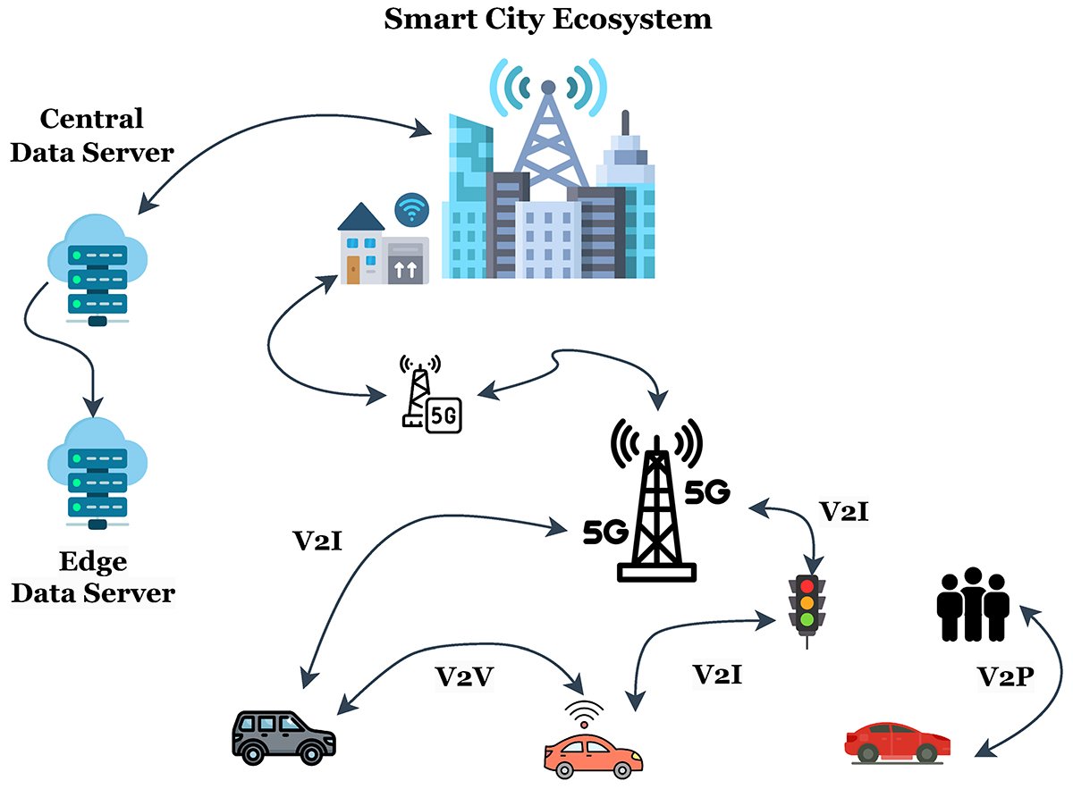
Networked perception fundamentally changes what a vehicle can “see.” Rather than relying solely on onboard sensors, vehicles contribute LiDAR point cloud data to a shared Intelligent Vehicle Platform, where real-time environmental maps are built collaboratively. A single vehicle rounding a blind corner becomes a data source for every other node in the network. This cooperative model dramatically reduces the latency gap between sensing an obstacle and responding to it. Explore how modern sensor portfolios are evolving to support exactly these multi-sensor, networked architectures.
Underpinning all of this is foundational software—the middleware and fusion algorithms that translate raw sensor streams into actionable driving decisions. Without robust software layers managing sensor arbitration, data synchronization, and edge-case handling, even the most advanced hardware delivers inconsistent results. This software-hardware interdependency becomes especially critical when scaling from prototype testing to real-world fleets—which is precisely where implementation strategy, the focus of the next section, determines whether a Level 4 system succeeds or stalls.
Implementation Strategy: From R&D to Scalable Deployment
Moving from lab prototype to production-grade autonomy isn’t just an engineering challenge—it’s a data management challenge. As covered in previous sections, FMCW and solid-state sensors generate extraordinarily rich point clouds, and handling that output at scale requires a disciplined pipeline from the start.
Building a Smarter Data Pipeline
Point cloud analysis increasingly borrows from text-processing methods. Techniques like TF-IDF weighting—applied to feature extraction across large sensor repositories—help prioritize which environmental signatures matter most during model training. GitHub-based research illustrates just how complex managing autonomous sensor datasets can become at scale. Sensor fusion compounds this further: when LiDAR, radar, and camera streams merge, clean preprocessing isn’t optional—it’s foundational.
📺 [Embed: LiDAR Data Visualization — YouTube Placeholder]
Sensor Selection Checklist
Use this framework when specifying hardware for a new deployment:
- FOV coverage first — Identify blind zones early; prioritize sensors with blind compensation built into the optical design, particularly for near-field urban scenarios (see how detection-focused LiDAR addresses this gap)
- Channel count vs. use case — Transitioning from 2D navigation to 128-channel 3D systems delivers dramatically richer scene understanding, but demands proportionally greater compute budgets
- Factory-direct certified hardware — Consistency between units is non-negotiable for fleet deployments; uncertified sensors introduce calibration drift that corrupts fusion outputs
- Interference immunity — Confirm the sensor’s interference rejection specs, especially for high-traffic environments
The sensors that survive real-world deployment aren’t always the most impressive in a data sheet—they’re the ones engineered for consistency across thousands of production units.
Choosing the right stack now directly shapes how resilient your autonomous system will be long-term—a reality the next section addresses head-on.
Key Takeaways
- No rotating components — eliminating the primary mechanical failure mode
- Shock and vibration resistance — engineered to handle real road conditions
- Compact form factor — enabling flush vehicle integration without aerodynamic drag
- Consistent thermal performance — stable operation across extreme temperature ranges
- Channel count vs. use case — Transitioning from 2D navigation to 128-channel 3D systems delivers dramatically richer scene understanding, but demands proportionally greater compute budgets
Conclusion: Future-Proofing Your Autonomous Stack
The journey from spinning mechanical rotors to solid-state and FMCW architectures isn’t a trend—it’s a structural shift in how autonomous systems establish ground truth. Accurate 3D spatial mapping, real-time velocity data, and interference immunity aren’t optional upgrades; they’re the safety pillars that separate functional Level 4 autonomy from a controlled lab experiment.
The practical recommendation is straightforward: prioritize sensors that combine durability with interference immunity. Solid-state designs eliminate failure-prone moving parts, while FMCW’s coherent detection filters crosstalk noise that would compromise a ToF system in dense traffic. Both qualities matter equally in real-world deployment.
LidarStar bridges the gap between expensive R&D hardware and accessible production-ready sensors—whether you’re scaling a fleet or evaluating high-channel-count architectures for complex environments.
Expert Tip: Before committing to a sensor platform, validate it against your specific operational domain—weather conditions, traffic density, and mounting constraints all influence which technology delivers consistent performance at scale. The right hardware choice today prevents costly re-engineering tomorrow.
Still have questions about which LiDAR architecture fits your application? The FAQ section ahead addresses the most common decision points directly.
Frequently Asked Questions (FAQ)
What is the difference between 2D and 3D LiDAR for AGVs?
2D LiDAR scans a single horizontal plane, making it useful for basic obstacle detection in controlled warehouse environments. 3D LiDAR captures full volumetric point clouds, enabling AGVs to identify object height, shape, and orientation. For Level 4 autonomy, vertical resolution matters enormously—distinguishing a pedestrian from a bollard requires depth data that 2D systems simply can’t provide.
Why is FMCW better than ToF for highway driving?
At highway speeds, radial velocity data is the decisive advantage. FMCW LiDAR measures a target’s instantaneous velocity in a single return pulse—no multi-frame inference required. ToF systems must calculate motion across sequential frames, introducing latency that becomes dangerous above 60 mph.
Can solid-state LiDAR handle extreme weather conditions?
It depends on the architecture. In practice, solid-state systems with no moving parts are more resistant to vibration and humidity than mechanical spinners. However, heavy rain and dense fog scatter photons regardless of sensor type. According to PatSnap’s 2026 landscape analysis, manufacturers are actively developing adaptive signal processing to improve all-weather reliability.
How does sensor fusion improve safety ratings?
No single sensor is ground truth. Combining LiDAR with radar and camera data creates redundant perception layers—when one modality degrades, others compensate. The 4DLidarOpen dataset demonstrates how fused FMCW data dramatically improves motion-aware detection accuracy, directly supporting higher SOTIF compliance scores across Level 4 validation frameworks.










