


Auto-Grade 128-Channel 360° High-Performance Long-Range Lidar
Introducing the Pandar128, a cutting-edge long-range Lidar system from Hesai, designed to meet the demanding needs of modern autonomous vehicles. This high-performance device boasts an impressive 128-channel configuration, providing a comprehensive 360° field of view that ensures no detail is missed in the environment around the vehicle. With a horizontal resolution of 0.1° and a vertical resolution of 0.125°, the Pandar128 delivers exceptional accuracy and clarity, making it an ideal choice for applications in robotaxis and robotrucking.
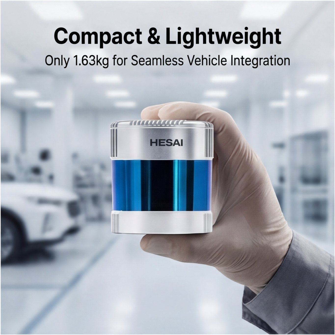
The Pandar128 is engineered for reliability and performance, featuring a point rate of up to 3,456,000 points per second in single return mode, and an astounding 6,912,000 points per second in dual return mode. This capability allows for the generation of image-like point clouds, providing a rich dataset for advanced perception algorithms. The system is compact and lightweight, optimized for seamless integration into various vehicle platforms without compromising on performance.
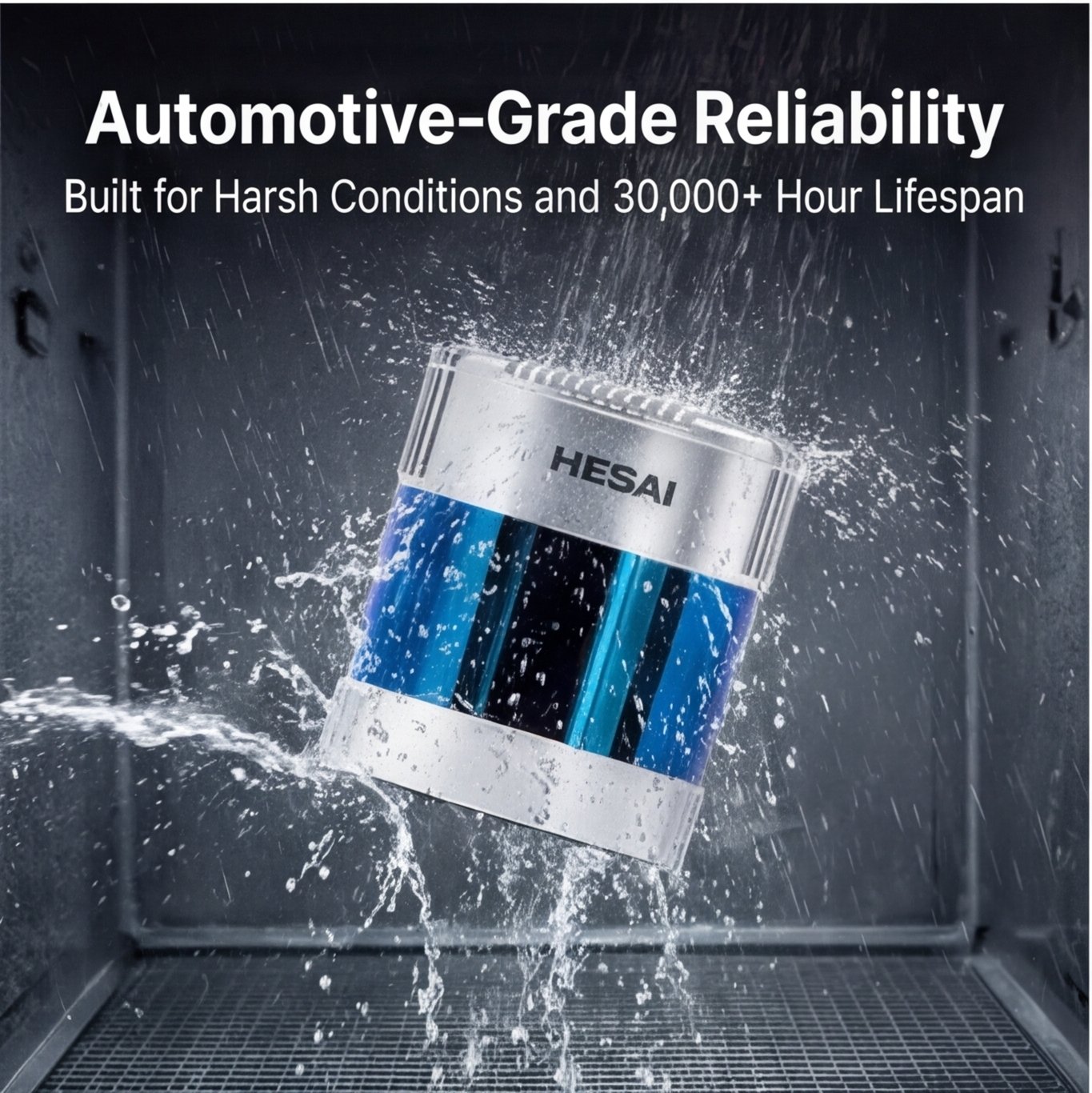
Designed with automotive-grade reliability in mind, the Pandar128 has undergone rigorous testing to meet international OEM standards, ensuring it can withstand the harshest conditions. It is certified for Class 1 eye safety and complies with ISO 26262 ASIL B functional safety and cybersecurity standards, making it a trustworthy choice for safety-critical applications.
The Pandar128’s innovative architecture includes advanced interference rejection technology, allowing it to operate effectively in complex environments where multiple Lidar systems may be in use. This feature, combined with its robust design, ensures that the Pandar128 can deliver consistent performance over its designed lifetime of over 30,000 hours.
Whether you are developing autonomous vehicles or enhancing existing systems, the Pandar128 stands out as a reliable and high-performance Lidar solution that meets the evolving demands of the industry. Experience the future of autonomous navigation with Hesai’s Pandar128.
Product Highlights
The Hesai Pandar128 is a high‑performance 360° mechanical LiDAR designed for applications that demand the highest level of perception quality, reliability, and resolution. As a flagship model in the Pandar series, it delivers dense point cloud data with exceptional range and accuracy, making it a trusted choice for the most demanding autonomous driving and robotics applications.
- 360° Full Surround Perception
Provides complete situational awareness with a single sensor, eliminating blind spots and simplifying system architecture for applications that require omnidirectional coverage. - High‑Resolution & Long Range
With 128 vertical channels, the Pandar128 generates an ultra‑dense point cloud that captures fine details of vehicles, pedestrians, and obstacles at long distances. It achieves reliable detection of low‑reflectivity objects beyond 200 meters, enabling safe operation at high speeds and in complex environments. - Advanced Point Cloud Quality
Engineered for minimal noise, high accuracy, and excellent reflectivity calibration, the Pandar128 delivers clean, reliable data that reduces post‑processing complexity and improves perception algorithm performance. - Industrial‑Grade Reliability
Built for continuous operation in challenging conditions, the Pandar128 undergoes rigorous validation to ensure stable performance across a wide temperature range, vibration, and other environmental stresses. - Class 1 Eye‑Safe
Compliant with Class 1 laser safety standards, ensuring safe operation in public and human‑centric environments.
Key Applications
The Pandar128 is widely adopted in industries and research fields that require high‑fidelity 360° perception with maximum range and resolution.
| Application Area | Description |
|---|---|
| Autonomous Driving | Used as a primary 360° perception sensor for L4 autonomous vehicles such as robotaxis, autonomous shuttles, and self‑driving trucks, providing full situational awareness for urban and highway operations. |
| High‑Definition Mapping & Surveying | Deployed on mobile mapping vehicles, drones, and aircraft to capture ultra‑high‑density 3D point cloud data for HD maps, digital twins, infrastructure modeling, and urban planning. |
| Robotics | Ideal for large‑scale autonomous robots, port automation, and mining equipment that require reliable 360° obstacle detection and navigation in dynamic environments. |
| Ground Truth & Research | Serves as a reference‑grade sensor for algorithm development, sensor fusion validation, and academic research in autonomous systems, providing high‑quality data for training and benchmarking. |
| Smart Infrastructure & Security | Used in intersection monitoring, border security, and large‑area surveillance to track multiple objects with high precision over a wide field of view. |